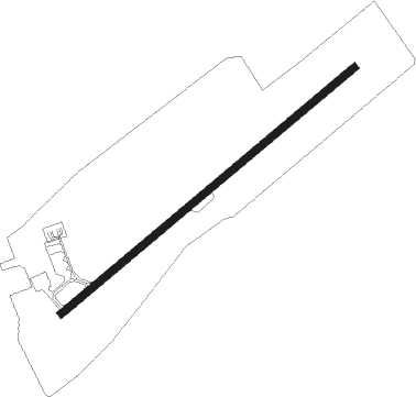
Tétouan - Saniat Rmel
Airport details
| Country | Morocco |
| State | Tétouan Province |
| Region | GM |
| Airspace | Casablanca Ctr |
| Municipality | Tétouan |
| Elevation | 7ft (2m) |
| Timezone | GMT +0 |
| Coordinates | 35.59444, -5.32000 |
| Magnetic var | |
| Type | land |
| Available since | X-Plane v10.40 |
| ICAO code | GMTN |
| IATA code | TTU |
| FAA code | n/a |
Communication
| Saniat Rmel TETOUAN Tower | 119.000 |
Approach frequencies
| ILS-cat-I | RW24 | 110.1 | 18.00mi |
| 3° GS | RW24 | 110.1 | 18.00mi |
Nearby Points of Interest:
Dar Al Mandri
-Zawiya of Harrak
-medersa loukach
-Torre de Piniés
-Museum of Ceuta
-Baluarte de la Coraza Alta, Ceuta
-Gate of La Ribera, Ceuta
-Contraguardia de San Francisco Javier, Ceuta
-Late Roman Basilica, Ceuta
-Baluarte de Santa Ana, Ceuta
-Plaza de Armas, Ceuta
-Royal Walls
-Revellín de San Ignacio, Museo de Ceuta
-Hornabeque del Frente de la Valenciana, Ceuta
-Revellín del Ángulo de San Pablo, Ceuta
-Semibaluarte de San Pedro, Ceuta
-Baluarte de la Bandera, Ceuta
-Baluarte de los Mallorquines, Ceuta
-Marinid Walls of Ceuta
-Fuertes del Hacho, Ceuta
-Fort of San Amaro, Ceuta
-Fort of Yebel Ányera, Ceuta
-Talassemtane National Park
-Bab El Bhar (Tangier)
-Dar el Makhzen (Tangier)
Nearby beacons
| code | identifier | dist | bearing | frequency |
|---|---|---|---|---|
| TTN | TETOUAN VOR/DME | 0.2 | 277° | 117.30 |
| CEU | CEUTA NDB | 17.9 | 3° | 300 |
| TAN | TANGER NDB | 24.8 | 285° | 374 |
| TNG | TANGER VOR/DME | 28.9 | 283° | 115.90 |
| TNR | TANGER VOR/DME | 30.4 | 283° | 108.05 |
| GBR | GIBRALTAR TACAN | 32.9 | 358° | 113.60 |
| VJF | VEJER DE LA FRONTERA VOR/DME | 50.1 | 315° | 117.80 |
Instrument approach procedures
| runway | airway (heading) | route (dist, bearing) |
|---|---|---|
| RW24 | GALTO (216°) | GALTO 4000ft TN102 (7mi, 161°) 2400ft |
| RW24 | ODROS (255°) | ODROS 4000ft TN102 (5mi, 296°) 2400ft |
| RNAV | TN102 2400ft TN104 (5mi, 240°) 2400ft TN106 (5mi, 240°) 764ft TN106 (turn) 900ft TN108 (4mi, 10°) 2000ft ODROS (12mi, 94°) 3000ft ODROS (turn) 4000ft |
Disclaimer
The information on this website is not for real aviation. Use this data with the X-Plane flight simulator only! Data taken with kind consent from X-Plane 12 source code and data files. Content is subject to change without notice.