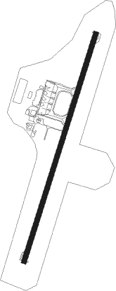
Praia - Praia Nelson Mandela Intl
Airport details
| Country | Cabo Verde |
| State | Sotavento Islands |
| Region | GV |
| Airspace | Sal Oceanic Ctr |
| Municipality | Praia |
| Elevation | 324ft (99m) |
| Timezone | GMT -1 |
| Coordinates | 14.94112, -23.48470 |
| Magnetic var | |
| Type | land |
| Available since | X-Plane v10.40 |
| ICAO code | GVNP |
| IATA code | RAI |
| FAA code | n/a |
Communication
Nearby beacons
| code | identifier | dist | bearing | frequency |
|---|---|---|---|---|
| SNT | PRAIA VOR/DME | 0.1 | 128° | 116.60 |
| PRA | PRAIA NDB | 1 | 203° | 349 |
Departure and arrival routes
| Transition altitude | 7000ft |
| SID end points | distance | outbound heading | |
|---|---|---|---|
| RW03 | |||
| CVS1E | 112mi | 17° | |
| BVT1E | 80mi | 27° | |
| SONV1E | 82mi | 94° | |
| VONT1E | 80mi | 110° | |
| AGTI1M, AGTI1E | 80mi | 219° | |
| BULV1M, BULV1E | 80mi | 229° | |
| SVT1E | 146mi | 320° | |
| NCL1E | 108mi | 334° | |
| RW21 | |||
| CVS1N, CVS1F | 112mi | 17° | |
| BVT1N, BVT1F | 80mi | 27° | |
| SONV1F | 82mi | 94° | |
| VONT1F | 80mi | 110° | |
| AGTI1F | 80mi | 219° | |
| BULV1F | 80mi | 229° | |
| SVT1F | 146mi | 320° | |
| NCL1F | 108mi | 334° | |
| STAR starting points | distance | inbound heading | |
|---|---|---|---|
| ALL | |||
| AGTI1T, AGTI1W | 80.0 | 39° | |
| BULV1T, BULV1W | 80.1 | 49° | |
| SVT1T, SVT1W, SVT1P | 145.5 | 140° | |
| NCL1T, NCL1W, NCL1P | 107.7 | 154° | |
| CVS1T | 112.1 | 197° | |
| BVT1T | 79.5 | 207° | |
| SONV1W, SONV1T, SONV1P | 81.9 | 274° | |
| VONT1W, VONT1T, VONT1P | 80.2 | 290° | |
Disclaimer
The information on this website is not for real aviation. Use this data with the X-Plane flight simulator only! Data taken with kind consent from X-Plane 12 source code and data files. Content is subject to change without notice.
