Buffalo - Buffalo Muni
Airport details
| Country | United States of America |
| State | Missouri |
| Region | K3 |
| Airspace | Kansas City Ctr |
| Municipality | Buffalo |
| Elevation | 1152ft (351m) |
| Timezone | GMT -6 |
| Coordinates | 37.65408, -93.08700 |
| Magnetic var | |
| Type | land |
| Available since | X-Plane v10.40 |
| ICAO code | H17 |
| IATA code | n/a |
| FAA code | n/a |
Communication
| Buffalo Muni CTAF | 122.900 |
Nearby Points of Interest:
Bolivar Public Library
-Boegel and Hine Flour Mill-Wommack Mill
-Joe Knight Building
-Laclede County Jail
-George Dimmitt Memorial Hospital
-Commercial Street Historic District
-Pythian Home of Missouri
-Bentley House
-Greene County Courthouse
-Lincoln School
-Benton Avenue AME Church
-D.M. Oberman Manufacturing Co. Building
-U.S. Customhouse and Post Office
-Woods-Evertz Stove Company Historic District
-Gottfried Furniture Company Building
-Springfield Public Square Historic District
-Franklin Springfield Motor Co. Building
-Springfield Seed Co. Office and Warehouse
-Finkbiner Building
-Ambassador Apartments
-Gilmore Barn
-College Apartments
-Holland Building
-Henry Schneider Building
-Heer's Department Store
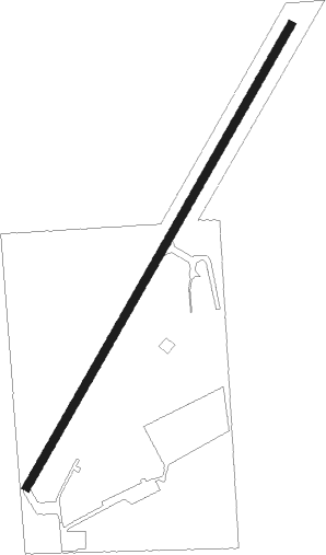
Runway info
| Runway 4 / 22 | ||
| length | 982m (3222ft) | |
| bearing | 41° / 221° | |
| width | 15m (50ft) | |
| surface | asphalt | |
| displ threshold | 86m (282ft) / 0m (0ft) | |
Nearby beacons
| code | identifier | dist | bearing | frequency |
|---|---|---|---|---|
| SGF | SPRINGFIELD VORTAC | 21.4 | 220° | 116.90 |
| SHY | SUNSHINE (KAISER) VOR/DME | 32.6 | 51° | 108.40 |
| DGD | DOGWOOD VORTAC | 39.1 | 162° | 109.40 |
| TBN | FORNEY (FORT LEONARD WOOD VOR | 45.3 | 85° | 110 |
| BHN | BUCKHORN (FORT LEONARD WOOD) NDB | 46.8 | 87° | 391 |
Disclaimer
The information on this website is not for real aviation. Use this data with the X-Plane flight simulator only! Data taken with kind consent from X-Plane 12 source code and data files. Content is subject to change without notice.