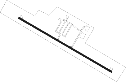
Huntsville - Huntsville Muni
Airport details
| Country | United States of America |
| State | Arkansas |
| Region | K4 |
| Airspace | Memphis Ctr |
| Municipality | Huntsville |
| Elevation | 1748ft (533m) |
| Timezone | GMT -6 |
| Coordinates | 36.07806, -93.75503 |
| Magnetic var | |
| Type | land |
| Available since | X-Plane v10.40 |
| ICAO code | H34 |
| IATA code | n/a |
| FAA code | H34 |
Communication
| Huntsville Muni CTAF/UNICOM | 122.800 |
| Huntsville Muni RAZORBACK Approach/Departure | 126.600 |
Nearby Points of Interest:
Huntsville Commercial Historic District
-War Eagle Creek Bridge
-Enterprise School
-Spring Valley School District 120 Building
-Bunch Store
-Bank of Kingston
-Maguire-Williams House
-Durham School
-Williams House and Associated Farmstead
-Cannon Creek Bridge
-Adrian Fletcher Residence
-St. Paul School Building
-Quigley's Castle
-Pettigrew School
-Skillern House
-Goff Farm Stone Bridge
-Rocky Branch School
-Peter Smyth House
-Sanitarium Lake Bridges Historic District
-Villines Mill
-Stamps Store
-Happy Hollow Farm
-Hemingway House and Barn
-Concord School House
-Fitzgerald Station and Farmstead
Runway info
| Runway 12 / 30 | ||
| length | 1098m (3602ft) | |
| bearing | 119° / 299° | |
| width | 18m (60ft) | |
| surface | asphalt | |
Nearby beacons
| code | identifier | dist | bearing | frequency |
|---|---|---|---|---|
| RZC | RAZORBACK (FAYETTEVILLE) VORTAC | 20.4 | 295° | 116.40 |
| HRO | HARRISON VOR/DME | 29.9 | 66° | 112.50 |
| SLG | SILOAM SPRINGS NDB | 36.2 | 279° | 284 |
| FSM | FORT SMITH VORTAC | 48.4 | 217° | 110.40 |
| EOS | NEOSHO VOR/DME | 56.4 | 318° | 117.30 |
| RUE | RUSSELLVILLE NDB | 58.9 | 141° | 379 |
| DGD | DOGWOOD VORTAC | 70.8 | 43° | 109.40 |
Instrument approach procedures
| runway | airway (heading) | route (dist, bearing) |
|---|---|---|
| RW12 | WUVIL (119°) | WUVIL 4000ft |
| RNAV | WUVIL 4000ft ZEVQA (6mi, 119°) 3500ft YUBYU (4mi, 119°) 2340ft H34 (2mi, 119°) 1784ft (5587mi, 111°) 2093ft IDICO (5578mi, 291°) 4000ft IDICO (turn) | |
| RW30 | IDICO (299°) | IDICO 4000ft |
| RNAV | IDICO 4000ft ZOVPO (6mi, 299°) 3500ft POCBU (3mi, 299°) 2440ft H34 (2mi, 299°) 1785ft (5587mi, 111°) 2044ft WUVIL (5597mi, 291°) 4000ft WUVIL (turn) |
Disclaimer
The information on this website is not for real aviation. Use this data with the X-Plane flight simulator only! Data taken with kind consent from X-Plane 12 source code and data files. Content is subject to change without notice.
