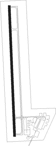
Eldon - Eldon Model Airpark
Airport details
| Country | United States of America |
| State | Missouri |
| Region | K3 |
| Airspace | Kansas City Ctr |
| Municipality | Miller County |
| Elevation | 909ft (277m) |
| Timezone | GMT -6 |
| Coordinates | 38.36158, -92.57132 |
| Magnetic var | |
| Type | land |
| Available since | X-Plane v10.40 |
| ICAO code | H79 |
| IATA code | n/a |
| FAA code | n/a |
Communication
| Eldon Model Airpark CTAF/UNICOM | 122.800 |
| Eldon Model Airpark MIZZU App | 124.100 |
Nearby Points of Interest:
Morgan County Courthouse
-Finke Opera House
-Moniteau County Courthouse Square
-Gray-Wood Buildings
-Joseph and Elizabeth Wallendorf House
-Lewis and Elizabeth Bolton House
-Moreau Park Historic District
-John M. and Lillian Sommerer House
-Dulle Farmstead Historic District
-Moreau Drive Historic District
-Oscar G. and Mary H. Burch House
-Charles J. and Clara B. Schmidt House
-Nelson C. and Gertrude A. Burch House
-William E. and Frederica M. Zuendt House
-Philip Hess House
-Henry and Elizabeth Bockrath House
-Broadway-Dunklin Historic District
-Munichburg Commercial Historic District
-Albert and Wilhelmina Thomas House
-Jefferson City Community Center
-Hugh and Bessie Stephens House
-Tergin Apartment Building
-Hobo Hill Historic District
-Herman Haar House
-H.E. Gensky Grocery Store Building
Nearby beacons
| code | identifier | dist | bearing | frequency |
|---|---|---|---|---|
| SHY | SUNSHINE (KAISER) VOR/DME | 19.3 | 186° | 108.40 |
| JE | ALGOA (JEFFERSON CITY) NDB | 26 | 70° | 397 |
| COU | COLUMBIA VOR/DME | 31.6 | 38° | 110.20 |
| TBN | FORNEY (FORT LEONARD WOOD VOR | 42.4 | 145° | 110 |
| VIH | VICHY (ROLLA/VICHY) VOR/DME | 42.6 | 103° | 117.70 |
| BHN | BUCKHORN (FORT LEONARD WOOD) NDB | 45.5 | 145° | 391 |
| HLV | HALLSVILLE VORTAC | 49.7 | 31° | 114.20 |
| SZL | WHITEMAN (KNOB NOSTER) TACAN | 51.1 | 291° | 109.80 |
| MAP | MAPLES TACAN | 59.2 | 135° | 113.40 |
Instrument approach procedures
| runway | airway (heading) | route (dist, bearing) |
|---|---|---|
| RW18 | JICDA (190°) | JICDA 3100ft |
| RNAV | JICDA 3100ft ZUMIL (4mi, 199°) 2600ft ZARUB (2mi, 183°) 1900ft H79 (3mi, 183°) 957ft (5526mi, 113°) 1317ft MIVPE (5527mi, 292°) 3000ft MIVPE (turn) | |
| RW36 | LOJOV (45°) | LOJOV SECOC (9mi, 70°) 3000ft MIVPE (5mi, 70°) 3000ft |
| RW36 | LUYIR (303°) | LUYIR WABNI (9mi, 258°) 3000ft MIVPE (5mi, 295°) 3000ft |
| RW36 | MIVPE (3°) | MIVPE 3000ft |
| RNAV | MIVPE 3000ft FOVMU (5mi, 3°) 2600ft HUPUD (2mi, 3°) 1920ft H79 (3mi, 3°) 943ft (5526mi, 113°) 1304ft ZARUB (5526mi, 293°) JICDA (6mi, 13°) 3100ft JICDA (turn) |
Disclaimer
The information on this website is not for real aviation. Use this data with the X-Plane flight simulator only! Data taken with kind consent from X-Plane 12 source code and data files. Content is subject to change without notice.