Gitega
Airport details
| Country | Burundi |
| State | Gitega |
| Region | HB |
| Elevation | 5741ft (1750m) |
| Timezone | GMT +2 |
| Coordinates | -3.41812, 29.91395 |
| Magnetic var | |
| Type | land |
| Available since | X-Plane v10.40 |
| ICAO code | HBBE |
| IATA code | GID |
| FAA code | n/a |
Communication
Nearby Points of Interest:
Mugamba
Runway info
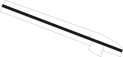
| Runway 12 / 30 | ||
| length | 996m (3268ft) | |
| bearing | 115° / 295° | |
| width | 20m (66ft) | |
| surface | dirt | |
Nearby beacons
| code | identifier | dist | bearing | frequency |
|---|---|---|---|---|
| GI | GITEGA NDB | 0.1 | 155° | 360 |
| YI | RUYIGI NDB | 20.3 | 100° | 275 |
| BJA | BUJUMBURA VOR/DME | 35.7 | 277° | 112.30 |
| BS | BUJUMBURA NDB | 35.7 | 277° | 285 |
| BN | BUJUMBURA NDB | 37.8 | 286° | 255 |
| RG | RWEGURA NDB | 38.3 | 322° | 305 |
| KW | BUJUMBURA NDB | 41.2 | 295° | 385 |
| GA | MUYINGA NDB | 43.1 | 37° | 345 |
| BU | BUTARE NDB | 50.3 | 348° | 340 |
| DO | KIRUNDO NDB | 53.6 | 12° | 295 |
| NL | NYANZA-LAC NDB | 58.9 | 199° | 375 |
Disclaimer
The information on this website is not for real aviation. Use this data with the X-Plane flight simulator only! Data taken with kind consent from X-Plane 12 source code and data files. Content is subject to change without notice.