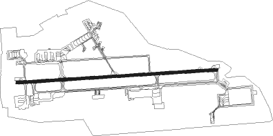
Djibouti City - Djibouti Ambouli
Airport details
| Country | Djibouti |
| State | Djibouti |
| Region | HD |
| Airspace | Addis Abeba Ctr |
| Elevation | 47ft (14m) |
| Timezone | GMT +3 |
| Coordinates | 11.54722, 43.15944 |
| Magnetic var | |
| Type | land |
| Available since | X-Plane v10.40 |
| ICAO code | HDAM |
| IATA code | JIB |
| FAA code | n/a |
Communication
| Djibouti Ambouli Ground Control | 118.100 |
| Djibouti Ambouli Tower | 122.100 |
| Djibouti Ambouli Approach | 121.100 |
Approach frequencies
| ILS-cat-I | RW27 | 110.3 | 18.00mi |
| 2.5° GS | RW27 | 110.3 | 18.00mi |
Nearby Points of Interest:
Djibouti
-Obock Region
-Day Forest National Park
Nearby beacons
| code | identifier | dist | bearing | frequency |
|---|---|---|---|---|
| ABI | DJIBOUTI TACAN | 0.2 | 294° | 114.60 |
| DTI | DJIBOUTI VOR/DME | 3.8 | 271° | 113.90 |
Departure and arrival routes
| Transition altitude | 5000ft |
| SID end points | distance | outbound heading | |
|---|---|---|---|
| RW09 | |||
| PARI2E, PARI1P, PARI1G | 61mi | 17° | |
| TORB2E, TORB1P | 64mi | 54° | |
| LUBA1P, LUBA2E | 65mi | 156° | |
| ASTA2F, ASTA1G, ASTA1P, ASTA2E | 66mi | 216° | |
| LAKB1G, LAKB2F, LAKB2E, LAKB1P | 66mi | 243° | |
| RAGA1P | 68mi | 309° | |
| MAND1P | 66mi | 340° | |
| RW27 | |||
| PARI3W, PARI1V, PARI1D | 61mi | 17° | |
| TORB1V, TORB3W | 64mi | 54° | |
| LUBA1V, LUBA3W | 65mi | 156° | |
| ASTA3W, ASTA1V | 66mi | 216° | |
| LAKB1V, LAKB3W | 66mi | 243° | |
| RAGA1V | 68mi | 309° | |
| MAND1V | 66mi | 340° | |
| STAR starting points | distance | inbound heading | |
|---|---|---|---|
| RW09 | |||
| ASTA1R, ASTA1U, ASTA2B | 65.7 | 36° | |
| LAKB1R, LAKB1U, LAKB2B | 66.2 | 63° | |
| RAGA1R | 68.0 | 129° | |
| MAND1R | 66.4 | 160° | |
| PARI1R, PARI2B | 61.3 | 197° | |
| TORB2B, TORB1R | 63.8 | 234° | |
| LUBA1U, LUBA2B, LUBA1R | 65.2 | 336° | |
| RW27 | |||
| ASTA2A, ASTA1P, ASTA1D | 65.7 | 36° | |
| LAKB1D, LAKB1P, LAKB2A | 66.2 | 63° | |
| RAGA1P | 68.0 | 129° | |
| MAND1P | 66.4 | 160° | |
| PARI1P, PARI2A, PARI2V | 61.3 | 197° | |
| TORB2V, TORB2A, TORB1P | 63.8 | 234° | |
| LUBA2V, LUBA2A, LUBA1P, LUBA1D | 65.2 | 336° | |
Instrument approach procedures
| runway | airway (heading) | route (dist, bearing) |
|---|---|---|
| RW09-Y | AM400 (91°) | AM400 4700ft AM416 (5mi, 91°) 3900ft |
| RW09-Y | AM402 (111°) | AM402 4800ft AM416 (6mi, 181°) 3900ft |
| RW09-Y | AM403 (65°) | AM403 4100ft AM416 (8mi, 1°) 3900ft |
| RW09-Y | AM804 (42°) | AM804 AM805 (7mi, 26°) AM403 (19mi, 26°) 4100ft AM416 (8mi, 1°) 3900ft |
| RNAV | AM416 3900ft AM418 (5mi, 91°) 3900ft HDAM (11mi, 91°) 99ft AM441 (1mi, 90°) AM443 (9mi, 347°) AM402 (15mi, 260°) 4800ft | |
| RW09-Z | AM400 (91°) | AM400 4700ft AM416 (5mi, 91°) 3900ft |
| RW09-Z | AM402 (111°) | AM402 4800ft AM416 (6mi, 181°) 3900ft |
| RW09-Z | AM403 (65°) | AM403 4100ft AM416 (8mi, 1°) 3900ft |
| RW09-Z | AM804 (42°) | AM804 AM805 (7mi, 26°) AM403 (19mi, 26°) 4100ft AM416 (8mi, 1°) 3900ft |
| RNAV | AM416 3900ft AM420 (5mi, 91°) 3200ft HDAM (11mi, 91°) 99ft AM441 (1mi, 90°) AM443 (9mi, 347°) AM402 (15mi, 260°) 4800ft | |
| RW27-Y | AM502 (229°) | AM502 2700ft AM506 (10mi, 181°) 1700ft |
| RW27-Y | AM504 (313°) | AM504 2400ft AM506 (10mi, 1°) 1700ft |
| RW27-Y | AM506 (271°) | AM506 1700ft |
| RW27-Y | AM909 (17°) | AM909 AM910 (9mi, 53°) AM912 (16mi, 53°) AM504 (6mi, 1°) 2400ft AM506 (10mi, 1°) 1700ft |
| RNAV | AM506 1700ft AM518 (5mi, 271°) 1700ft HDAM (6mi, 271°) 74ft AM541 (3mi, 271°) AM542 (5mi, 270°) AM544 (9mi, 1°) AM502 (19mi, 88°) 3700ft | |
| RW27-Z | AM502 (229°) | AM502 2700ft AM506 (10mi, 181°) 1700ft |
| RW27-Z | AM504 (313°) | AM504 2400ft AM506 (10mi, 1°) 1700ft |
| RW27-Z | AM506 (271°) | AM506 1700ft |
| RW27-Z | AM909 (17°) | AM909 AM910 (9mi, 53°) AM912 (16mi, 53°) AM504 (6mi, 1°) 2400ft AM506 (10mi, 1°) 1700ft |
| RNAV | AM506 1700ft AM519 (5mi, 271°) 1700ft HDAM (6mi, 271°) 74ft AM541 (3mi, 271°) AM542 (5mi, 270°) AM544 (9mi, 1°) AM502 (19mi, 88°) 3700ft |
Holding patterns
| STAR name | hold at | type | turn | heading* | altitude | leg | speed limit |
|---|---|---|---|---|---|---|---|
| ASTA1D | AM909 | VHF | right | 230 (50)° | 13000ft - 24000ft | 1.5min timed | 280 |
| ASTA1P | AM909 | VHF | right | 230 (50)° | 13000ft - 24000ft | 1.5min timed | 280 |
| ASTA1R | AM804 | VHF | right | 204 (24)° | 13000ft - 24000ft | 1.5min timed | 280 |
| ASTA1U | AM804 | VHF | right | 204 (24)° | 13000ft - 24000ft | 1.5min timed | 280 |
| ASTA2A | DTI | NDB | left | 269 (89)° | 3700ft - 9000ft | 1.0min timed | 230 |
| LAKB1D | AM909 | VHF | right | 230 (50)° | 13000ft - 24000ft | 1.5min timed | 280 |
| LAKB1U | AM804 | VHF | right | 204 (24)° | 13000ft - 24000ft | 1.5min timed | 280 |
| LAKB2A | DTI | NDB | left | 269 (89)° | 3700ft - 9000ft | 1.0min timed | 230 |
| LUBA1D | AM909 | VHF | right | 230 (50)° | 13000ft - 24000ft | 1.5min timed | 280 |
| LUBA1U | AM804 | VHF | right | 204 (24)° | 13000ft - 24000ft | 1.5min timed | 280 |
| LUBA2V | DTI | NDB | left | 269 (89)° | 3700ft - 9000ft | 1.0min timed | 230 |
| MAND1R | AM402 | VHF | right | 28 (208)° | 4800ft - 7500ft | 1.0min timed | 210 |
| PARI1R | AM402 | VHF | right | 28 (208)° | 4800ft - 7500ft | 1.0min timed | 210 |
| PARI2V | DTI | NDB | left | 269 (89)° | 3700ft - 9000ft | 1.0min timed | 230 |
| RAGA1R | AM402 | VHF | right | 28 (208)° | 4800ft - 7500ft | 1.0min timed | 210 |
| TORB1R | AM402 | VHF | right | 28 (208)° | 4800ft - 7500ft | 1.0min timed | 210 |
| *) magnetic outbound (inbound) holding course | |||||||
Disclaimer
The information on this website is not for real aviation. Use this data with the X-Plane flight simulator only! Data taken with kind consent from X-Plane 12 source code and data files. Content is subject to change without notice.