El Cairo - Sphinx Intl
Airport details
| Country | Egypt |
| State | Giza |
| Region | HE |
| Airspace | Cairo Ctr |
| Municipality | Sixth Of October |
| Elevation | 546ft (166m) |
| Timezone | GMT +2 |
| Coordinates | 30.10806, 30.89583 |
| Magnetic var | |
| Type | land |
| Available since | X-Plane v10.40 |
| ICAO code | HESX |
| IATA code | SPX |
| FAA code | n/a |
Communication
| Sphinx Intl Ground Control | 121.925 |
| Sphinx Intl Tower alt | 118.725 |
| Sphinx Intl Tower | 121.000 |
Approach frequencies
| ILS-cat-I | RW34L | 111.5 | 18.00mi |
| 3° GS | RW34L | 111.5 | 18.00mi |
Nearby Points of Interest:
Memphis and its Necropolis – the Pyramid Fields from Giza to Dahshur
-Giza pyramid complex
-Fustat
-Mosque and Khanqah of Shaykhu
-Mosque of Qanibay al-Muhammadi
-Sultan Qaytbay Complex
-Madrassa of Al-Nasir Muhammad
-Mosque-Madrassa of Sultan Barquq
-Wikala of Al-Ghuri
-Gamal Eddin Youssef Istadar Mosque
-Amir Khayrbak Funerary Complex
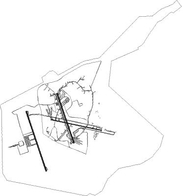
Runway info
Runway 16R / 34L  | ||
| length | 3663m (12018ft) | |
| bearing | 164° / 344° | |
| width | 60m (197ft) | |
| surface | asphalt | |
| blast zone | 63m (207ft) / 70m (230ft) | |
| Runway 16L / 34R | ||
| length | 3039m (9970ft) | |
| bearing | 164° / 344° | |
| width | 60m (196ft) | |
| surface | asphalt | |
| blast zone | 255m (837ft) / 255m (837ft) | |
| Runway 10 / 28 | ||
| length | 3043m (9984ft) | |
| bearing | 104° / 284° | |
| width | 40m (131ft) | |
| surface | asphalt | |
| blast zone | 255m (837ft) / 255m (837ft) | |
Nearby beacons
| code | identifier | dist | bearing | frequency |
|---|---|---|---|---|
| OCT | OCTOBER NDB | 18.1 | 192° | 340 |
| MKT | MOQUATTAM NDB | 20.1 | 100° | 317 |
| MXR | ALMAZA TACAN | 23.9 | 92° | 116.30 |
| A | ALMAZA NDB | 24.1 | 94° | 490 |
| ALI | CAIRO NDB | 25.6 | 83° | 310 |
| CVO | CAIRO VOR/DME | 25.6 | 92° | 115.20 |
| CAI | CAIRO VOR/DME | 27.5 | 85° | 112.50 |
| FYM | FAYOUM VOR/DME | 50 | 215° | 117.30 |
Instrument approach procedures
| runway | airway (heading) | route (dist, bearing) |
|---|---|---|
| RW34L | CVO (272°) | CVO SX601 (22mi, 237°) 3500ft SX602 (6mi, 297°) 2500ft |
| RNAV | SX602 2500ft SX603 (6mi, 344°) 2000ft HESX (5mi, 344°) 583ft SX604 (6mi, 344°) 1800ft SX605 (9mi, 78°) 3200ft SX606 (7mi, 78°) 4400ft CVO (16mi, 131°) CVO (turn) |
Disclaimer
The information on this website is not for real aviation. Use this data with the X-Plane flight simulator only! Data taken with kind consent from X-Plane 12 source code and data files. Content is subject to change without notice.