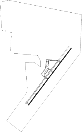
Taba - Taba Intl
Airport details
| Country | Egypt |
| State | North Sinai |
| Region | HE |
| Airspace | Cairo Ctr |
| Elevation | 2415ft (736m) |
| Timezone | GMT +2 |
| Coordinates | 29.58778, 34.77806 |
| Magnetic var | |
| Type | land |
| Available since | X-Plane v10.40 |
| ICAO code | HETB |
| IATA code | TCP |
| FAA code | n/a |
Communication
| Taba Intl Tower | 120.800 |
Approach frequencies
| ILS-cat-I | RW04 | 109.5 | 18.00mi |
| 3° GS | RW04 | 109.5 | 18.00mi |
Nearby Points of Interest:
Umm Rashrash Police Station
-Timna valley
-Wadi Rum
-Nuweiba
Nearby beacons
| code | identifier | dist | bearing | frequency |
|---|---|---|---|---|
| TBA | TABA VOR/DME | 1.5 | 46° | 114.50 |
| LOT | EILOT VOR/DME | 10.4 | 84° | 112 |
| AQB | AQABA VOR/DME | 12 | 91° | 113.10 |
| RAM | EILAT VOR/DME | 16 | 56° | 113.85 |
| AQC | KING HUSSEIN NDB | 25.9 | 47° | 326 |
| NWB | NUWEIBAA NDB | 33.8 | 191° | 288 |
| ZFR | ZOFAR VOR/DME | 61.6 | 22° | 115.60 |
Departure and arrival routes
| Transition altitude | 7000ft |
| Transition level | 8000ft |
| SID end points | distance | outbound heading | |
|---|---|---|---|
| RW04 | |||
| GETA1A | 19mi | 182° | |
| GIST1A | 20mi | 273° | |
| KITA1A | 26mi | 330° | |
| RW22 | |||
| GETA1B | 19mi | 182° | |
| GIST1B | 20mi | 273° | |
| KITA1B | 26mi | 330° | |
| STAR starting points | distance | inbound heading | |
|---|---|---|---|
| RW04 | |||
| GETA1A | 19.1 | 2° | |
| GIST1A | 20.1 | 93° | |
| KITA1A | 26.4 | 150° | |
| RW22 | |||
| GETA1B | 19.1 | 2° | |
| GIST1B | 20.1 | 93° | |
| KITA1B | 26.4 | 150° | |
Instrument approach procedures
| runway | airway (heading) | route (dist, bearing) |
|---|---|---|
| RW04 | TB514 (82°) | TB514 TB516 (10mi, 128°) 5500ft |
| RW04 | TB515 (29°) | TB515 TB516 (10mi, 8°) 5500ft |
| RNAV | TB516 5500ft TB517 (5mi, 45°) 4500ft TB518 (6mi, 46°) 2507ft (2667mi, 230°) 3200ft (turn) | |
| RW22 | TB513 (144°) | TB513 TB523 (10mi, 108°) 4500ft TB524 (6mi, 159°) 3500ft |
| RNAV | TB524 3500ft TB525 (3mi, 210°) 2653ft (2669mi, 230°) 3500ft (turn) |
Holding patterns
| STAR name | hold at | type | turn | heading* | altitude | leg | speed limit |
|---|---|---|---|---|---|---|---|
| GETA1B | TB513 | VHF | right | 288 (108)° | > 8000ft | 1.0min timed | ICAO rules |
| GIST1A | TB514 | VHF | right | 308 (128)° | > 8000ft | 1.0min timed | ICAO rules |
| GIST1B | TB513 | VHF | right | 288 (108)° | > 8000ft | 1.0min timed | ICAO rules |
| KITA1A | TB514 | VHF | right | 308 (128)° | > 8000ft | 1.0min timed | ICAO rules |
| KITA1B | TB513 | VHF | right | 288 (108)° | > 8000ft | 1.0min timed | ICAO rules |
| *) magnetic outbound (inbound) holding course | |||||||
Disclaimer
The information on this website is not for real aviation. Use this data with the X-Plane flight simulator only! Data taken with kind consent from X-Plane 12 source code and data files. Content is subject to change without notice.