Asmara - Asmara Intl
Airport details
| Country | Eritrea |
| State | Maekel Region |
| Region | HH |
| Airspace | Asmara Ctr |
| Municipality | Asmara |
| Elevation | 7661ft (2335m) |
| Timezone | GMT +3 |
| Coordinates | 15.29426, 38.91941 |
| Magnetic var | |
| Type | land |
| Available since | X-Plane v10.32 |
| ICAO code | HHAS |
| IATA code | ASM |
| FAA code | n/a |
Communication
| Asmara Intl ASMARA Tower | 118.100 |
| Asmara Intl ASMARA Tower | 121.900 |
| Asmara Intl ASMARA Approach | 120.700 |
| Asmara Intl ASMARA Approach | 129.500 |
Approach frequencies
| ILS-cat-I | RW07 | 110.3 | 18.00mi |
| 3° GS | RW07 | 110.3 | 18.00mi |
Nearby Points of Interest:
Asmara
-Qohaito
Runway info
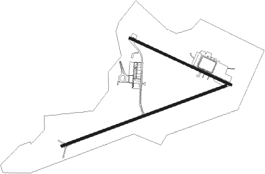
Runway 07 / 25  | ||
| length | 3006m (9862ft) | |
| bearing | 75° / 255° | |
| width | 45m (148ft) | |
| surface | asphalt | |
| blast zone | 60m (197ft) / 0m (0ft) | |
| Runway 12 / 30 | ||
| length | 1918m (6293ft) | |
| bearing | 119° / 299° | |
| width | 45m (148ft) | |
| surface | asphalt | |
Nearby beacons
| code | identifier | dist | bearing | frequency |
|---|---|---|---|---|
| ASM | ASMARA VOR/DME | 1.2 | 242° | 113.70 |
| AS | ASMARA NDB | 2.1 | 250° | 305 |
| MS | MASSAWA NDB | 33.1 | 49° | 230 |
Instrument approach procedures
| runway | airway (heading) | route (dist, bearing) |
|---|---|---|
| RW07 | LEZAN (103°) | LEZAN HH102 (7mi, 180°) 11500ft HH101 (4mi, 118°) 10900ft NEFHI (4mi, 75°) 10900ft |
| RW07 | SKETI (44°) | SKETI HH104 (7mi, 326°) 11500ft HH101 (4mi, 30°) 10900ft NEFHI (4mi, 75°) 10900ft |
| RNAV | NEFHI 10900ft HHAS (12mi, 74°) 7711ft (2484mi, 249°) 8200ft (turn) HH110 (2480mi, 69°) 11500ft HH110 (turn) | |
| RW25 | DIGSA (288°) | DIGSA HH204 (7mi, 5°) 11500ft HH201 (4mi, 303°) 10900ft DIRFO (4mi, 255°) 10900ft |
| RW25 | DOGOL (222°) | DOGOL HH202 (7mi, 141°) 11500ft HH201 (4mi, 211°) 10900ft DIRFO (4mi, 255°) 10900ft |
| RNAV | DIRFO 10900ft HHAS (10mi, 256°) 7704ft (2484mi, 249°) 8200ft (turn) HH110 (2480mi, 69°) 11500ft HH110 (turn) |
Disclaimer
The information on this website is not for real aviation. Use this data with the X-Plane flight simulator only! Data taken with kind consent from X-Plane 12 source code and data files. Content is subject to change without notice.