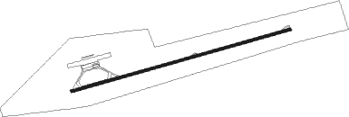
Eldoret - Eldoret Intl
Airport details
| Country | Kenya |
| State | Uasin Gishu County |
| Region | HK |
| Airspace | Nairobi Ctr |
| Municipality | Eldoret |
| Elevation | 6939ft (2115m) |
| Timezone | GMT +3 |
| Coordinates | 0.40401, 35.23671 |
| Magnetic var | |
| Type | land |
| Available since | X-Plane v10.40 |
| ICAO code | HKEL |
| IATA code | EDL |
| FAA code | n/a |
Communication
| ELDORET INTL Tower | 118.400 |
| ELDORET INTL Approach | 119.400 |
| ELDORET INTL RADAR | 121.100 |
Approach frequencies
| ILS-cat-I | RW08 | 110.5 | 18.00mi |
| 3° GS | RW08 | 110.5 | 18.00mi |
Nearby Points of Interest:
Kakamega Forest
Nearby beacons
| code | identifier | dist | bearing | frequency |
|---|---|---|---|---|
| ELD | ELDORET VOR/DME | 0.3 | 295° | 114.70 |
| KIV | KISUMU VOR/DME | 42.8 | 226° | 114.10 |
| NAK | LANET VOR/DME | 69.6 | 128° | 115.10 |
Departure and arrival routes
| Transition altitude | 10000ft |
| Transition level | 11000ft |
| SID end points | distance | outbound heading | |
|---|---|---|---|
| RW08 | |||
| KIDU1Y | 50mi | 150° | |
| RW26 | |||
| KIDU1Z | 50mi | 150° | |
| STAR starting points | distance | inbound heading | |
|---|---|---|---|
| RW08 | |||
| GERI2A | 50.3 | 45° | |
| GONG2A | 56.0 | 152° | |
| KIME2Z | 47.0 | 202° | |
| DUPS1A | 49.8 | 317° | |
| RW26 | |||
| GERI2B | 50.3 | 45° | |
| GONG2B, GONG1C | 56.0 | 152° | |
| KIME1C, KIME2B | 47.0 | 202° | |
| BEND1C | 43.8 | 302° | |
| DUPS1B | 49.8 | 317° | |
| KIDU1C | 50.0 | 330° | |
Instrument approach procedures
| runway | airway (heading) | route (dist, bearing) |
|---|---|---|
| RW08 | TIBAB (57°) | TIBAB EL007 (6mi, 9°) 10000ft |
| RW08 | TIMAK (100°) | TIMAK EL007 (6mi, 149°) 10000ft |
| RNAV | EL007 10000ft EL008 (5mi, 79°) 9000ft HKEL (8mi, 79°) 6889ft (2116mi, 269°) 9000ft TIBAB (2103mi, 90°) TIBAB (turn) | |
| RW26 | TILEV (237°) | TILEV EL010 (6mi, 189°) 10000ft |
| RW26 | UVANA (280°) | UVANA EL010 (6mi, 329°) 10000ft |
| RNAV | EL010 10000ft EL009 (5mi, 259°) 9000ft HKEL (7mi, 259°) 6995ft HKEL (turn) 9000ft UVANA (15mi, 100°) UVANA (turn) |
Disclaimer
The information on this website is not for real aviation. Use this data with the X-Plane flight simulator only! Data taken with kind consent from X-Plane 12 source code and data files. Content is subject to change without notice.
