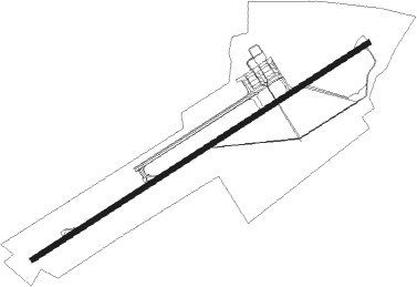
Kisumu
Airport details
| Country | Kenya |
| State | Kisumu County |
| Region | HK |
| Airspace | Nairobi Ctr |
| Elevation | 3730ft (1137m) |
| Timezone | GMT +3 |
| Coordinates | -0.08621, 34.73479 |
| Magnetic var | |
| Type | land |
| Available since | X-Plane v10.40 |
| ICAO code | HKKI |
| IATA code | KIS |
| FAA code | n/a |
Communication
| Kisumu Ground Control | 121.600 |
| Kisumu Tower | 118.800 |
Nearby Points of Interest:
Kakamega Forest
Nearby beacons
| code | identifier | dist | bearing | frequency |
|---|---|---|---|---|
| KIV | KISUMU VOR/DME | 0.7 | 244° | 114.10 |
| ELD | ELDORET VOR/DME | 42 | 45° | 114.70 |
Departure and arrival routes
| Transition altitude | 7000ft |
| Transition level | 8000ft |
| SID end points | distance | outbound heading | |
|---|---|---|---|
| RW06 | |||
| IBSU1A | 23mi | 156° | |
| RW24 | |||
| IBSU1B | 23mi | 156° | |
| STAR starting points | distance | inbound heading | |
|---|---|---|---|
| RW06 | |||
| NEVO1A | 36.4 | 305° | |
| RW24 | |||
| NEVO1B | 36.4 | 305° | |
Instrument approach procedures
| runway | airway (heading) | route (dist, bearing) |
|---|---|---|
| RW06 | AXURA (62°) | AXURA UTAKO (6mi, 62°) 7000ft |
| RW06 | NEXES (87°) | NEXES UTAKO (6mi, 144°) 7000ft |
| RW06 | XABUL (38°) | XABUL UTAKO (6mi, 340°) 7000ft |
| RNAV | UTAKO 7000ft EXALI (5mi, 62°) 5800ft UTOLO (5mi, 62°) 4117ft XABUL (12mi, 213°) XABUL (turn) | |
| RW24 | TEXAV (278°) | TEXAV UTETU (8mi, 287°) 6700ft OKBEL (6mi, 287°) 5400ft |
| RNAV | OKBEL 5400ft AVOBA (4mi, 257°) 4099ft (2087mi, 270°) 5000ft TEXAV (2104mi, 90°) TEXAV (turn) |
Disclaimer
The information on this website is not for real aviation. Use this data with the X-Plane flight simulator only! Data taken with kind consent from X-Plane 12 source code and data files. Content is subject to change without notice.
