Mombasa - Mombasa Moi Intl
Airport details
| Country | Kenya |
| State | Mombasa County |
| Region | HK |
| Airspace | Nairobi Ctr |
| Municipality | Mombasa |
| Elevation | 200ft (61m) |
| Timezone | GMT +3 |
| Coordinates | -4.02628, 39.59906 |
| Magnetic var | |
| Type | land |
| Available since | X-Plane v10.40 |
| ICAO code | HKMO |
| IATA code | MBA |
| FAA code | n/a |
Communication
| Mombasa Moi Intl ATIS | 126.300 |
| Mombasa Moi Intl APRON CTL | 121.600 |
| Mombasa Moi Intl Tower | 118.600 |
| Mombasa Moi Intl Approach | 120.300 |
| Mombasa Moi Intl Radar | 121.700 |
Approach frequencies
| ILS-cat-I | RW21 | 110.1 | 18.00mi |
| 3° GS | RW21 | 110.1 | 18.00mi |
Nearby Points of Interest:
Holy Ghost Cathedral, Mombasa
-Mombasa Old Town
-Sacred Mijikenda Kaya Forests
-Mnarani ruins
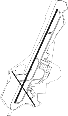
Runway info
Runway 03 / 21  | ||
| length | 3362m (11030ft) | |
| bearing | 29° / 209° | |
| width | 46m (151ft) | |
| surface | asphalt | |
| blast zone | 65m (213ft) / 60m (197ft) | |
| Runway 15 / 33 | ||
| length | 1327m (4354ft) | |
| bearing | 150° / 330° | |
| width | 25m (82ft) | |
| surface | asphalt | |
| displ threshold | 0m (0ft) / 16m (52ft) | |
| blast zone | 67m (220ft) / 4m (13ft) | |
Nearby beacons
| code | identifier | dist | bearing | frequency |
|---|---|---|---|---|
| MOV | MOVEX VOR/DME | 5.3 | 29° | 112.30 |
| MLD | MALINDI VOR/DME | 56.3 | 32° | 113.30 |
Departure and arrival routes
| Transition altitude | 2000ft |
| Transition level | 3000ft |
| SID end points | distance | outbound heading | |
|---|---|---|---|
| RW03 | |||
| ETBA1A | 94mi | 16° | |
| ESRI1B | 41mi | 188° | |
| EVID1A | 55mi | 306° | |
| RW21 | |||
| ESRI1A | 62mi | 87° | |
| MOKA1C | 65mi | 126° | |
| IMSI1A | 41mi | 188° | |
| GEVA1A | 55mi | 306° | |
| STAR starting points | distance | inbound heading | |
|---|---|---|---|
| RW03 | |||
| UVUK2B | 41.0 | 8° | |
| GADL2B | 61.7 | 107° | |
| NERE2B | 55.2 | 148° | |
| IBNO2B | 84.8 | 186° | |
| MIDN2B | 94.2 | 196° | |
| AVUD2B | 96.9 | 223° | |
| MOBA2B | 62.1 | 267° | |
| MOKA2B | 64.9 | 306° | |
| RW21 | |||
| UVUK1A | 41.0 | 8° | |
| GADL2A | 61.7 | 107° | |
| NERE2A | 55.2 | 148° | |
| IBNO2A | 84.8 | 186° | |
| MIDN2A | 94.2 | 196° | |
| AVUD2A | 96.9 | 223° | |
| MOBA2A | 62.1 | 267° | |
| MOKA2A | 64.9 | 306° | |
Instrument approach procedures
| runway | airway (heading) | route (dist, bearing) |
|---|---|---|
| RW03 | EPLAX (31°) | EPLAX EGNOP (6mi, 31°) |
| RW03 | EPNEX (8°) | EPNEX EGNOP (6mi, 302°) |
| RW03 | GENIL (54°) | GENIL EGNOP (6mi, 121°) |
| RNAV | EGNOP ITGOT (6mi, 31°) 2700ft ATD30 (4mi, 31°) 1270ft HKMO (4mi, 31°) 240ft ESPOM (20mi, 29°) MOV (14mi, 209°) MOV (turn) | |
| RW21 | EGMUK (233°) | EGMUK ETUSU (6mi, 299°) |
| RW21 | EGVOM (186°) | EGVOM ETUSU (6mi, 119°) |
| RW21 | ESPOM (209°) | ESPOM ETUSU (6mi, 209°) |
| RNAV | ETUSU EPLEB (6mi, 209°) 2500ft ATD36 (3mi, 209°) 1460ft HKMO (5mi, 209°) 250ft EPLAX (20mi, 211°) MOV (26mi, 31°) MOV (turn) |
Disclaimer
The information on this website is not for real aviation. Use this data with the X-Plane flight simulator only! Data taken with kind consent from X-Plane 12 source code and data files. Content is subject to change without notice.