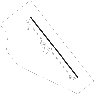
Wajir
Airport details
| Country | Kenya |
| State | Wajir County |
| Region | HK |
| Airspace | Nairobi Ctr |
| Elevation | 770ft (235m) |
| Timezone | GMT +3 |
| Coordinates | 1.73317, 40.09153 |
| Magnetic var | |
| Type | land |
| Available since | X-Plane v10.40 |
| ICAO code | HKWJ |
| IATA code | WJR |
| FAA code | n/a |
Communication
| Wajir AFIS | 118.200 |
Runway info
| Runway 15 / 33 | ||
| length | 2809m (9216ft) | |
| bearing | 146° / 326° | |
| width | 32m (104ft) | |
| surface | asphalt | |
| blast zone | 50m (164ft) / 50m (164ft) | |
Nearby beacons
| code | identifier | dist | bearing | frequency |
|---|---|---|---|---|
| WAV | WAJIR VOR/DME | 0.9 | 326° | 112.50 |
Departure and arrival routes
| Transition altitude | 4000ft |
| Transition level | 5000ft |
| STAR starting points | distance | inbound heading | |
|---|---|---|---|
| RW15 | |||
| ENOR1B | 45.8 | 6° | |
| NETO1B | 60.2 | 49° | |
| DUNL1B | 50.9 | 190° | |
| OKNA1B | 50.4 | 218° | |
| APNE1B | 55.9 | 254° | |
| RW33 | |||
| ENOR1A | 45.8 | 6° | |
| NETO1A | 60.2 | 49° | |
| DUNL1A | 50.9 | 190° | |
| OKNA1A | 50.4 | 218° | |
| APNE1A | 55.9 | 254° | |
| ENAB1A | 70.2 | 309° | |
Instrument approach procedures
| runway | airway (heading) | route (dist, bearing) |
|---|---|---|
| RW15 | APKEM (169°) | APKEM WJ203 (5mi, 236°) 3000ft |
| RW15 | DUVRA (123°) | DUVRA WJ203 (5mi, 56°) 3000ft |
| RW15 | GEPIN (146°) | GEPIN WJ203 (5mi, 146°) 3000ft |
| RNAV | WJ203 3000ft WJ204 (4mi, 146°) 3000ft HKWJ (8mi, 146°) 807ft EPVEM (17mi, 146°) EPVEM (turn) | |
| RW33 | AVAVO (349°) | AVAVO WJ201 (5mi, 56°) 3000ft |
| RW33 | EPVEM (326°) | EPVEM WJ201 (5mi, 326°) 3000ft |
| RW33 | PURIT (299°) | PURIT WJ201 (6mi, 236°) 3000ft |
| RNAV | WJ201 3000ft WJ202 (4mi, 326°) 3000ft HKWJ (8mi, 326°) 793ft GEPIN (17mi, 326°) GEPIN (turn) |
Disclaimer
The information on this website is not for real aviation. Use this data with the X-Plane flight simulator only! Data taken with kind consent from X-Plane 12 source code and data files. Content is subject to change without notice.
