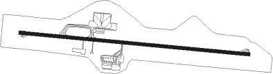
Kigali
Airport details
| Country | Rwanda |
| State | Kigali City |
| Region | HR |
| Municipality | Kicukiro District |
| Elevation | 4856ft (1480m) |
| Timezone | GMT +2 |
| Coordinates | -1.96627, 30.13664 |
| Magnetic var | |
| Type | land |
| Available since | X-Plane v10.40 |
| ICAO code | HRYR |
| IATA code | KGL |
| FAA code | n/a |
Communication
| Kigali Ground Control | 121.700 |
| Kigali Tower | 118.300 |
| Kigali Approach | 125.300 |
Approach frequencies
| ILS-cat-I | RW28 | 109.9 | 18.00mi |
| 3° GS | RW28 | 109.9 | 18.00mi |
Nearby beacons
| code | identifier | dist | bearing | frequency |
|---|---|---|---|---|
| KNM | KIGALI VOR/DME | 0.6 | 102° | 114.90 |
| LO | KIGALI NDB | 8.8 | 101° | 255 |
| DO | KIRUNDO NDB | 34.8 | 183° | 295 |
| BU | BUTARE NDB | 45.1 | 212° | 340 |
| KS | KISORO NDB | 48.1 | 328° | 258 |
| GA | MUYINGA NDB | 54.1 | 167° | 345 |
| GS | GOMA NDB | 56 | 287° | 397 |
| GOM | GOMA VOR/DME | 56.4 | 288° | 116.50 |
| RG | RWEGURA NDB | 68 | 213° | 305 |
Departure and arrival routes
| Transition altitude | 9000ft |
| Transition level | 11000ft |
| SID end points | distance | outbound heading | |
|---|---|---|---|
| RW10 | |||
| EGRE1D | 55mi | 16° | |
| ALSA1D | 48mi | 50° | |
| BOSA1D | 41mi | 85° | |
| DATA1D | 46mi | 100° | |
| GAVD1D | 58mi | 210° | |
| KARO1D | 54mi | 255° | |
| RANA1D | 42mi | 288° | |
| STAR starting points | distance | inbound heading | |
|---|---|---|---|
| RW28 | |||
| GAVD1C, GAVD1A | 58.0 | 30° | |
| KARO1A, KARO1C | 54.0 | 75° | |
| RANA1C, RANA1A | 41.5 | 108° | |
| EGRE1A, EGRE1C | 55.3 | 196° | |
| ALSA1A, ALSA1C | 47.8 | 230° | |
| BOSA1C, BOSA1A | 41.1 | 265° | |
| DATA1C, DATA1A | 46.2 | 280° | |
Instrument approach procedures
| runway | airway (heading) | route (dist, bearing) |
|---|---|---|
| RW28 | DUKMA (280°) | DUKMA 8000ft EKBIG (5mi, 280°) 7100ft |
| RW28 | ESVAV (303°) | ESVAV 8000ft EKBIG (5mi, 10°) 7100ft |
| RW28 | UDBEN (258°) | UDBEN 8000ft EKBIG (5mi, 190°) 7100ft |
| RNAV | EKBIG 7100ft NIGUB (6mi, 280°) 6500ft UVDUV (4mi, 280°) 5306ft (1816mi, 274°) 5306ft ESVAV (1825mi, 94°) 8000ft ESVAV (turn) 8000ft |
Holding patterns
| STAR name | hold at | type | turn | heading* | altitude | leg | speed limit |
|---|---|---|---|---|---|---|---|
| ALSA1C | ETMAP | VHF | right | 48 (228)° | > 11000ft | 1.0min timed | 230 |
| EGRE1C | ETMAP | VHF | right | 48 (228)° | > 11000ft | 1.0min timed | 230 |
| GAVD1C | GESOL | VHF | left | 143 (323)° | > 9000ft | 1.0min timed | 230 |
| KARO1C | GESOL | VHF | left | 143 (323)° | > 9000ft | 1.0min timed | 230 |
| RANA1C | ETMAP | VHF | right | 48 (228)° | > 11000ft | 1.0min timed | 230 |
| *) magnetic outbound (inbound) holding course | |||||||
Disclaimer
The information on this website is not for real aviation. Use this data with the X-Plane flight simulator only! Data taken with kind consent from X-Plane 12 source code and data files. Content is subject to change without notice.