Arusha - Kilimanjaro Intl
Airport details
| Country | Tanzania |
| State | Kilimanjaro |
| Region | HT |
| Airspace | Dar-es-salaam Ctr |
| Municipality | Hai |
| Elevation | 2932ft (894m) |
| Timezone | GMT +3 |
| Coordinates | -3.42941, 37.07446 |
| Magnetic var | |
| Type | land |
| Available since | X-Plane v10.40 |
| ICAO code | HTKJ |
| IATA code | JRO |
| FAA code | n/a |
Communication
| Kilimanjaro Intl ATIS | 126.600 |
| Kilimanjaro Intl Tower | 120.100 |
| Kilimanjaro Intl Approach | 119.900 |
| Kilimanjaro Intl Approach | 120.100 |
Approach frequencies
| ILS-cat-I | RW09 | 110.9 | 18.00mi |
| 3° GS | RW09 | 110.9 | 18.00mi |
Runway info
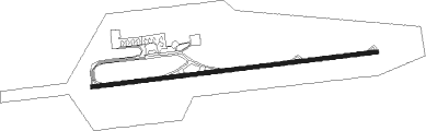
| Runway 09 / 27 | ||
| length | 3586m (11765ft) | |
| bearing | 88° / 268° | |
| width | 45m (148ft) | |
| surface | asphalt | |
| blast zone | 71m (233ft) / 60m (197ft) | |
Nearby beacons
| code | identifier | dist | bearing | frequency |
|---|---|---|---|---|
| KV | KILIMANJARO VOR/DME | 1.9 | 87° | 115.30 |
| KO | KILIMANJARO NDB | 4.8 | 268° | 298 |
| KL | KILIMANJARO NDB | 8.9 | 267° | 283 |
| KB | KILIMANJARO NDB | 24.5 | 248° | 293 |
| AR | ARUSHA NDB | 27.4 | 278° | 391 |
Departure and arrival routes
| Transition altitude | 9000ft |
| Transition level | 10000ft |
| SID end points | distance | outbound heading | |
|---|---|---|---|
| RW09 | |||
| GABS1A, GABS1B | 46mi | 41° | |
| UTOP1A | 58mi | 114° | |
| NEVA1A, GERE1A | 129mi | 140° | |
| MUMT1A | 125mi | 148° | |
| AVAT1A | 102mi | 283° | |
| IBTI1A | 60mi | 287° | |
| EVAT1A | 76mi | 330° | |
| ATBA1A | 57mi | 341° | |
| UTAT1A | 45mi | 358° | |
| RW27 | |||
| GABS1E | 46mi | 41° | |
| NEVA1B | 58mi | 114° | |
| GERE1E, IBTI1B | 129mi | 140° | |
| MUMT1E | 125mi | 148° | |
| AVAT1E | 102mi | 283° | |
| IBVO1A | 60mi | 287° | |
| EVAT1E | 76mi | 330° | |
| ATBA1E | 57mi | 341° | |
| UTAT1E | 45mi | 358° | |
| STAR starting points | distance | inbound heading | |
|---|---|---|---|
| RW09 | |||
| IBGO1A | 36.3 | 20° | |
| IMLA1A | 84.9 | 127° | |
| UNGA1A | 96.3 | 143° | |
| EVAT1A | 75.5 | 150° | |
| LUDO1A | 58.0 | 294° | |
| RW27 | |||
| IMLA1B | 84.9 | 127° | |
| UNGA1B | 96.3 | 143° | |
| EVAT1B | 75.5 | 150° | |
| LUDO1B | 58.0 | 294° | |
Instrument approach procedures
| runway | airway (heading) | route (dist, bearing) |
|---|---|---|
| RW09 | TESOV (88°) | TESOV 6500ft OKREX (4mi, 88°) 5100ft |
| RW09 | UBTOL (48°) | UBTOL 6500ft OKREX (10mi, 358°) 5100ft |
| RNAV | OKREX 5100ft IMPEK (6mi, 88°) 4700ft HTKJ (6mi, 88°) 2982ft GABNI (16mi, 88°) UBTOL (30mi, 248°) 6500ft | |
| RW27 | EVOKA (308°) | EVOKA 6500ft IMGOT (10mi, 358°) 6000ft |
| RW27 | GABNI (268°) | GABNI 6500ft IMGOT (4mi, 268°) 6000ft |
| RNAV | IMGOT 6000ft ITSIS (6mi, 268°) 4600ft HTKJ (6mi, 268°) 2953ft NEXOS (14mi, 268°) UBTOL (10mi, 166°) 6500ft |
Disclaimer
The information on this website is not for real aviation. Use this data with the X-Plane flight simulator only! Data taken with kind consent from X-Plane 12 source code and data files. Content is subject to change without notice.