Kampala - Kajjansi
Airport details
| Country | Uganda |
| State | Wakiso |
| Region | HU |
| Airspace | Entebbe Ctr |
| Municipality | Entebbe City |
| Elevation | 3748ft (1142m) |
| Timezone | GMT +3 |
| Coordinates | 0.20000, 32.55000 |
| Magnetic var | |
| Type | land |
| Available since | X-Plane v10.40 |
| ICAO code | HUKJ |
| IATA code | n/a |
| FAA code | n/a |
Communication
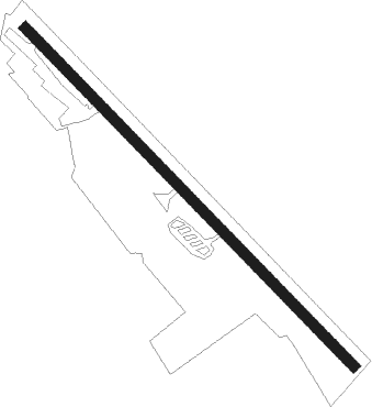
Runway info
| Runway 14 / 32 | ||
| length | 1113m (3652ft) | |
| bearing | 140° / 320° | |
| width | 24m (80ft) | |
| surface | dirt | |
Nearby beacons
| code | identifier | dist | bearing | frequency |
|---|---|---|---|---|
| EM | ENTEBBE NDB | 8.3 | 244° | 355 |
| PB | PORTBELL NDB | 8.5 | 48° | 270 |
| NN | ENTEBBE VOR/DME | 11 | 217° | 117.50 |
Disclaimer
The information on this website is not for real aviation. Use this data with the X-Plane flight simulator only! Data taken with kind consent from X-Plane 12 source code and data files. Content is subject to change without notice.