Caldwell - Noble Co
Airport details
| Country | United States of America |
| State | Ohio |
| Region | K5 |
| Airspace | Cleveland Ctr |
| Municipality | Noble County |
| Elevation | 876ft (267m) |
| Timezone | GMT -5 |
| Coordinates | 39.80097, -81.53632 |
| Magnetic var | |
| Type | land |
| Available since | X-Plane v10.40 |
| ICAO code | I10 |
| IATA code | n/a |
| FAA code | n/a |
Communication
| Noble Co CTAF/UNICOM | 122.800 |
Nearby Points of Interest:
Samuel Caldwell House
-Young-Shaw House
-Samuel Danford Farm
-Abner Williams Log House
-Broom Building
-McCracken-McFarland House
-Barnett-Criss House
-Colonel Joseph Taylor House
-Guernsey County Courthouse
-Mason House
-Jonathan Sprague House
-William Rainey Harper Log House
-West Union School
-Ralph Hardesty Stone House
-Broom-Braden Stone House
-Samuel Harper Stone House
-Barnesville Petroglyph
-Colonel Joseph Barker House
-Simeon Deming House
-Monroe County Courthouse
-Monroe Bank
-Kennedy Stone House
-William C. Mooney House
-Tower Site
-Hollister-Parry House
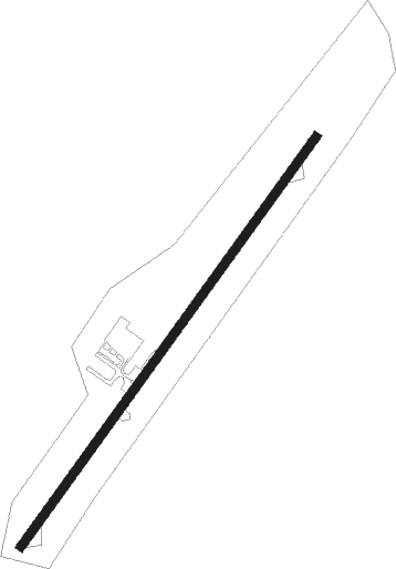
Runway info
| Runway 5 / 23 | ||
| length | 1163m (3816ft) | |
| bearing | 48° / 228° | |
| width | 20m (65ft) | |
| surface | asphalt | |
| displ threshold | 0m (0ft) / 126m (413ft) | |
Nearby beacons
| code | identifier | dist | bearing | frequency |
|---|---|---|---|---|
| ZZV | ZANESVILLE VOR/DME | 18.4 | 291° | 114.95 |
| JPU | PARKERSBURG VOR/DME | 22.8 | 156° | 108.60 |
| CTW | DME | 25.8 | 8° | 111.80 |
| PK | VERSI (PARKERSBURG) NDB | 32.9 | 175° | 388 |
| AIR | BELLAIRE VOR/DME | 35.5 | 73° | 117.10 |
| CFX | CADIZ NDB | 35.5 | 50° | 239 |
| UGS | UNIVERSITY (ATHENS) NDB | 42.5 | 227° | 250 |
| HLG | WHEELING VOR/DME | 52.3 | 65° | 112.20 |
| BSV | BRIGGS VOR/DME | 56.6 | 6° | 112.40 |
| MF | MANNS (MANSFIELD) NDB | 71.3 | 317° | 372 |
Instrument approach procedures
| runway | airway (heading) | route (dist, bearing) |
|---|---|---|
| RW23 | CADRE (304°) | CADRE RAMIQ (10mi, 40°) 3000ft ZAKFE (6mi, 303°) 2800ft |
| RW23 | ZZV (111°) | ZZV UMVIW (19mi, 82°) 3000ft ZAKFE (6mi, 123°) 2800ft |
| RNAV | ZAKFE 2800ft ENISY (5mi, 228°) 2800ft I10 (5mi, 228°) 928ft (5015mi, 116°) 1279ft CUMBA (5023mi, 296°) 3000ft CUMBA (turn) |
Disclaimer
The information on this website is not for real aviation. Use this data with the X-Plane flight simulator only! Data taken with kind consent from X-Plane 12 source code and data files. Content is subject to change without notice.