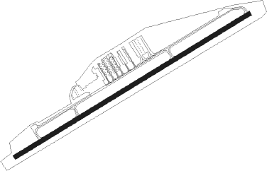
Dayton - Greene Co-jackson Rgnl
Airport details
| Country | United States of America |
| State | Ohio |
| Region | |
| Airspace | Indianapolis Ctr |
| Municipality | Beavercreek Township |
| Elevation | 949ft (289m) |
| Timezone | GMT -5 |
| Coordinates | 39.68761, -84.00070 |
| Magnetic var | |
| Type | land |
| Available since | X-Plane v10.40 |
| ICAO code | I19 |
| IATA code | n/a |
| FAA code | I19 |
Communication
| Greene Co-Jackson Rgnl AWOS 3 | 118.525 |
| Greene Co-Jackson Rgnl CTAF/UNICOM | 122.700 |
| Greene Co-Jackson Rgnl DAYTON Approach | 118.850 |
| Greene Co-Jackson Rgnl DAYTON Departure | 126.500 |
Nearby Points of Interest:
Samuel N. Patterson House
-Millen-Schmidt House
-Bank of Xenia
-Alexander Conner House
-Hollencamp House
-McDonald Farm
-Berryhill-Morris House
-Wright-Patterson Air Force Base Mound
-Lewis Kemp House
-Huffman Prairie
-Fairborn Twin Cinemas
-South School
-Mercer Log House
-Hawthorn Hill
-Dayton Fire Department Station No. 16
-Antioch Hall, North and South Halls
-Whitelaw Reid House
-Samuel N. Brown House
-Orators Mound
-Charles F. Kettering House
-Whitehall Farm
-Rudolph Pretzinger House
-Kelly Family Home
-Wright Flyer III
-Harper Mausoleum and George W. Harper Memorial Entrance
Nearby beacons
| code | identifier | dist | bearing | frequency |
|---|---|---|---|---|
| FFO | PATTERSON (DAYTON) TACAN | 8.2 | 337° | 115.20 |
| SGH | DME | 11.4 | 46° | 113.20 |
| XSF | SPRINGFIELD TACAN | 11.6 | 47° | 133.80 |
| MW | ONIDA (MIDDLETOWN) NDB | 16.3 | 251° | 223 |
| IL | AIRBO (WILMINGTON) NDB | 16.8 | 127° | 407 |
| MXQ | MIDWEST (WILMINGTON) VOR/DME | 18 | 142° | 112.90 |
| AT | BRUNY (DAYTON) NDB | 18.1 | 295° | 315 |
| HW | CUBLA (WILMINGTON) NDB | 20.8 | 160° | 299 |
| HKF | HOOK FIELD (MIDDLETOWN) NDB | 23.5 | 247° | 239 |
| DQN | DAYTON VOR/DME | 26.9 | 310° | 114.50 |
| CSS | COURT HOUSE (WASHINGTON) NDB | 28.6 | 98° | 414 |
| ROD | ROSEWOOD VORTAC | 36 | 356° | 117.50 |
| BU | BOUTN (COLUMBUS) NDB | 37.5 | 81° | 230 |
| PWF | SPORTYS (BATAVIA) NDB | 38 | 199° | 245 |
| RID | RICHMOND VOR/DME | 38.9 | 275° | 110.60 |
| OS | FULER (COLUMBUS) NDB | 43.6 | 64° | 515 |
| DD | COBBS (COLUMBUS) NDB | 45.4 | 87° | 253 |
| AWW | WINCHESTER NDB | 51.3 | 298° | 212 |
| CVG | CINCINNATI VORTAC | 51.8 | 226° | 117.30 |
| BUD | BUCKEYE (MARION) VOR | 70.4 | 45° | 109.80 |
Instrument approach procedures
| runway | airway (heading) | route (dist, bearing) |
|---|---|---|
| RW07 | CINPA (82°) | CINPA UYOKO (8mi, 102°) 2700ft |
| RW07 | JENEY (15°) | JENEY UYOKO (16mi, 332°) 2700ft |
| RW07 | UYOKO (68°) | UYOKO 6000ft UYOKO (turn) 2700ft |
| RNAV | UYOKO 2700ft WANKU (7mi, 68°) 2700ft NINRE (2mi, 69°) 1860ft I19 (2mi, 69°) 950ft (5128mi, 115°) 1205ft TUNNU (5118mi, 295°) 2700ft TUNNU (turn) | |
| RW25 | BONEE (188°) | BONEE PODIY (12mi, 148°) 2700ft TUNNU (6mi, 147°) 2700ft |
| RW25 | SHIRT (277°) | SHIRT ORBOE (7mi, 289°) 2700ft TUNNU (6mi, 327°) 2700ft |
| RW25 | TUNNU (249°) | TUNNU 6000ft TUNNU (turn) 2700ft |
| RNAV | TUNNU 2700ft YONDU (7mi, 249°) 2600ft IXAME (3mi, 249°) 1620ft I19 (3mi, 249°) 989ft (5128mi, 115°) 1219ft UYOKO (5138mi, 295°) 2700ft UYOKO (turn) |
Disclaimer
The information on this website is not for real aviation. Use this data with the X-Plane flight simulator only! Data taken with kind consent from X-Plane 12 source code and data files. Content is subject to change without notice.
