Urbana - Grimes Flield
Airport details
| Country | United States of America |
| State | Ohio |
| Region | K5 |
| Airspace | Indianapolis Ctr |
| Municipality | Urbana |
| Elevation | 1065ft (325m) |
| Timezone | GMT -5 |
| Coordinates | 40.13237, -83.75407 |
| Magnetic var | |
| Type | land |
| Available since | X-Plane v10.40 |
| ICAO code | I74 |
| IATA code | n/a |
| FAA code | n/a |
Communication
| Grimes Flield AWOS 3 | 118.325 |
| Grimes Flield CTAF/UNICOM | 122.700 |
| Grimes Flield DAYTON Approach/Departure | 127.650 |
Nearby Points of Interest:
Nutwood Place
-Dr. Adam Mosgrove House
-Richards-Sewall House
-John Q.A. Ward House
-Urbana College Historic Buildings
-Piatt Castles
-Carl Potter Mound
-Jeff Kimball House
-Demand-Gest House
-Oram Nincehelser House
-John H. Clark House
-William Culbertson House
-Village Hobby Shop
-Masonic Temple
-Monitor House
-Norvall Hunter Farm
-The Fort
-Odd Fellows' Home for Orphans, Indigent and Aged
-Third Presbyterian Church
-Martin Marmon House
-Elmwood Place
-Westcott House
-Lagonda Club Building
-Tecumseh Building
-Warder Public Library
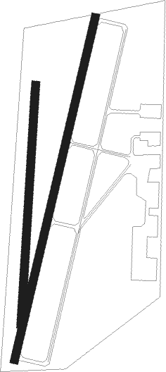
Runway info
Runway 2 / 20  | ||
| length | 1342m (4403ft) | |
| bearing | 23° / 203° | |
| width | 30m (100ft) | |
| surface | asphalt | |
| Runway 01 / 19 | ||
| length | 916m (3005ft) | |
| bearing | 10° / 190° | |
| width | 30m (100ft) | |
| surface | grass | |
Nearby beacons
| code | identifier | dist | bearing | frequency |
|---|---|---|---|---|
| ROD | ROSEWOOD VORTAC | 16.2 | 298° | 117.50 |
| XSF | SPRINGFIELD TACAN | 18.1 | 196° | 133.80 |
| SGH | DME | 18.2 | 197° | 113.20 |
| FFO | PATTERSON (DAYTON) TACAN | 23.3 | 224° | 115.20 |
| OS | FULER (COLUMBUS) NDB | 25.7 | 96° | 515 |
| DQN | DAYTON VOR/DME | 30.3 | 260° | 114.50 |
| BU | BOUTN (COLUMBUS) NDB | 31.5 | 120° | 230 |
| AT | BRUNY (DAYTON) NDB | 31.7 | 244° | 315 |
| CSS | COURT HOUSE (WASHINGTON) NDB | 36 | 146° | 414 |
| IL | AIRBO (WILMINGTON) NDB | 38.4 | 179° | 407 |
| DD | COBBS (COLUMBUS) NDB | 41 | 118° | 253 |
| MXQ | MIDWEST (WILMINGTON) VOR/DME | 42.2 | 184° | 112.90 |
| MW | ONIDA (MIDDLETOWN) NDB | 42.3 | 226° | 223 |
| LCK | RICKENBACKER (COLUMBUS) TACAN | 42.6 | 111° | 134.20 |
| BUD | BUCKEYE (MARION) VOR | 42.9 | 55° | 109.80 |
| LC | PICKL (COLUMBUS) NDB | 44.8 | 105° | 376 |
| HW | CUBLA (WILMINGTON) NDB | 47.1 | 189° | 299 |
| FBC | FLAG CITY VORTAC | 49.4 | 360° | 108.20 |
| HKF | HOOK FIELD (MIDDLETOWN) NDB | 49.7 | 228° | 239 |
| XUB | YELLOW BUD (CIRCLEVILLE) VOR | 51 | 128° | 112.50 |
| TII | TIFFIN NDB | 62.8 | 29° | 269 |
| EOP | WAVERLY NDB | 69.3 | 140° | 385 |
Instrument approach procedures
| runway | airway (heading) | route (dist, bearing) |
|---|---|---|
| RW02 | JOGER (320°) | JOGER PENOE (19mi, 300°) 4000ft SEBUE (5mi, 284°) 4000ft |
| RW02 | SEBUE (23°) | SEBUE 4000ft |
| RW02 | TRUNC (77°) | TRUNC OREXE (12mi, 107°) 4000ft SEBUE (5mi, 104°) 4000ft |
| RNAV | SEBUE 4000ft RIKOE (6mi, 23°) 3000ft WANIS (3mi, 23°) 1860ft I74 (3mi, 22°) 1102ft (5119mi, 116°) 1318ft HIRID (5116mi, 296°) 3000ft HIRID (turn) | |
| RW20 | GUNNE (246°) | GUNNE YEGUT (16mi, 260°) 3000ft HIRID (5mi, 284°) 3000ft |
| RW20 | HIRID (203°) | HIRID 3000ft |
| RW20 | ROD (118°) | ROD IJMIN (13mi, 76°) 3000ft HIRID (5mi, 104°) 3000ft |
| RNAV | HIRID 3000ft LEKNE (6mi, 203°) 3000ft OWEQO (4mi, 203°) 1700ft I74 (2mi, 203°) 1106ft SEBUE (12mi, 203°) 4000ft SEBUE (turn) |
Disclaimer
The information on this website is not for real aviation. Use this data with the X-Plane flight simulator only! Data taken with kind consent from X-Plane 12 source code and data files. Content is subject to change without notice.