Alexandria
Airport details
| Country | United States of America |
| State | Indiana |
| Region | |
| Airspace | Indianapolis Ctr |
| Municipality | Madison County |
| Elevation | 897ft (273m) |
| Timezone | GMT -5 |
| Coordinates | 40.23249, -85.63750 |
| Magnetic var | |
| Type | land |
| Available since | X-Plane v10.30 |
| ICAO code | I99 |
| IATA code | n/a |
| FAA code | I99 |
Communication
| Alexandria CTAF/UNICOM | 123.050 |
| Alexandria INDIANAPOLIS ApproachROACH | 120.650 |
| Alexandria INDIANAPOLIS DepartureARTURE | 120.650 |
Nearby Points of Interest:
Job Garner-Jacob W. Miller House
-Anderson Bank Building
-Paramount Theatre
-Joseph & Lucinda Thawley House
-George Makepeace House
-Gruenewald House
-Anderson Center for the Arts
-West Eighth Street Historic District
-Anderson Downtown Historic District
-West Central Historic District
-Central Avenue School
-Westwood Historic District
-Richwood Evangelical Lutheran Church
-J.W. Patterson House
-Alva Kitselman House
-Riverside Historic District
-Baldwin Addition Historic District
-John Valentine House
-Otto Carmichael House
-Minnetrista Boulevard Historic District
-Meeks Avenue Historic District
-Old West End Historic District
-John W. Hedrick House
-Judson Building
-Middletown Commercial Historic District
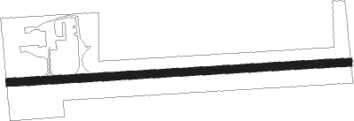
Runway info
| Runway 9 / 27 | ||
| length | 787m (2582ft) | |
| bearing | 91° / 271° | |
| width | 18m (60ft) | |
| surface | asphalt | |
| displ threshold | 59m (194ft) / 82m (269ft) | |
Nearby beacons
| code | identifier | dist | bearing | frequency |
|---|---|---|---|---|
| MIE | MUNCIE VOR/DME | 11.1 | 89° | 114.40 |
| AI | VIDEO (ANDERSON) NDB | 11.3 | 142° | 394 |
| JN | BALLL (MUNCIE) NDB | 14.8 | 99° | 365 |
| MI | BALLL (MUNCIE) NDB | 14.8 | 99° | 365 |
| MZZ | MARION VOR/DME | 15.7 | 351° | 108.60 |
| UWL | NEW CASTLE NDB | 25.7 | 138° | 385 |
| UMP | METROPOLITAN (INDIANAPOLIS) NDB | 25.9 | 234° | 338 |
| OKK | KOKOMO VORTAC | 26.1 | 305° | 113.50 |
| AWW | WINCHESTER NDB | 33 | 95° | 212 |
| GUS | GRISSOM (PERU) VORTAC | 34.1 | 309° | 108.45 |
| SQ | PNTHR (CONNERSVILLE) NDB | 35.9 | 132° | 227 |
| SHB | SHELBYVILLE VOR/DME | 37 | 197° | 112 |
| FV | LAREZ (INDIANAPOLIS) NDB | 37.1 | 231° | 349 |
| VHP | BRICKYARD VORTAC | 41.9 | 240° | 116.30 |
| CO | COLFA (INDIANAPOLIS) NDB | 42.7 | 224° | 232 |
| RID | RICHMOND VOR/DME | 46.6 | 121° | 110.60 |
| FWA | FORT WAYNE VORTAC | 49.2 | 31° | 117.80 |
| BA | CLIFS (COLUMBUS) NDB | 55.3 | 191° | 410 |
| HLB | BATESVILLE NDB | 56 | 157° | 254 |
Disclaimer
The information on this website is not for real aviation. Use this data with the X-Plane flight simulator only! Data taken with kind consent from X-Plane 12 source code and data files. Content is subject to change without notice.