Coeur D'alene - Carlin Bay
Airport details
| Country | United States of America |
| State | Idaho |
| Region | |
| Airspace | Seattle Ctr |
| Municipality | Kootenai County |
| Elevation | 2702ft (824m) |
| Timezone | GMT -8 |
| Coordinates | 47.54811, -116.76706 |
| Magnetic var | |
| Type | land |
| Available since | X-Plane v10.40 |
| ICAO code | ID43 |
| IATA code | n/a |
| FAA code | ID43 |
Communication
Nearby Points of Interest:
Mineral Ridge National Recreation Trail, Idaho
-John P. and Stella Gray House
-Coeur d'Alene City Hall
-Coeur d'Alene Masonic Temple
-Coeur d'Alene Federal Building
-First United Methodist Church (Coeur d'Alene, Idaho)
-Harvey M. Davey House
-Kootenai County Courthouse
-Fort Sherman
-Post Falls Community United Presbyterian Church
-Samuel and Ann Young House
-Clark House
-John A. Finch Caretaker's House
-Spokane River Centennial Trail
-St. Maries 1910 Fire Memorial
-St. Maries Masonic Temple No. 63
-Benewah County Courthouse
-Rosebush House
-Coeur d'Alene Mission of the Sacred Heart
-Spokane Public Library - East Side Branch
-Mount Saint Michael
-Cambern Dutch Shop Windmill
-Frequency Changing Station
-Mount Spokane Vista House
-The Globe Hotel
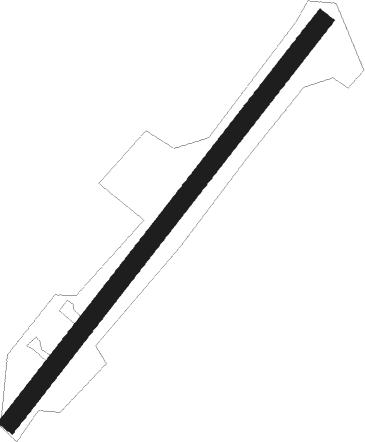
Runway info
| Runway 05 / 23 | ||
| length | 842m (2762ft) | |
| bearing | 53° / 233° | |
| width | 30m (100ft) | |
| surface | grass | |
Nearby beacons
| code | identifier | dist | bearing | frequency |
|---|---|---|---|---|
| COE | COEUR D'ALENE VOR/DME | 13.7 | 347° | 108.80 |
| GEG | SPOKANE VORTAC | 34.8 | 271° | 115.50 |
| SKA | FAIRCHILD (SPOKANE) TACAN | 36.4 | 274° | 111.40 |
| DPY | DEER PARK NDB | 36.6 | 302° | 365 |
| SZT | SANDPOE (SANDPOINT) NDB | 45.3 | 15° | 264 |
| PUW | PULLMAN (PULLMAN/MOSCOW) VOR/DME | 55.6 | 208° | 109 |
Disclaimer
The information on this website is not for real aviation. Use this data with the X-Plane flight simulator only! Data taken with kind consent from X-Plane 12 source code and data files. Content is subject to change without notice.