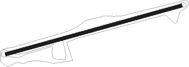
Millville - Hill Top Airport
Airport details
| Country | United States of America |
| State | New Jersey |
| Region | K6 |
| Airspace | New York Ctr |
| Municipality | West Milford |
| Elevation | 919ft (280m) |
| Timezone | GMT -5 |
| Coordinates | 41.08322, -74.33855 |
| Magnetic var | |
| Type | land |
| Available since | X-Plane v10.40 |
| ICAO code | JY43 |
| IATA code | n/a |
| FAA code | JY43 |
Communication
Runway info
| Runway 9 / 27 | ||
| length | 616m (2021ft) | |
| bearing | 82° / 262° | |
| width | 12m (40ft) | |
| surface | asphalt | |
Nearby beacons
| code | identifier | dist | bearing | frequency |
|---|---|---|---|---|
| SAX | SPARTA VORTAC | 9 | 266° | 115.70 |
| MM | MOREE (MORRISTOWN) NDB | 12.2 | 179° | 392 |
| TEB | TETERBORO VOR/DME | 18.8 | 130° | 108.40 |
| TE | TORBY (TETERBORO) NDB | 19.1 | 144° | 214 |
| CAT | CHATHAM NDB | 20.9 | 195° | 254 |
| HUO | HUGUENOT VOR/DME | 22.6 | 322° | 116.10 |
| STW | STILLWATER VOR/DME | 24.5 | 261° | 109.60 |
| SW | NEELY (NEWBURGH) NDB | 24.6 | 15° | 335 |
| BWZ | BROADWAY (SCHOOLEY'S MT) VOR/DME | 27.8 | 239° | 114.20 |
| LGA | LA GUARDIA (NEW YORK) VOR/DME | 27.8 | 123° | 113.10 |
| SKU | STANWYCK (NEWBURGH) NDB | 29.8 | 33° | 261 |
| CRI | CANARSIE VOR/DME | 34.7 | 137° | 112.30 |
| SBJ | SOLBERG VOR/DME | 35.1 | 219° | 112.90 |
| CMK | CARMEL VOR/DME | 36.2 | 75° | 116.60 |
| JFK | KENNEDY (NEW YORK) VOR/DME | 37.3 | 128° | 115.90 |
| IGN | KINGSTON VOR/DME | 42 | 42° | 117.60 |
| FR | FRIKK (FARMINGDALE) NDB | 42.9 | 110° | 407 |
| COL | COLTS NECK VOR/DME | 47 | 167° | 115.40 |
| PWL | PAWLING (POUGHKEEPSIE) VOR/DME | 52.9 | 47° | 114.30 |
| RBV | ROBBINSVILLE VORTAC | 53.3 | 190° | 113.80 |
| ARD | YARDLEY VOR/DME | 56.1 | 214° | 108.20 |
| ING | AMBLER NDB | 71.8 | 225° | 275 |
| HNK | HANCOCK VOR/DME | 73.4 | 315° | 116.80 |
Disclaimer
The information on this website is not for real aviation. Use this data with the X-Plane flight simulator only! Data taken with kind consent from X-Plane 12 source code and data files. Content is subject to change without notice.
