Perryville - Perryville Rgnl
Airport details
| Country | United States of America |
| State | Missouri |
| Region | K3 |
| Airspace | Kansas City Ctr |
| Municipality | Perry County |
| Elevation | 371ft (113m) |
| Timezone | GMT -6 |
| Coordinates | 37.86867, -89.86214 |
| Magnetic var | |
| Type | land |
| Available since | X-Plane v10.40 |
| ICAO code | K02 |
| IATA code | n/a |
| FAA code | PCD |
Communication
| Perryville Rgnl AWOS-3PT | 118.950 |
| Perryville Rgnl CTAF/UNICOM | 122.800 |
| Perryville Rgnl KANSAS CITY Approach/Departure | 127.475 |
Nearby Points of Interest:
Frederick Weistar House
-Old Fire Station
-Christian F. Weinrich House
-Madison County Sheriff's House and Jail
-Pierre Menard House
-Perry County Courthouse
-St. Mary's of the Barrens Catholic Church
-Shelby-Nicholson-Schindler House
-Doerr–Brown House
-Amoureux House
-Tegtmeyer Site
-Piney Creek West Site
-Piney Creek Site
-Piney Creek South Site
-Jacques Guibourd Historic House
-Shiloh College
-Eggers and Company General Store
-Charter Oak Schoolhouse
-Cleiman Mound and Village Site
-Creole House
-Old Appleton Bridge
-Saxon Lutheran Memorial (Frohna, Missouri)
-French Colonial Historic District
-Concordia Log Cabin College (Altenburg, Missouri)
-Fort de Chartres
Runway info
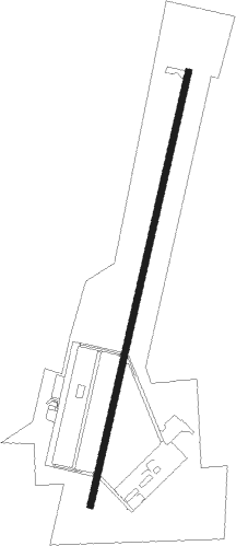
| Runway 2 / 20 | ||
| length | 2137m (7011ft) | |
| bearing | 21° / 201° | |
| width | 30m (100ft) | |
| surface | concrete | |
| displ threshold | 159m (522ft) / 0m (0ft) | |
Nearby beacons
| code | identifier | dist | bearing | frequency |
|---|---|---|---|---|
| FAM | FARMINGTON VORTAC | 21.1 | 242° | 115.70 |
| MD | CABBI (CARBONDALE-MURPHYSBORO) NDB | 29.2 | 90° | 388 |
| JD | GOOEY (BELLEVILLE) NDB | 37 | 12° | 385 |
| CG | DUTCH (CAPE GIRARDEAU) NDB | 37.7 | 165° | 248 |
| CP | ACORE (CAHOKIA/ST LOUIS) NDB | 40.2 | 343° | 350 |
| SKE | SCOTT (BELLEVILLE) TACAN | 40.6 | 1° | 112.20 |
| CGI | GIRARDEAU DME | 40.9 | 156° | 112.90 |
| MWA | DME | 40.9 | 98° | 110.40 |
| MW | JONNY (MARION) NDB | 42.3 | 92° | 382 |
| ENL | CENTRALIA VORTAC | 46.8 | 52° | 115 |
| TOY | TROY VORTAC | 52.3 | 356° | 116 |
| CIR | CAIRO NDB | 57.2 | 142° | 397 |
| CSX | DME | 58 | 331° | 116.45 |
| FZ | EAVES (ST LOUIS) NDB | 58.3 | 320° | 227 |
| GRE | GREENVILLE NDB | 62.4 | 27° | 233 |
| SU | SNOOP (ST LOUIS) NDB | 62.9 | 310° | 326 |
| STL | SAINT LOUIS VORTAC | 66.3 | 328° | 117.40 |
Disclaimer
The information on this website is not for real aviation. Use this data with the X-Plane flight simulator only! Data taken with kind consent from X-Plane 12 source code and data files. Content is subject to change without notice.