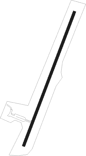
Falmouth - Gene Snyder
Airport details
| Country | United States of America |
| State | Kentucky |
| Region | K5 |
| Airspace | Indianapolis Ctr |
| Municipality | Pendleton County |
| Elevation | 895ft (273m) |
| Timezone | GMT -5 |
| Coordinates | 38.70408, -84.39183 |
| Magnetic var | |
| Type | land |
| Available since | X-Plane v10.40 |
| ICAO code | K62 |
| IATA code | n/a |
| FAA code | n/a |
Communication
| Gene Snyder CTAF/UNICOM | 122.700 |
| Gene Snyder CINCINNATI Approach/Departure | 121.000 |
Nearby Points of Interest:
Charity's House
-Sheehan House
-Bullskin Creek Site
-Ferris Site
-Ford Stone House
-Blenk House
-Kort Grocery
-William Winter Stone House
-Emery Row
-Thomas Metcalf House
-Cynthiana Commercial District
-Wells-Keith House
-James Weldon House
-Brothers-O'Neil House
-St. John the Baptist Roman Catholic Church
-Church of the Advent, Episcopal
-Spur Gasoline Station
-Robertson County Courthouse
-Big Bone Methodist Church
-Clinton Blankenbeker House
-Florence Fire Station
-United Brethren in Christ
-Merit-Tandy Farmstead
-Holy Cross Church and School Complex-Latonia
-Bracken Baptist Church
Runway info
| Runway 3 / 21 | ||
| length | 1223m (4012ft) | |
| bearing | 31° / 211° | |
| width | 23m (75ft) | |
| surface | asphalt | |
| displ threshold | 32m (105ft) / 0m (0ft) | |
Nearby beacons
| code | identifier | dist | bearing | frequency |
|---|---|---|---|---|
| FLM | FALMOUTH VOR/DME | 5 | 124° | 117 |
| CVG | CINCINNATI VORTAC | 23.7 | 315° | 117.30 |
| PWF | SPORTYS (BATAVIA) NDB | 23.8 | 25° | 245 |
| GN | BRIDL (LEXINGTON) NDB | 35.2 | 191° | 340 |
| FFT | FRANKFORT VOR | 39.6 | 225° | 109.40 |
| IOB | MOUNT STERLING NDB | 43.2 | 148° | 210 |
| HYK | LEXINGTON VOR/DME | 44.4 | 186° | 112.60 |
| LE | BLAYD (LEXINGTON) NDB | 44.8 | 201° | 242 |
| HW | CUBLA (WILMINGTON) NDB | 45.8 | 38° | 299 |
| HKF | HOOK FIELD (MIDDLETOWN) NDB | 47.7 | 356° | 239 |
| MXQ | MIDWEST (WILMINGTON) VOR/DME | 51.5 | 39° | 112.90 |
| MW | ONIDA (MIDDLETOWN) NDB | 52.5 | 4° | 223 |
| HLB | BATESVILLE NDB | 55.8 | 307° | 254 |
| IL | AIRBO (WILMINGTON) NDB | 56.3 | 40° | 407 |
Departure and arrival routes
| Transition altitude | 18000ft |
| Transition level | 18000ft |
| STAR starting points | distance | inbound heading | |
|---|---|---|---|
| ALL | |||
| SHB6 | 70.6 | 127° | |
| CINCE9 | 49.7 | 203° | |
| HEDEE4 | 62.3 | 212° | |
| HARDU5 | 64.8 | 323° | |
Instrument approach procedures
| runway | airway (heading) | route (dist, bearing) |
|---|---|---|
| RW21 | HUXIK (235°) | HUXIK 2500ft JIKRU (4mi, 290°) 2500ft |
| RW21 | JIKRU (211°) | JIKRU 2500ft |
| RW21 | WOGEM (184°) | WOGEM 2500ft JIKRU (4mi, 110°) 2500ft |
| RNAV | JIKRU 2500ft ZUBVO (4mi, 211°) 2400ft K62 (5mi, 211°) 926ft (5142mi, 115°) 1299ft YANUR (5145mi, 295°) 2600ft YANUR (turn) |
Holding patterns
| STAR name | hold at | type | turn | heading* | altitude | leg | speed limit |
|---|---|---|---|---|---|---|---|
| CINCE9 | BOWRR | VHF | left | 68 (248)° | 1.0min timed | ICAO rules | |
| CINCE9 | HEDEE | VHF | left | 68 (248)° | 1.0min timed | ICAO rules | |
| CINCE9 | TIGRR | VHF | left | 51 (231)° | 1.0min timed | 230 | |
| HARDU5 | CHEDA | VHF | left | 191 (11)° | 1.5min timed | ICAO rules | |
| HARDU5 | HARDU | VHF | right | 154 (334)° | DME 10.0mi | ICAO rules | |
| SHB6 | CEGRM | VHF | left | 292 (112)° | < 17999ft | 1.0min timed | 230 |
| SHB6 | VHP | NDB | left | 272 (92)° | 1.0min timed | ICAO rules | |
| *) magnetic outbound (inbound) holding course | |||||||
Disclaimer
The information on this website is not for real aviation. Use this data with the X-Plane flight simulator only! Data taken with kind consent from X-Plane 12 source code and data files. Content is subject to change without notice.
