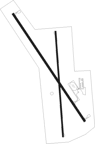
Smith Center - Smith Center Muni
Airport details
| Country | United States of America |
| State | Kansas |
| Region | K3 |
| Airspace | Minneapolis Ctr |
| Municipality | Smith County |
| Elevation | 1798ft (548m) |
| Timezone | GMT -6 |
| Coordinates | 39.76261, -98.79450 |
| Magnetic var | |
| Type | land |
| Available since | X-Plane v10.40 |
| ICAO code | K82 |
| IATA code | n/a |
| FAA code | K82 |
Communication
| Smith Center Muni AWOS-3 | 118.450 |
| Smith Center Muni CTAF/UNICOM | 122.800 |
Nearby Points of Interest:
Home on the Range Cabin
-Kirwin City Hall
-Pottawatomie County Fair Pavilion
-Old Cawker City Library
-Farmer's and Merchant's Bank Building
-Warner-Cather House
-Auld Public Library
-Webster County Courthouse
-Matthew R. Bentley House
-Burr Oak United Methodist Church
-First Congregational Church, U.C.C.
-Jewell County Courthouse
-E. W. Norris Service Station
-Rooks County Courthouse
Nearby beacons
| code | identifier | dist | bearing | frequency |
|---|---|---|---|---|
| TKO | MANKATO VORTAC | 24.8 | 85° | 109.80 |
| HSI | HASTINGS VOR/DME | 53.2 | 23° | 108.80 |
| EAR | KEARNEY VOR | 58.6 | 348° | 111.20 |
| HYS | HAYS VORTAC | 59.3 | 208° | 110.40 |
| HY | NETTE (HAYS) NDB | 63.3 | 205° | 374 |
Instrument approach procedures
| runway | airway (heading) | route (dist, bearing) |
|---|---|---|
| RW14 | LAYIP (144°) | LAYIP 3900ft |
| RNAV | LAYIP 3900ft WONID (6mi, 143°) 3700ft K82 (6mi, 144°) 1826ft (5811mi, 112°) 1986ft JUXUL (5805mi, 292°) 3700ft JUXUL (turn) | |
| RW18 | BANRE (61°) | BANRE WOVER (24mi, 35°) 3700ft ZUGIS (5mi, 90°) 3700ft |
| RW18 | RISHO (50°) | RISHO ZUGIS (20mi, 31°) 3700ft ZUGIS (turn) 3700ft |
| RW18 | TKO01 (292°) | TKO ZUGIS (25mi, 282°) 3700ft ZUGIS (turn) 3700ft |
| RW18 | TKO02 (292°) | TKO IYURA (20mi, 285°) 3700ft ZUGIS (5mi, 270°) 3700ft |
| RNAV | ZUGIS 3700ft EWAFY (4mi, 180°) 3600ft K82 (6mi, 181°) 1837ft (5811mi, 112°) 2200ft ZUVUP (5811mi, 292°) 3500ft ZUVUP (turn) | |
| RW32 | JUXUL (324°) | JUXUL 3700ft |
| RNAV | JUXUL 3700ft WULOS (7mi, 324°) 3600ft K82 (6mi, 324°) 1840ft (5811mi, 112°) 2000ft LAYIP (5816mi, 292°) 3900ft LAYIP (turn) | |
| RW36 | KOVJY (294°) | KOVJY IKHUD (10mi, 270°) 3500ft ZUVUP (5mi, 270°) 3500ft |
| RW36 | RISHO (50°) | RISHO OGUTE (3mi, 86°) 3500ft ZUVUP (5mi, 90°) 3500ft |
| RW36 | TKO (265°) | TKO ZUVUP (27mi, 250°) 3500ft ZUVUP (turn) 3500ft |
| RW36 | ZABEK (0°) | ZABEK ZUVUP (19mi, 0°) 3500ft |
| RNAV | ZUVUP 3500ft ELAWA (4mi, 0°) 3400ft UZZIV (2mi, 0°) 2620ft K82 (3mi, 360°) 1827ft (5811mi, 112°) 2100ft ZUGIS (5810mi, 292°) 3700ft ZUGIS (turn) |
Disclaimer
The information on this website is not for real aviation. Use this data with the X-Plane flight simulator only! Data taken with kind consent from X-Plane 12 source code and data files. Content is subject to change without notice.

