Aberdeen - Aberdeen Regl
Airport details
| Country | United States of America |
| State | South Dakota |
| Region | K3 |
| Airspace | Minneapolis Ctr |
| Municipality | Aberdeen |
| Elevation | 1299ft (396m) |
| Timezone | GMT -6 |
| Coordinates | 45.44831, -98.42245 |
| Magnetic var | |
| Type | land |
| Available since | X-Plane v10.30 |
| ICAO code | KABR |
| IATA code | ABR |
| FAA code | ABR |
Communication
| Aberdeen Regl ASOS | 125.875 |
| Aberdeen Regl UNICOM | 122.950 |
| Aberdeen Regl CTAF | 122.700 |
Approach frequencies
| ILS-cat-I | RW31 | 109.9 | 18.00mi |
| 3° GS | RW31 | 109.9 | 18.00mi |
Nearby Points of Interest:
Masonic Temple
-Great Northern Railway Passenger and Freight Depot
-United States Post Office and Courthouse–Aberdeen
-Brown County Courthouse
-Western Union Building (Aberdeen, South Dakota)
-Chicago, Milwaukee, St. Paul and Pacific Railroad Depot
-Martilla-Pettingel and Gorder General Merchandise Store
-Savo Hall
-First Presbyterian Church of Langford
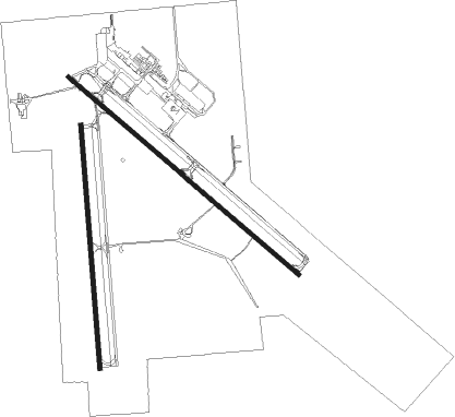
Runway info
Runway 13 / 31  | ||
| length | 2101m (6893ft) | |
| bearing | 125° / 305° | |
| width | 30m (98ft) | |
| surface | concrete | |
| blast zone | 5m (16ft) / 5m (16ft) | |
| Runway 17 / 35 | ||
| length | 1687m (5535ft) | |
| bearing | 180° / 0° | |
| width | 30m (98ft) | |
| surface | asphalt | |
| blast zone | 8m (26ft) / 0m (0ft) | |
Nearby beacons
| code | identifier | dist | bearing | frequency |
|---|---|---|---|---|
| ABR | ABERDEEN VOR/DME | 2.9 | 120° | 113 |
| AB | RENEY (ABERDEEN) NDB | 5.4 | 124° | 203 |
Instrument approach procedures
| runway | airway (heading) | route (dist, bearing) |
|---|---|---|
| RW13 | HATHR (126°) | HATHR 3000ft |
| RNAV | HATHR 3000ft GUBDE (6mi, 125°) 3000ft LOWOB (3mi, 125°) 2140ft KABR (3mi, 128°) 1353ft (5759mi, 115°) 1502ft DOXCU (5752mi, 295°) 3000ft DOXCU (turn) | |
| RW17 | FISPO (178°) | FISPO 3000ft |
| RNAV | FISPO 3000ft ISISE (6mi, 180°) 3000ft SCAMP (3mi, 180°) 2000ft KABR (2mi, 173°) 1341ft (5759mi, 115°) 1502ft GOLUY (5761mi, 295°) 3000ft GOLUY (turn) | |
| RW31 | ABR (300°) | ABR DOXCU (9mi, 126°) 3000ft DOXCU (turn) 3000ft |
| RW31 | EFJAM (344°) | EFJAM DOXCU (8mi, 55°) 3000ft |
| RW31 | FIBDA (291°) | FIBDA DOXCU (5mi, 263°) 3000ft |
| RNAV | DOXCU 3000ft CISOD (6mi, 305°) 3000ft ATPIC (2mi, 305°) 2180ft KABR (3mi, 303°) 1353ft (5759mi, 115°) 1501ft HATHR (5767mi, 295°) 3000ft HATHR (turn) | |
| RW35 | GOLUY (1°) | GOLUY 3000ft |
| RNAV | GOLUY 3000ft YAZKY (6mi, 360°) 3000ft TSADE (3mi, 360°) 2000ft KABR (3mi, 6°) 1340ft (5759mi, 115°) 1500ft FISPO (5758mi, 295°) 3000ft FISPO (turn) |
Disclaimer
The information on this website is not for real aviation. Use this data with the X-Plane flight simulator only! Data taken with kind consent from X-Plane 12 source code and data files. Content is subject to change without notice.