Bellaire - Antrim County
Airport details
| Country | United States of America |
| State | Michigan |
| Region | K5 |
| Airspace | Minneapolis Ctr |
| Municipality | Kearney Township |
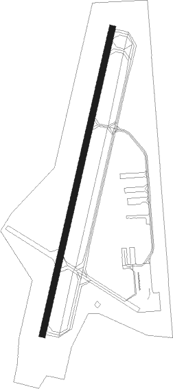
| Elevation | 623ft (190m) |
| Timezone | GMT -5 |
| Coordinates | 44.98858, -85.19836 |
| Magnetic var | |
| Type | land |
| Available since | X-Plane v10.40 |
| ICAO code | KACB |
| IATA code | ACB |
| FAA code | ACB |
Communication
| Antrim County AWOS 3 | 119.275 |
| Antrim County CTAF/UNICOM | 122.700 |
Nearby Points of Interest:
Holtz Site
-Henry Richardi House
-M-88–Intermediate River Bridge
-Antrim County Courthouse
-East Jordan Lumber Company Store Building
-Votruba Block
-Hughes House (Elk Rapids, Michigan)
-Jordan River Pathway
-Boyne City Water Works Building
-Bowers Harbor Inn
-Boyne City Central Historic District
-Grove Hill New Mission Church
-Omena Historic District
-John Pulcipher House
-Castle Farms
-Horton Bay General Store
-Horton Bay School
-O'Neill Site
-Leelanau Transit Company Suttons Bay Depot
-Ernest Hemingway Cottage
-Morgan-Copp-Mervau Building
-Chicago and West Michigan Railroad Charlevoix Station
-Charlevoix City Park Site
-Pine River Site
-Mt. McSauba Site
Nearby beacons
| code | identifier | dist | bearing | frequency |
|---|---|---|---|---|
| GL | BANGU (GAYLORD) NDB | 16.6 | 86° | 375 |
| TV | GWENN (TRAVERSE CITY) NDB | 18.1 | 222° | 365 |
| GLR | GAYLORD VOR/DME | 21 | 87° | 109.20 |
| GYG | GRAYLING NDB | 21.2 | 123° | 359 |
| TVC | TRAVERSE CITY VOR/DME | 24.3 | 228° | 114.60 |
| CGG | GRAYLING VOR | 27.2 | 123° | 109.80 |
| PLN | PELLSTON VORTAC | 44.6 | 40° | 111.80 |
| MA | WEXOR (CADILLAC) NDB | 47.5 | 205° | 336 |
| MB | JEPOT (MANISTEE) NDB | 59 | 233° | 254 |
| ISQ | CO. (MANISTIQ DME | 72.1 | 315° | 114.85 |
Instrument approach procedures
| runway | airway (heading) | route (dist, bearing) |
|---|---|---|
| RW02 | GLR (267°) | GLR TUGGS (24mi, 243°) 3500ft KEENO (5mi, 283°) 2600ft FOVUP (4mi, 24°) 2600ft |
| RW02 | KEENO (24°) | KEENO 2600ft FOVUP (4mi, 24°) 2600ft |
| RW02 | SKIPR (52°) | SKIPR KEENO (5mi, 103°) 2600ft FOVUP (4mi, 24°) 2600ft |
| RNAV | FOVUP 2600ft HATTR (2mi, 24°) 2300ft KACB (5mi, 24°) 665ft (5201mi, 118°) 908ft POXOE (5201mi, 298°) IROTO (11mi, 33°) 3000ft IROTO (turn) |
Disclaimer
The information on this website is not for real aviation. Use this data with the X-Plane flight simulator only! Data taken with kind consent from X-Plane 12 source code and data files. Content is subject to change without notice.