Americus - Jimmy Carter Regl
Airport details
| Country | United States of America |
| State | Georgia |
| Region | K7 |
| Airspace | Atlanta Ctr |
| Municipality | Sumter County |
| Elevation | 471ft (144m) |
| Timezone | GMT -5 |
| Coordinates | 32.11081, -84.18886 |
| Magnetic var | |
| Type | land |
| Available since | X-Plane v10.40 |
| ICAO code | KACJ |
| IATA code | ACJ |
| FAA code | ACJ |
Communication
| Jimmy Carter Regl AWOS 3 | 128.375 |
| Jimmy Carter Regl CTAF/UNICOM | 122.800 |
| Jimmy Carter Regl ATLANTA Approach | 124.200 |
| Jimmy Carter Regl ATLANTA Departure | 124.200 |
Approach frequencies
| ILS-cat-I | RW23 | 110.5 | 18.00mi |
| 3° GS | RW23 | 110.5 | 18.00mi |
Nearby Points of Interest:
Liberty Hall Plantation
-Schley County Courthouse
-Macon County Courthouse
-Lilly Historic District
-Webster County Jails
-Webster County Courthouse
-Dooly County Courthouse
-Boyd Mill Place
-Old Marion County Courthouse
-Marion County Courthouse
-U.S. Post Office
-Leesburg Depot
-Lee County Courthouse
-Richland Historic District
-Pasaquan
-Taylor County Courthouse
-Butler Downtown Historic District
-Shellman Historic District
-Peach County Courthouse
-Stewart County Courthouse
-Heritage Plaza
-Albany Municipal Auditorium
-John A. Davis House
-Rosenberg Brothers Department Store
-Bridge House
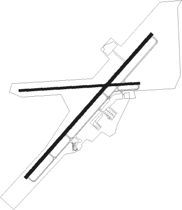
Runway info
Runway 5 / 23  | ||
| length | 1832m (6010ft) | |
| bearing | 50° / 230° | |
| width | 30m (100ft) | |
| surface | asphalt | |
| blast zone | 47m (154ft) / 59m (194ft) | |
| Runway 10 / 28 | ||
| length | 1151m (3776ft) | |
| bearing | 91° / 271° | |
| width | 23m (75ft) | |
| surface | asphalt | |
Nearby beacons
| code | identifier | dist | bearing | frequency |
|---|---|---|---|---|
| ACJ | SOUTHER (AMERICUS) NDB | 0.1 | 57° | 242 |
| LKG | LINDBERGH (AMERICUS) NDB | 5.6 | 52° | 242 |
| IZS | MONTEZUMA NDB | 17.9 | 35° | 426 |
| OHY | CONEY (CORDELE) NDB | 17.9 | 109° | 400 |
| PZD | PECAN (ALBANY) VOR/DME | 27.8 | 193° | 116.10 |
| VNA | VIENNA VORTAC | 35.6 | 82° | 116.50 |
| LSF | LAWSON (COLUMBUS) VOR/DME | 42.9 | 285° | 111.40 |
| AWS | LAWSON (COLUMBUS) NDB | 43.7 | 282° | 335 |
| WRB | ROBINS (WARNER ROBINS) TACAN | 43.9 | 48° | 135.30 |
| MCN | MACON VORTAC | 44.3 | 43° | 114.20 |
| CS | FENIX (COLUMBUS) NDB | 47.9 | 292° | 355 |
| OP | YATES (THOMASTON) NDB | 48.5 | 0° | 339 |
| EUF | EUFAULA VORTAC | 48.9 | 260° | 109.20 |
| CSG | COLUMBUS VORTAC | 51.8 | 301° | 117.10 |
| IFM | TIFT MYERS (TIFTON) VOR | 54.3 | 134° | 112.50 |
| SUR | FITZGERALD NDB | 54.7 | 119° | 362 |
Instrument approach procedures
| runway | airway (heading) | route (dist, bearing) |
|---|---|---|
| RW05 | CANPO (77°) | CANPO 2600ft JIMOP (9mi, 112°) 2600ft |
| RW05 | JIMOP (50°) | JIMOP 2600ft |
| RW05 | RUMTE (19°) | RUMTE 2600ft JIMOP (9mi, 332°) 2600ft |
| RNAV | JIMOP 2600ft GUMKE (6mi, 50°) 2200ft CATLO (3mi, 50°) 1100ft KACJ (2mi, 49°) 513ft (5110mi, 111°) 718ft HASER (5102mi, 291°) 2600ft HASER (turn) | |
| RW23 | CATNA (199°) | CATNA 2600ft HASER (9mi, 152°) 2600ft |
| RW23 | HASER (231°) | HASER 2600ft |
| RW23 | SAPNE (257°) | SAPNE 2600ft HASER (9mi, 292°) 2600ft |
| RNAV | HASER 2600ft FEDLO (6mi, 231°) 2200ft KACJ (6mi, 231°) 504ft (5110mi, 111°) 755ft JIMOP (5117mi, 291°) 2600ft JIMOP (turn) |
Disclaimer
The information on this website is not for real aviation. Use this data with the X-Plane flight simulator only! Data taken with kind consent from X-Plane 12 source code and data files. Content is subject to change without notice.