Oakdale - Allen Parish
Airport details
| Country | United States of America |
| State | Louisiana |
| Region | K4 |
| Municipality | Allen Parish |
| Elevation | 104ft (32m) |
| Timezone | GMT -6 |
| Coordinates | 30.75050, -92.68849 |
| Magnetic var | |
| Type | land |
| Available since | X-Plane v10.30 |
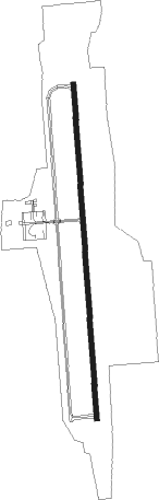
| ICAO code | KACP |
| IATA code | n/a |
| FAA code | ACP |
Communication
| Allen Parish AWOS 3 | 118.275 |
| Allen Parish CTAF/UNICOM | 122.800 |
| Allen Parish POLK Approach/Departure | 123.700 |
Nearby Points of Interest:
Allen Parish Courthouse
-Britt Place
-Elton United Methodist Church
-Evangeline Bank and Trust Company
-Alexis LaTour House
-Lecompte High School
-White's Chapel United Methodist Church
-Alexander State Forest Headquarters Building
-Trinity Episcopal Church
-Frithland
-Texas and Pacific Railroad Depot
-Jennings Carnegie Public Library
-DeRidder USO Building
-Beauregard Parish Jail
-Beauregard Parish Courthouse
-DeRidder Commercial Historic District
-Le Vieux Presbytere
-Bayou Rouge Baptist Church
-Mayer Hirsch House
-Edward Benjamin Dubuisson House
Nearby beacons
| code | identifier | dist | bearing | frequency |
|---|---|---|---|---|
| ECY | DURALDE (EUNICE) NDB | 16.8 | 128° | 263 |
| AEX | ALEXANDRIA VORTAC | 31.8 | 20° | 116.10 |
| DXB | DE RIDDER NDB | 33.3 | 270° | 385 |
| FXU | POLK (FORT POLK) VOR | 34.8 | 304° | 108.40 |
| CW | MOSSY (LAKE CHARLES) NDB | 37.4 | 229° | 418 |
| LCH | LAKE CHARLES VORTAC | 42.4 | 214° | 113.40 |
| LF | LAFFS (LAFARETTE) NDB | 48.9 | 121° | 375 |
| LFT | LAFAYETTE VORTAC | 49.1 | 129° | 109.80 |
| AUR | SULFY (SULPHUR) NDB | 50.3 | 233° | 278 |
| BNZ | ABBEVILLE NDB | 50.7 | 141° | 230 |
| OOC | NATCHITOCHES NDB | 58 | 337° | 407 |
Instrument approach procedures
| runway | airway (heading) | route (dist, bearing) |
|---|---|---|
| RW18 | CATCS (220°) | CATCS AMWIX (18mi, 230°) 2800ft OPMEE (5mi, 270°) 2200ft |
| RW18 | OPMEE (181°) | OPMEE 2200ft |
| RW18 | SUGGA (102°) | SUGGA CIDIK (18mi, 72°) 2200ft OPMEE (5mi, 90°) 2200ft |
| RNAV | OPMEE 2200ft JIKLO (6mi, 181°) 1900ft FOSUX (3mi, 181°) 920ft KACP (3mi, 181°) 152ft ONICE (12mi, 181°) 2000ft ONICE (turn) | |
| RW36 | HATHA (2°) | HATHA ONICE (14mi, 3°) 2000ft |
| RW36 | MAXON (331°) | MAXON POSCI (10mi, 326°) 2000ft ONICE (5mi, 270°) 2000ft |
| RW36 | ONICE (1°) | ONICE 2000ft |
| RNAV | ONICE 2000ft KAKKE (6mi, 1°) 1900ft KACP (6mi, 1°) 158ft OPMEE (12mi, 1°) 2200ft OPMEE (turn) |
Disclaimer
The information on this website is not for real aviation. Use this data with the X-Plane flight simulator only! Data taken with kind consent from X-Plane 12 source code and data files. Content is subject to change without notice.