Ardmore - Ardmore Muni
Airport details
| Country | United States of America |
| State | Oklahoma |
| Region | K4 |
| Airspace | Ft Worth Ctr |
| Municipality | Ardmore |
| Elevation | 762ft (232m) |
| Timezone | GMT -6 |
| Coordinates | 34.30428, -97.02058 |
| Magnetic var | |
| Type | land |
| Available since | X-Plane v10.32 |
| ICAO code | KADM |
| IATA code | ADM |
| FAA code | ADM |
Communication
| Ardmore Muni ATIS | 125.600 |
| Ardmore Muni CTAF | 118.500 |
| Ardmore Muni UNICOM | 122.950 |
| Ardmore Muni Ground Control | 121.800 |
| Ardmore Muni Tower | 118.500 |
Approach frequencies
| ILS-cat-I | RW31 | 108.9 | 18.00mi |
| 3° GS | RW31 | 108.9 | 18.00mi |
Nearby Points of Interest:
Black Theater of Ardmore
-Ardmore Historic Commercial District
-Ardmore Carnegie Library
-Murray County Courthouse
-Marshall County Courthouse
-Love County Courthouse
-Love County Jail and Sheriff's Residence
-Bethel Missionary Baptist Church
-First National Bank Building
-Wintersmith Park Historic District
-Ada Arts and Heritage Center
-Pontotoc County Courthouse
-Sugg Clinic
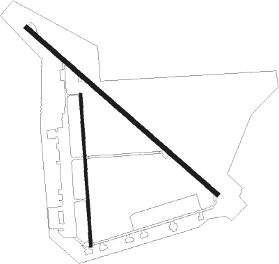
Runway info
Runway 13 / 31  | ||
| length | 2750m (9022ft) | |
| bearing | 130° / 310° | |
| width | 48m (156ft) | |
| surface | asphalt | |
| blast zone | 78m (256ft) / 75m (246ft) | |
| Runway 17 / 35 | ||
| length | 1648m (5407ft) | |
| bearing | 181° / 1° | |
| width | 30m (100ft) | |
| surface | asphalt | |
| displ threshold | 0m (0ft) / 122m (400ft) | |
| blast zone | 137m (449ft) / 0m (0ft) | |
Nearby beacons
| code | identifier | dist | bearing | frequency |
|---|---|---|---|---|
| AI | ADDMO (ARDMORE) NDB | 6.1 | 129° | 400 |
| ADM | ARDMORE VORTAC | 9.2 | 238° | 116.70 |
| DNI | DENISON (SHERMAN-DENISON) NDB | 33.6 | 144° | 341 |
| URH | (DURANT) DME | 38 | 120° | 114.30 |
| DUC | DME | 44.7 | 275° | 111 |
| BYP | BONHAM VORTAC | 60.4 | 134° | 114.60 |
| SRE | SEMINOLE NDB | 60.5 | 20° | 278 |
| UKW | BOWIE VORTAC | 61 | 226° | 117.15 |
| RG | GALLY (OKLAHOMA CITY) NDB | 65.7 | 330° | 350 |
Instrument approach procedures
| runway | airway (heading) | route (dist, bearing) |
|---|---|---|
| RW13 | ADM (58°) | ADM RRDEE (16mi, 348°) 3600ft RRDEE (turn) 3600ft |
| RW13 | DECKK (155°) | DECKK BBOBY (20mi, 147°) 3600ft RRDEE (9mi, 231°) 3600ft |
| RW13 | FOYER (102°) | FOYER MRGIE (45mi, 102°) 3600ft RRDEE (9mi, 51°) 3600ft |
| RNAV | RRDEE 3600ft AANDD (6mi, 130°) 2900ft MARYV (2mi, 130°) 2800ft CRSWT (3mi, 130°) 1780ft KADM (4mi, 132°) 834ft (5753mi, 109°) 1177ft NIXHE (5744mi, 289°) 3600ft NIXHE (turn) | |
| RW31 | ADM (58°) | ADM NIXHE (18mi, 102°) 3600ft NIXHE (turn) 3600ft |
| RW31 | TEYUS (323°) | TEYUS SANJN (14mi, 310°) 3600ft NIXHE (7mi, 30°) 3600ft |
| RW31 | TIKYS (292°) | TIKYS GLARY (15mi, 295°) 3600ft NIXHE (7mi, 249°) 3600ft |
| RNAV | NIXHE 3600ft LIBTE (8mi, 310°) 2600ft UMEHU (4mi, 310°) 1340ft KADM (3mi, 307°) 778ft (5753mi, 109°) 929ft RRDEE (5762mi, 290°) 3600ft RRDEE (turn) |
Disclaimer
The information on this website is not for real aviation. Use this data with the X-Plane flight simulator only! Data taken with kind consent from X-Plane 12 source code and data files. Content is subject to change without notice.