Atwood - Atwood-rawlins Co
Airport details
| Country | United States of America |
| State | Kansas |
| Region | K3 |
| Airspace | Denver Ctr |
| Municipality | Rawlins County |
| Elevation | 2991ft (912m) |
| Timezone | GMT -6 |
| Coordinates | 39.84034, -101.04248 |
| Magnetic var | |
| Type | land |
| Available since | X-Plane v10.32 |
| ICAO code | KADT |
| IATA code | n/a |
| FAA code | ADT |
Communication
| Atwood-Rawlins Co AWOS | 118.375 |
| Atwood-Rawlins Co CTAF/UNICOM | 122.700 |
Nearby Points of Interest:
Shirley Opera House
-St. Paul's Methodist Protestant Church
-Ideal Cement bridge (Stratton, Nebraska)
-Weyl Service Station
-Minor Sod House
-Henry Hickert Building
-Bank of Oberlin
-Dundy County Courthouse
-Thomas County Courthouse
-McCook YMCA
-Red Willow County Courthouse
-Harvey P. Sutton House
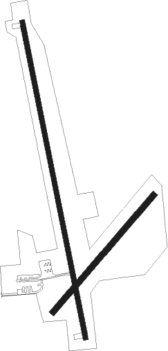
Runway info
Runway 16 / 34  | ||
| length | 1527m (5010ft) | |
| bearing | 171° / 351° | |
| width | 23m (75ft) | |
| surface | asphalt | |
| Runway 03 / 21 | ||
| length | 732m (2402ft) | |
| bearing | 53° / 233° | |
| width | 30m (100ft) | |
| surface | grass | |
Nearby beacons
| code | identifier | dist | bearing | frequency |
|---|---|---|---|---|
| JDM | WHEATFIELD (COLBY) NDB | 19.8 | 181° | 408 |
| OIN | OBERLIN NDB | 23.2 | 91° | 341 |
| MCK | MC COOK VOR/DME | 30 | 51° | 115.30 |
| SYF | SAINT FRANCIS NDB | 34.1 | 261° | 386 |
| HCT | HAYES CENTER VORTAC | 37.2 | 11° | 117.70 |
| GLD | GOODLAND VORTAC | 40.5 | 235° | 115.10 |
| GL | SHUGR (GOODLAND) NDB | 41.7 | 226° | 414 |
| OEL | OAKLEY NDB | 44.9 | 163° | 380 |
| HLC | HILL CITY VORTAC | 51.4 | 125° | 113.70 |
Instrument approach procedures
| runway | airway (heading) | route (dist, bearing) |
|---|---|---|
| RW17 | HOMIM (171°) | HOMIM 5000ft |
| RW17 | JITAM (210°) | JITAM HOMIM (9mi, 265°) 5000ft |
| RW17 | WIXAR (135°) | WIXAR HOMIM (9mi, 85°) 5000ft |
| RNAV | HOMIM 5000ft IHUKY (9mi, 171°) 4800ft HORUK (4mi, 171°) 3640ft KADT (2mi, 170°) 3032ft (5913mi, 112°) 3500ft HOMIM (5913mi, 292°) 5000ft HOMIM (turn) |
Disclaimer
The information on this website is not for real aviation. Use this data with the X-Plane flight simulator only! Data taken with kind consent from X-Plane 12 source code and data files. Content is subject to change without notice.