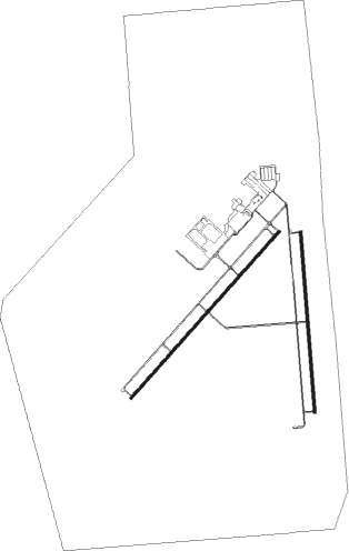
Albuquerque - Double Eagle Ii
Airport details
| Country | United States of America |
| State | New Mexico |
| Region | K2 |
| Airspace | Albuquerque Ctr |
| Municipality | Albuquerque |
| Elevation | 5836ft (1779m) |
| Timezone | GMT -7 |
| Coordinates | 35.14515, -106.79517 |
| Magnetic var | |
| Type | land |
| Available since | X-Plane v10.40 |
| ICAO code | KAEG |
| IATA code | n/a |
| FAA code | AEG |
Communication
| Double Eagle II AWOS 3 | 119.025 |
| Double Eagle II CTAF/UNICOM | 120.150 |
| Double Eagle II CLEARANCE DELIVERY | 124.800 |
| Double Eagle II TOWER | 120.150 |
| Double Eagle II ALBUQUERQUE ApproachROACH | 127.400 |
| Double Eagle II ALBUQUERQUE DepartureARTURE | 127.400 |
Approach frequencies
| ILS-cat-I | RW22 | 110.1 | 18.00mi |
| 3° GS | RW22 | 110.1 | 18.00mi |
Nearby Points of Interest:
Gavino Anaya House
-Los Duranes Chapel
-Our Lady of the Angels School
-Charles A. Bottger House
-La Glorieta
-Lembke House
-Employees' New Dormitory and Club
-Hilario Lopez House
-Castle Apartments
-Atchison, Topeka and Santa Fe Railway 2926
-Los Tomases Chapel
-Berthold Spitz House
-Washington Apartments
-A. W. Hayden House
-W. E. Mauger House
-Eller Apartments
-Southern Union Gas Company Building
-Newlander Apartments
-Main Library
-Maisel's Indian Trading Post
-McCanna-Hubbell Building
-S. H. Kress Building
-Federal Building and United States Courthouse
-Old Post Office
-Simms Building
Nearby beacons
| code | identifier | dist | bearing | frequency |
|---|---|---|---|---|
| AE | DUDLE (ALBUQUERQUE) NDB | 5.9 | 49° | 351 |
| ABQ | ALBUQUERQUE VORTAC | 6.1 | 192° | 113.20 |
| BRG | DME | 29.8 | 184° | 114.75 |
| OTO | OTTO VOR | 42.4 | 95° | 114 |
| SAF | SANTA FE VORTAC | 42.9 | 62° | 110.60 |
| ONM | SOCORRO VORTAC | 48.4 | 182° | 116.80 |
Departure and arrival routes
| Transition altitude | 18000ft |
| Transition level | 18000ft |
| STAR starting points | distance | inbound heading | |
|---|---|---|---|
| ALL | |||
| LAVAN3 | 30.0 | 59° | |
| CURLY3 | 21.9 | 133° | |
| FRIHO4 | 18.9 | 206° | |
| MIERA2 | 35.3 | 285° | |
Instrument approach procedures
| runway | airway (heading) | route (dist, bearing) |
|---|---|---|
| RW04 | ABQ (12°) | ABQ YECUG (10mi, 253°) 8800ft YECUG (turn) 8800ft |
| RW04 | CARTY (81°) | CARTY YECUG (28mi, 94°) 8800ft |
| RW04 | LORAT (90°) | LORAT YECUG (17mi, 119°) 8800ft |
| RW04 | STONY (47°) | STONY YECUG (17mi, 43°) 8800ft |
| RNAV | YECUG 8800ft ZIVIP (7mi, 52°) 7700ft JUSIB (3mi, 52°) 6840ft KAEG (4mi, 55°) 5892ft (6226mi, 108°) 6300ft EYIPE (6217mi, 288°) 8600ft EYIPE (turn) | |
| RW22 | ABQ (12°) | ABQ EYIPE (18mi, 34°) 9000ft EYIPE (turn) 8600ft |
| RW22 | DULKE (259°) | DULKE EYIPE (18mi, 279°) 13000ft EYIPE (turn) 8600ft |
| RW22 | FRIHO (206°) | FRIHO EYIPE (8mi, 177°) 8600ft |
| RW22 | NELGE (230°) | NELGE EYIPE (6mi, 242°) 8600ft |
| RNAV | EYIPE 8600ft CUTIX (6mi, 217°) 7700ft KAEG (6mi, 230°) 5865ft (6226mi, 108°) 6017ft YECUG (6237mi, 288°) 8800ft YECUG (turn) |
Holding patterns
| STAR name | hold at | type | turn | heading* | altitude | leg | speed limit |
|---|---|---|---|---|---|---|---|
| FRIHO4 | FRIHO | VHF | right | 6 (186)° | < 17999ft | DME 6.0mi | ICAO rules |
| *) magnetic outbound (inbound) holding course | |||||||
Disclaimer
The information on this website is not for real aviation. Use this data with the X-Plane flight simulator only! Data taken with kind consent from X-Plane 12 source code and data files. Content is subject to change without notice.

