Alexandria - Alexandria Intl
Airport details
| Country | United States of America |
| State | Louisiana |
| Region | K4 |
| Airspace | Houston Oceanic Ctr |
| Municipality | Rapides Parish |
| Elevation | 86ft (26m) |
| Timezone | GMT -6 |
| Coordinates | 31.32737, -92.54855 |
| Magnetic var | |
| Type | land |
| Available since | X-Plane v10.30 |
| ICAO code | KAEX |
| IATA code | AEX |
| FAA code | AEX |
Communication
| Alexandria Intl ASOS | 123.975 |
| Alexandria Intl CTAF | 127.350 |
| Alexandria Intl Ground Control | 121.900 |
| Alexandria Intl Tower | 127.350 |
| Alexandria Intl POLK Approach | 132.050 |
| Alexandria Intl POLK Departure | 132.050 |
Approach frequencies
| ILS-cat-I | RW14 | 110.1 | 18.00mi |
| 3° GS | RW14 | 110.1 | 18.00mi |
Nearby Points of Interest:
Kent Plantation House
-Alexandria Garden District
-Bailey's Dam
-Fort Randolph
-First Methodist Church
-Hemenway Furniture Co. Building
-United States Post Office and Courthouse–Alexandria
-C.A. Schnack Jewelry Company Store
-Masonic Building
-Rapides Bank and Trust Company Building
-Commercial Building
-Arna Wendell Bontemps House
-Central Louisiana State Hospital Dairy Barn
-Bland House
-James Wade Bolton House
-Mt. Olivet Episcopal Church and Cemetery
-Alexandria Hall
-Cottingham House
-Eden
-Tioga Commissary
-Mayer Hirsch House
-Alexander State Forest Headquarters Building
-Lecompte High School
-Britt Place
-Trinity Episcopal Church
Runway info
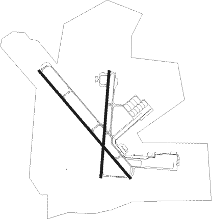
Runway 14 / 32  | ||
| length | 2855m (9367ft) | |
| bearing | 140° / 320° | |
| width | 46m (150ft) | |
| surface | concrete | |
| blast zone | 255m (837ft) / 255m (837ft) | |
| Runway 18 / 36 | ||
| length | 2141m (7024ft) | |
| bearing | 190° / 10° | |
| width | 46m (150ft) | |
| surface | asphalt | |
| blast zone | 61m (200ft) / 255m (837ft) | |
Nearby beacons
| code | identifier | dist | bearing | frequency |
|---|---|---|---|---|
| AEX | ALEXANDRIA VORTAC | 4.8 | 146° | 116.10 |
| OOC | NATCHITOCHES NDB | 33.5 | 302° | 407 |
| FXU | POLK (FORT POLK) VOR | 36.8 | 252° | 108.40 |
| SWB | SAWMILL (WINNFIELD) VOR/DME | 39.3 | 349° | 113.75 |
| ECY | DURALDE (EUNICE) NDB | 46.3 | 173° | 263 |
| DXB | DE RIDDER NDB | 53.1 | 234° | 385 |
Instrument approach procedures
| runway | airway (heading) | route (dist, bearing) |
|---|---|---|
| RW14 | AEX (326°) | AEX EBYAJ (19mi, 321°) 3000ft EBYAJ (turn) 3000ft |
| RW14 | MUSHE (294°) | MUSHE IBVUW (35mi, 311°) 3000ft EBYAJ (5mi, 238°) 3000ft |
| RW14 | NUBOY (113°) | NUBOY IBHEJ (10mi, 103°) 3000ft EBYAJ (5mi, 58°) 3000ft |
| RNAV | EBYAJ 3000ft CROVE (8mi, 140°) 1800ft CUBIP (3mi, 140°) 780ft KAEX (3mi, 138°) 140ft EHHIR (5mi, 141°) MUSHE (18mi, 107°) 4000ft MUSHE (turn) | |
| RW18 | AEX (326°) | AEX LATIW (16mi, 358°) 3000ft LATIW (turn) 2600ft |
| RW18 | MUSHE (294°) | MUSHE ESJUJ (25mi, 323°) 3000ft LATIW (5mi, 278°) 2600ft |
| RW18 | NUBOY (113°) | NUBOY XAFQU (19mi, 87°) 3000ft LATIW (5mi, 98°) 2600ft |
| RNAV | LATIW 2600ft AQEKO (6mi, 190°) 1700ft KAEX (5mi, 192°) 139ft HIPKU (4mi, 188°) 4000ft MUSHE (22mi, 106°) MUSHE (turn) | |
| RW32 | MUSHE (294°) | MUSHE OTQAB (10mi, 290°) 2000ft MEJVE (5mi, 238°) 2000ft |
| RNAV | MEJVE 2000ft AJBOJ (6mi, 320°) 1700ft KAEX (6mi, 321°) 144ft (5536mi, 109°) 340ft EBYAJ (5544mi, 289°) 3000ft EBYAJ (turn) | |
| RW36 | MUSHE (294°) | MUSHE ISOCA (17mi, 265°) 3000ft OYUBA (5mi, 278°) 2600ft |
| RNAV | OYUBA 2600ft JEVRU (6mi, 10°) 1700ft HIPKU (2mi, 10°) 1100ft KAEX (4mi, 8°) 142ft LATIW (12mi, 11°) 2600ft LATIW (turn) |
Disclaimer
The information on this website is not for real aviation. Use this data with the X-Plane flight simulator only! Data taken with kind consent from X-Plane 12 source code and data files. Content is subject to change without notice.