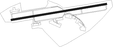
Washington - Washington Co
Airport details
| Country | United States of America |
| State | Pennsylvania |
| Region | K6 |
| Airspace | Cleveland Ctr |
| Municipality | South Franklin Township |
| Elevation | 1184ft (361m) |
| Timezone | GMT -5 |
| Coordinates | 40.13647, -80.29019 |
| Magnetic var | |
| Type | land |
| Available since | X-Plane v10.40 |
| ICAO code | KAFJ |
| IATA code | WSG |
| FAA code | AFJ |
Communication
| Washington Co AWOS 3 | 118.425 |
| Washington Co CTAF/UNICOM | 122.800 |
| Washington Co PITTSBURGH Approach/Departure | 119.350 |
Approach frequencies
| ILS-cat-I | RW27 | 110.3 | 18.00mi |
| 3° GS | RW27 | 110.3 | 18.00mi |
Nearby Points of Interest:
Pennsylvania Railroad Freight Station
-Washington Armory
-Dr. Joseph Maurer House
-Washington County Jail
-Washington County Courthouse
-F. Julius LeMoyne House
-Washington Trust Building
-McMillan Hall
-Sackville House
-East Washington Historic District
-Taylorstown Historic District
-John White House
-Moses Little Tavern
-Doak-Little House
-Thomas Munce House
-Montgomery House
-Margaret Derrow House
-Martin Farmstead
-Dager-Wonsettler Farmstead
-James Thome Farm
-Frank L. Ross Farm
-Robert Parkinson Farm
-Philip Friend House
-Samuel Brownlee House
-Caldwell Tavern
Nearby beacons
| code | identifier | dist | bearing | frequency |
|---|---|---|---|---|
| AGC | ALLEGHENY (PITTSBURGH) VOR/DME | 14.2 | 60° | 110 |
| HLG | WHEELING VOR/DME | 14.7 | 294° | 112.20 |
| MMJ | (PITTSBURGH) DME | 21.5 | 15° | 112 |
| AIR | BELLAIRE VOR/DME | 25.2 | 257° | 117.10 |
| VV | CAMOR (CONNELLSVILLE) NDB | 29.3 | 115° | 299 |
| CFX | CADIZ NDB | 33.7 | 278° | 239 |
| MGW | MORGANTOWN VOR/DME | 40 | 143° | 111.60 |
| EWC | ELLWOOD CITY VOR/DME | 41.5 | 7° | 115.80 |
| IHD | INDIAN HEAD VORTAC | 43.9 | 100° | 108.20 |
| CKB | CLARKSBURG VOR/DME | 53 | 179° | 112.60 |
| UCP | CASTLE (NEW CASTLE) NDB | 53.5 | 352° | 272 |
| ACO | AKRON VOR/DME | 71.6 | 317° | 114.40 |
Instrument approach procedures
| runway | airway (heading) | route (dist, bearing) |
|---|---|---|
| RW09 | WISKE (89°) | WISKE WUZGO (6mi, 94°) 3000ft |
| RNAV | WUZGO 3000ft WAVVO (6mi, 86°) 2900ft ZIXEL (3mi, 86°) 1920ft KAFJ (3mi, 86°) 1228ft (4960mi, 117°) 1584ft KEYRE (4949mi, 297°) 3000ft KEYRE (turn) | |
| RW27 | HLG (114°) | HLG KEYRE (25mi, 101°) 3100ft KEYRE (turn) 3000ft |
| RW27 | NESTO (264°) | NESTO KEYRE (15mi, 263°) 3000ft |
| RNAV | KEYRE 3000ft ANUYE (6mi, 266°) 3000ft KAFJ (6mi, 266°) 1224ft (4960mi, 117°) 1700ft HLG (4974mi, 297°) 3300ft HLG (turn) |
Disclaimer
The information on this website is not for real aviation. Use this data with the X-Plane flight simulator only! Data taken with kind consent from X-Plane 12 source code and data files. Content is subject to change without notice.