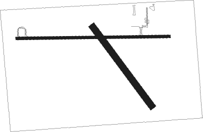
Wagner - Wagner Muni
Airport details
| Country | United States of America |
| State | South Dakota |
| Region | K3 |
| Airspace | Minneapolis Ctr |
| Municipality | Wagner |
| Elevation | 1475ft (450m) |
| Timezone | GMT -6 |
| Coordinates | 43.06417, -98.29639 |
| Magnetic var | |
| Type | land |
| Available since | X-Plane v10.40 |
| ICAO code | KAGZ |
| IATA code | n/a |
| FAA code | AGZ |
Communication
| Wagner Muni CTAF/UNICOM | 122.800 |
Nearby Points of Interest:
Wagner House
-Holy Fellowship Episcopal Church (Greenwood, South Dakota)
-Charles Mix County Courthouse
-Delmont Public School
-Delmont Pumphouse
-Delmont State Bank
-Douglas County Courthouse
-Armour Historic District
-ZCBJ Hall
-Bon Homme County Courthouse
-Rad Sladkovsky
-Ponca Tribal Self-Help Community Building Historic District
-John Frydrych Farmstead
-Congregational Church and Manse
-Church of Our Most Merciful Saviour
-St. Andrew's Episcopal Church
-Methodist Episcopal Church
-St. Wenceslaus Catholic Church and Parish House
-Old St. Wenceslaus Catholic Parish House
Nearby beacons
| code | identifier | dist | bearing | frequency |
|---|---|---|---|---|
| AGZ | WAGNER NDB | 0.1 | 104° | 392 |
| ONL | O'NEILL VORTAC | 39.5 | 213° | 113.90 |
| YKN | YANKTON VOR/DME | 40.9 | 99° | 111.40 |
| MHE | MITCHELL VOR/DME | 44.2 | 20° | 109.20 |
| YK | CAGUR (YANKTON) NDB | 45.6 | 103° | 347 |
Instrument approach procedures
| runway | airway (heading) | route (dist, bearing) |
|---|---|---|
| RW09 | ADEDY (89°) | ADEDY DIBQE (21mi, 88°) 3800ft NUYIG (13mi, 88°) 3400ft |
| RW09 | ONL (33°) | ONL OHULU (19mi, 15°) 3600ft NUYIG (19mi, 15°) 3400ft |
| RW09 | TYNDA (276°) | TYNDA NUYIG (31mi, 275°) 3400ft NUYIG (turn) 3400ft |
| RNAV | NUYIG 3400ft FISOB (5mi, 93°) 3000ft SOYDO (2mi, 93°) 2400ft KAGZ (3mi, 93°) 1518ft (5769mi, 114°) 1847ft NEBYI (5761mi, 294°) 3400ft NEBYI (turn) | |
| RW27 | CURIR (353°) | CURIR NEBYI (20mi, 24°) 3400ft NEBYI (turn) 3400ft |
| RW27 | PUKIC (262°) | PUKIC NEBYI (25mi, 258°) 3400ft |
| RW27 | TECUD (222°) | TECUD NEBYI (32mi, 207°) 3400ft |
| RW27 | YKN (279°) | YKN NEBYI (33mi, 281°) 3400ft |
| RNAV | NEBYI 3400ft FOFGU (3mi, 273°) 3000ft SUJYO (2mi, 273°) 2200ft KAGZ (2mi, 272°) 1505ft (5769mi, 114°) 1834ft NUYIG (5778mi, 294°) 3400ft NUYIG (turn) |
Disclaimer
The information on this website is not for real aviation. Use this data with the X-Plane flight simulator only! Data taken with kind consent from X-Plane 12 source code and data files. Content is subject to change without notice.

