Athens - Athens-ben Epps
Airport details
| Country | United States of America |
| State | Georgia |
| Region | K7 |
| Airspace | Atlanta Ctr |
| Municipality | Athens-Clarke County Unified Government |
| Elevation | 812ft (247m) |
| Timezone | GMT -5 |
| Coordinates | 33.95079, -83.32542 |
| Magnetic var | |
| Type | land |
| Available since | X-Plane v10.40 |
| ICAO code | KAHN |
| IATA code | AHN |
| FAA code | AHN |
Communication
| Athens-Ben Epps ASOS | 132.875 |
| Athens-Ben Epps UNICOM | 122.950 |
| Athens-Ben Epps CTAF | 126.300 |
| Athens-Ben Epps Ground Control / CLR | 121.800 |
| Athens-Ben Epps Tower | 126.300 |
| Athens-Ben Epps ATLANTA Approach/Departure | 132.475 |
Approach frequencies
| ILS-cat-I | RW27 | 110.95 | 18.00mi |
| 3° GS | RW27 | 110.95 | 18.00mi |
Nearby Points of Interest:
Gospel Pilgrim Cemetery
-Ware-Lyndon house
-Joseph Henry Lumpkin House
-Camak House
-Henry W. Grady House
-Lucy Cobb Institute
-Cobbham Historic District
-UGA Carnegie Library
-Elder's Mill Covered Bridge and Elder Mill
-Crawford Depot
-Barrow County Courthouse
-William Harris Homestead
-Kilgore Mill Covered Bridge and Mill Site
-Hard Labor Creek State Park
-Carter-Newton House
-Greene County Courthouse
-Hamilton Historic District
-Walnut Hill Historic District
-Elbert County Courthouse
-Elberton Depot
-Jefferson Hall
-Franklin County Courthouse
-Kettle Creek Battlefield
-Siloam Historic District
-Brick Store
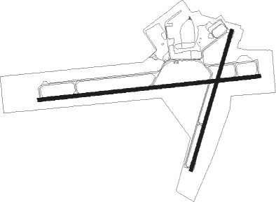
Runway info
Runway 9 / 27  | ||
| length | 1863m (6112ft) | |
| bearing | 89° / 269° | |
| width | 30m (100ft) | |
| surface | asphalt | |
| blast zone | 45m (148ft) / 42m (138ft) | |
| Runway 2 / 20 | ||
| length | 1219m (3999ft) | |
| bearing | 24° / 204° | |
| width | 30m (100ft) | |
| surface | asphalt | |
Nearby beacons
| code | identifier | dist | bearing | frequency |
|---|---|---|---|---|
| AHN | ATHENS VOR/DME | 0.1 | 168° | 109.60 |
| BMW | BARROW COUNTY (WINDER) NDB | 13.1 | 267° | 404 |
| VV | JUNNE (GREENSBORO) NDB | 23.7 | 135° | 353 |
| TX | GWNET (LAWRENCEVILLE) NDB | 27 | 277° | 419 |
| VOF | ALCOVY (COVINGTON) NDB | 29.8 | 235° | 370 |
| FKV | FLOWERY BRANCH (GAINESVILLE) NDB | 32.6 | 294° | 365 |
| ELW | ELECTRIC CITY (ANDERSON) VORTAC | 38.8 | 49° | 108.60 |
| AA | CEDAR (THOMSON) NDB | 43.4 | 120° | 341 |
| ODF | FOOTHILLS (TOCCOA) VOR/DME | 44.7 | 2° | 113.40 |
| UMB | CULVR (MILLEDGEVILLE) NDB | 48.6 | 168° | 380 |
| PDK | PEACHTREE (ATLANTA) VOR/DME | 48.7 | 266° | 116.60 |
| GY | DYANA (GREENVILLE) NDB | 62.3 | 50° | 338 |
| HRS | HARRIS VORTAC | 66.3 | 329° | 109.80 |
| GM | JUDKY (GREENVILLE) NDB | 69.4 | 50° | 521 |
Instrument approach procedures
| runway | airway (heading) | route (dist, bearing) |
|---|---|---|
| RW02 | HOPLU (45°) | HOPLU KOBVE (5mi, 91°) 3100ft |
| RW02 | KOBVE (23°) | KOBVE 3100ft |
| RW02 | ROPUE (0°) | ROPUE KOBVE (5mi, 306°) 3100ft |
| RNAV | KOBVE 3100ft HUVOV (6mi, 24°) 2400ft OTADE (2mi, 24°) 1600ft KAHN (3mi, 20°) 814ft (5073mi, 112°) 1140ft UMMIL (5069mi, 292°) 3100ft UMMIL (turn) | |
| RW09 | HEKVA (69°) | HEKVA SALIN (6mi, 21°) 2500ft |
| RW09 | JODAS (107°) | JODAS SALIN (6mi, 154°) 2500ft |
| RW09 | SALIN (88°) | SALIN 6000ft SALIN (turn) 2500ft |
| RNAV | SALIN 2500ft APDAW (6mi, 89°) 2400ft OTKAE (3mi, 89°) 1520ft KAHN (3mi, 87°) 794ft (5073mi, 112°) 1028ft IMAVE (5061mi, 292°) 2500ft IMAVE (turn) | |
| RW20 | JIVDA (182°) | JIVDA UMMIL (5mi, 126°) 3100ft |
| RW20 | THUDS (227°) | THUDS UMMIL (5mi, 271°) 3100ft |
| RW20 | UMMIL (206°) | UMMIL 3100ft |
| RNAV | UMMIL 3100ft APEZA (6mi, 205°) 2500ft DEBNE (3mi, 205°) 1520ft KAHN (2mi, 210°) 858ft (5073mi, 112°) 1600ft UMMIL (5069mi, 292°) 3100ft UMMIL (turn) | |
| RW27 | IMAVE (269°) | IMAVE 2500ft |
| RW27 | JOMAP (252°) | JOMAP IMAVE (5mi, 202°) 2500ft |
| RW27 | KADME (285°) | KADME IMAVE (5mi, 335°) 2500ft |
| RNAV | IMAVE 2500ft BLLDG (6mi, 269°) 2500ft FEXUK (4mi, 269°) 1360ft KAHN (2mi, 271°) 853ft (5073mi, 112°) 1013ft SALIN (5085mi, 292°) 2500ft SALIN (turn) |
Disclaimer
The information on this website is not for real aviation. Use this data with the X-Plane flight simulator only! Data taken with kind consent from X-Plane 12 source code and data files. Content is subject to change without notice.