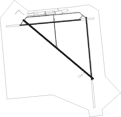
Alliance - Alliance Muni
Airport details
| Country | United States of America |
| State | Nebraska |
| Region | K3 |
| Airspace | Denver Ctr |
| Municipality | Box Butte County |
| Elevation | 3931ft (1198m) |
| Timezone | GMT -7 |
| Coordinates | 42.05322, -102.80375 |
| Magnetic var | |
| Type | land |
| Available since | X-Plane v10.30 |
| ICAO code | KAIA |
| IATA code | AIA |
| FAA code | AIA |
Communication
| Alliance Muni ASOS | 135.075 |
| Alliance Muni CTAF/UNICOM | 123.000 |
| Alliance Muni DENVER ApproachROACH | 127.950 |
| Alliance Muni DENVER DepartureARTURE | 127.950 |
Approach frequencies
| ILS-cat-I | RW30 | 108.35 | 18.00mi |
| 3° GS | RW30 | 108.35 | 18.00mi |
Nearby Points of Interest:
Alliance Commercial Historic District
-Box Butte County Courthouse
-Spade Ranch Store
-Morrill County Courthouse
-Nebraska Sand Hills Mixed Grasslands
-Camp Clarke Bridge Site
Nearby beacons
| code | identifier | dist | bearing | frequency |
|---|---|---|---|---|
| AIA | ALLIANCE VOR/DME | 0.1 | 344° | 111.80 |
| BFF | SCOTTSBLUFF VORTAC | 31.7 | 257° | 112.60 |
| TST | TOADSTOOL VOR/DME | 37.8 | 315° | 113.40 |
| OKS | OSHKOSH NDB | 44.1 | 145° | 233 |
| CD | DAWES (CHADRON) NDB | 45.2 | 332° | 362 |
| HIN | WHITNEY (CHADRON) NDB | 48.3 | 339° | 275 |
| GRN | GORDON NDB | 52.7 | 40° | 414 |
| SNY | SIDNEY VOR/DME | 58 | 191° | 115.90 |
| CNP | CHAPPELL NDB | 60.6 | 161° | 383 |
Instrument approach procedures
| runway | airway (heading) | route (dist, bearing) |
|---|---|---|
| RW08 | AIA (164°) | AIA WAKPA (12mi, 270°) 6000ft WAKPA (turn) 6000ft |
| RW08 | BFF (77°) | BFF WAKPA (20mi, 68°) 6000ft |
| RW08 | SPONS (101°) | SPONS WAKPA (16mi, 109°) 6000ft |
| RNAV | WAKPA 6000ft UBAYU (6mi, 89°) 5800ft KAIA (6mi, 92°) 3976ft (5974mi, 112°) 4331ft JEKTI (5963mi, 292°) 5700ft JEKTI (turn) | |
| RW12 | BFF (77°) | BFF NUNYI (23mi, 59°) 6100ft JIVAM (5mi, 53°) 5900ft |
| RW12 | EVENN (259°) | EVENN PEGIC (26mi, 281°) 5900ft JIVAM (5mi, 233°) 5900ft |
| RW12 | JIVAM (125°) | JIVAM 8000ft JIVAM (turn) 5900ft |
| RNAV | JIVAM 5900ft HOROV (6mi, 126°) 5700ft LURIY (3mi, 126°) 4600ft KAIA (3mi, 123°) 3969ft (5974mi, 112°) 4180ft DEMTY (5967mi, 292°) 6100ft DEMTY (turn) | |
| RW26 | AIA (164°) | AIA JEKTI (11mi, 89°) 5700ft JEKTI (turn) 5700ft |
| RW26 | EVENN (259°) | EVENN JEKTI (10mi, 247°) 5700ft |
| RNAV | JEKTI 5700ft HUBMU (6mi, 270°) 5600ft KAIA (5mi, 267°) 3970ft (5974mi, 112°) 4331ft WAKPA (5986mi, 292°) 6000ft WAKPA (turn) | |
| RW30 | BFF (77°) | BFF ACEHO (35mi, 93°) 6800ft DEMTY (5mi, 53°) 6100ft |
| RW30 | DEMTY (307°) | DEMTY 10000ft DEMTY (turn) 6100ft |
| RW30 | EVENN (259°) | EVENN AYULI (13mi, 228°) 6100ft DEMTY (5mi, 233°) 6100ft |
| RW30 | JADOB (328°) | JADOB DEMTY (19mi, 344°) 6100ft |
| RNAV | DEMTY 6100ft EBEBY (6mi, 306°) 5600ft ZUNUB (3mi, 306°) 4740ft KAIA (3mi, 309°) 3980ft (5974mi, 112°) 4127ft JIVAM (5981mi, 292°) 5900ft JIVAM (turn) |
Disclaimer
The information on this website is not for real aviation. Use this data with the X-Plane flight simulator only! Data taken with kind consent from X-Plane 12 source code and data files. Content is subject to change without notice.

