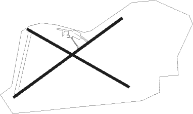
Nucla - Hopkins Fld
Airport details
| Country | United States of America |
| State | Colorado |
| Region | K2 |
| Airspace | Denver Ctr |
| Municipality | Montrose County |
| Elevation | 5939ft (1810m) |
| Timezone | GMT -7 |
| Coordinates | 38.23875, -108.56328 |
| Magnetic var | |
| Type | land |
| Available since | X-Plane v10.40 |
| ICAO code | KAIB |
| IATA code | n/a |
| FAA code | AIB |
Communication
| Hopkins Fld AWOS 3 | 132.525 |
| Hopkins Fld CTAF/UNICOM | 122.800 |
Nearby Points of Interest:
Hanging Flume
-Dolores River Bridge
Nearby beacons
| code | identifier | dist | bearing | frequency |
|---|---|---|---|---|
| ETL | CONES (TELLURIDE) VOR/DME | 18.6 | 123° | 110.20 |
| DVC | DOVE CREEK VORTAC | 31.1 | 221° | 114.60 |
| MTJ | MONTROSE VOR/DME | 35.1 | 68° | 117.10 |
| JNC | GRAND JUNCTION VOR/DME | 50.4 | 344° | 112.40 |
| CEZ | CORTEZ VOR/DME | 50.9 | 180° | 108.40 |
| BDG | BLANDING NDB | 61.7 | 232° | 340 |
Departure and arrival routes
| Transition altitude | 18000ft |
| Transition level | 18000ft |
| SID end points | distance | outbound heading | |
|---|---|---|---|
| RW05 | |||
| NUCLA1 | 20mi | 310° | |
| RW23 | |||
| NUCLA1 | 20mi | 310° | |
Instrument approach procedures
| runway | airway (heading) | route (dist, bearing) |
|---|---|---|
| RWNVA | PAROX (130°) | PAROX 12000ft CULIR (7mi, 130°) 9000ft |
| RNAV | CULIR 9000ft IVOYE (7mi, 130°) 8100ft TUYUY (6mi, 130°) 6600ft (6275mi, 109°) 6600ft PAROX (6285mi, 289°) 12000ft PAROX (turn) |
Disclaimer
The information on this website is not for real aviation. Use this data with the X-Plane flight simulator only! Data taken with kind consent from X-Plane 12 source code and data files. Content is subject to change without notice.

