Aliceville - George Downer
Airport details
| Country | United States of America |
| State | Alabama |
| Region | K7 |
| Airspace | Memphis Ctr |
| Municipality | Pickens County |
| Elevation | 149ft (45m) |
| Timezone | GMT -6 |
| Coordinates | 33.10674, -88.19717 |
| Magnetic var | |
| Type | land |
| Available since | X-Plane v10.40 |
| ICAO code | KAIV |
| IATA code | AIV |
| FAA code | AIV |
Communication
| George Downer CTAF/UNICOM | 122.800 |
Nearby Points of Interest:
Pickens County Courthouse
-Hugh Wilson Hill House
-Everhope Plantation
-Coffin Shop
-Colonel Green G. Mobley House
-Gibbs House
-Yates-Flora House
-Goodwin-Harrison House
-Old Jail (Gordo, Alabama)
-Oakhurst (Emelle, Alabama)
-John Coleman House
-William A. Rogers House
-Rev. John H. Gray House
-William B. Wills House
-Kirkwood
-William F. Pierce House
-William C. Jones House
-First Presbyterian Church
-William Peter Webb House
-Edwin Reese House
-Coleman-Banks House
-Daniel R. Wright House
-Attoway R. Davis Home
-Old Greene County Courthouse
-Antebellum Homes in Eutaw TR
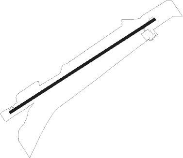
Runway info
| Runway 6 / 24 | ||
| length | 1526m (5007ft) | |
| bearing | 66° / 246° | |
| width | 24m (80ft) | |
| surface | asphalt | |
Nearby beacons
| code | identifier | dist | bearing | frequency |
|---|---|---|---|---|
| TC | TUSKE (TUSCALOOSA) NDB | 26.6 | 84° | 362 |
| IGB | BIGBEE (COLUMBUS) VORTAC | 27.7 | 320° | 116.20 |
| CBM | CALEDONIA (COLUMBUS) VORTAC | 34.3 | 336° | 115.20 |
| LDK | CRIMSON VORTAC | 34.4 | 77° | 117.80 |
| NMM | MERIDIAN TACAN | 36.2 | 213° | 111.90 |
| EWA | DME | 46.2 | 199° | 113.80 |
| OKW | BROOKWOOD VORTAC | 48.2 | 82° | 111 |
| MEI | MERIDIAN VORTAC | 53.4 | 220° | 117 |
Instrument approach procedures
| runway | airway (heading) | route (dist, bearing) |
|---|---|---|
| RW06 | ZESLO (66°) | ZESLO 3000ft |
| RNAV | ZESLO 3000ft JOGAM (6mi, 65°) 2000ft UDLEQ (3mi, 66°) 1020ft KAIV (3mi, 66°) 193ft (5314mi, 111°) 550ft CIKOB (5304mi, 291°) 3000ft CIKOB (turn) | |
| RW24 | CIKOB (246°) | CIKOB 3000ft |
| RNAV | CIKOB 3000ft ZOLUG (6mi, 246°) 2000ft FEPON (3mi, 246°) 1100ft KAIV (3mi, 246°) 190ft (5314mi, 111°) 550ft ZESLO (5325mi, 290°) 3000ft ZESLO (turn) |
Disclaimer
The information on this website is not for real aviation. Use this data with the X-Plane flight simulator only! Data taken with kind consent from X-Plane 12 source code and data files. Content is subject to change without notice.