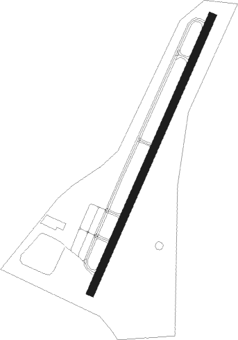
Gastonia - Gastonia Muni
Airport details
| Country | United States of America |
| State | North Carolina |
| Region | K7 |
| Airspace | Atlanta Ctr |
| Municipality | Gastonia |
| Elevation | 795ft (242m) |
| Timezone | GMT -5 |
| Coordinates | 35.20264, -81.14989 |
| Magnetic var | |
| Type | land |
| Available since | X-Plane v10.40 |
| ICAO code | KAKH |
| IATA code | n/a |
| FAA code | AKH |
Communication
| Gastonia Muni ASOS | 135.725 |
| Gastonia Muni CTAF/UNICOM | 123.000 |
| Gastonia Muni CHARLOTTE Approach/Departure | 120.050 |
Nearby Points of Interest:
Downtown Gastonia Historic District
-Gaston County Courthouse
-First National Bank Building
-Robinson-Gardner Building
-Third National Bank Building
-Mayworth School
-McAdenville Historic District
-Belmont City Hall
-Clover Downtown Historic District
-Dallas Historic District
-Eli Hoyle House
-Hoyle Historic Homestead
-Bessemer City Downtown Historic District
-Mount Holly Cotton Mill
-Hayes-Byrum Store and House
-Central School Historic District
-King Street Overhead Bridge
-West End Historic District
-Margrace Mill Village Historic District
-Former Thrift Mill
-Edward M. Rozzell House
-Andrew Carpenter House
-York Historic District
-Witherspoon-Hunter House
-York County Courthouse
Nearby beacons
| code | identifier | dist | bearing | frequency |
|---|---|---|---|---|
| GHJ | STONIA (GASTONIA) NDB | 0.7 | 215° | 260 |
| CLT | CHARLOTTE VOR/DME | 9.7 | 94° | 115 |
| UZ | RALLY (ROCK HILL) NDB | 19 | 168° | 227 |
| SLP | FIRST RIVER (SHELBY) NDB | 22.2 | 276° | 417 |
| DCM | CHESTER NDB | 25.1 | 187° | 220 |
| LKR | LANCASTER NDB | 32.1 | 149° | 400 |
| HK | TAWBA (HICKORY) NDB | 35.8 | 345° | 332 |
| UOT | UNION COUNTY NDB | 39.4 | 224° | 326 |
| SPA | SPARTANBURG VORTAC | 39.5 | 258° | 115.70 |
| FIQ | FIDDLERS (MORGANTON) NDB | 39.7 | 314° | 391 |
| BZM | BARRETTS MOUNTAIN (HICKOR VOR/DME | 40.2 | 352° | 113.75 |
| RU | ROVDY (SALISBURY) NDB | 45.3 | 51° | 275 |
| CTF | CHESTERFIELD VOR/DME | 54.3 | 122° | 108.20 |
| EOE | ENOREE (NEWBERRY) NDB | 58.6 | 209° | 278 |
| BAR | HEMLOCK (BANNER ELK) NDB | 67.2 | 322° | 320 |
| IN | REENO (WINSTON SALEM) NDB | 70.8 | 49° | 317 |
| GIW | CORONACA (GREENWOOD) NDB | 73.3 | 225° | 239 |
Departure and arrival routes
| Transition altitude | 18000ft |
| Transition level | 18000ft |
| SID end points | distance | outbound heading | |
|---|---|---|---|
| ALL | |||
| WEAZL4 | 73mi | 0° | |
| KRITR5 | 46mi | 23° | |
| KILNS4 | 129mi | 67° | |
| BARMY4 | 175mi | 77° | |
| KNI2 | 63mi | 90° | |
| LILLS2 | 62mi | 102° | |
| KWEEN4 | 62mi | 161° | |
| ICONS4 | 74mi | 174° | |
| BEAVY5 | 82mi | 186° | |
| ESTRR4 | 98mi | 243° | |
| BOBZY4 | 42mi | 263° | |
| JOJJO4 | 199mi | 282° | |
| RW03 | |||
| KER3 | 129mi | 188° | |
| RW21 | |||
| KER3 | 129mi | 188° | |
| STAR starting points | distance | inbound heading | |
|---|---|---|---|
| ALL | |||
| CHPTR3 | 44.5 | 28° | |
| UNARM6 | 40.8 | 42° | |
| LIINN3 | 42.0 | 116° | |
| MAJIC4 | 50.5 | 230° | |
| RASLN3 | 48.6 | 295° | |
Instrument approach procedures
| runway | airway (heading) | route (dist, bearing) |
|---|---|---|
| RW03 | GAFFE (75°) | GAFFE SIDAR (15mi, 101°) 3000ft |
| RW03 | LOCKS (27°) | LOCKS SIDAR (7mi, 17°) 3000ft |
| RNAV | SIDAR 3000ft ACLAC (6mi, 33°) 2400ft KAKH (5mi, 33°) 836ft SAVKE (5mi, 33°) HIVSI (18mi, 280°) GAFFE (16mi, 200°) 3200ft GAFFE (turn) | |
| RW21 | LINCO (134°) | LINCO STANN (14mi, 85°) 4000ft CUKNA (7mi, 147°) 3400ft |
| RNAV | CUKNA 3400ft ZURIM (6mi, 213°) 2300ft KAKH (5mi, 213°) 821ft WADAV (3mi, 213°) GAFFE (19mi, 260°) 3200ft GAFFE (turn) |
Holding patterns
| STAR name | hold at | type | turn | heading* | altitude | leg | speed limit |
|---|---|---|---|---|---|---|---|
| CHPTR3 | EYPAD | VHF | right | 218 (38)° | DME 10.0mi | ICAO rules | |
| CHPTR3 | GRD | NDB | right | 227 (47)° | < 17999ft | 1.0min timed | ICAO rules |
| LIINN3 | LIINN | VHF | right | 302 (122)° | DME 10.0mi | ICAO rules | |
| MAJIC4 | KELLS | VHF | right | 39 (219)° | DME 15.0mi | ICAO rules | |
| MAJIC4 | MAJIC | VHF | left | 39 (219)° | DME 10.0mi | ICAO rules | |
| RASLN3 | DSTEE | VHF | left | 141 (321)° | DME 4.0mi | ICAO rules | |
| RASLN3 | FLO | NDB | left | 140 (320)° | 1.0min timed | ICAO rules | |
| RASLN3 | RODEZ | VHF | left | 141 (321)° | DME 5.0mi | ICAO rules | |
| UNARM6 | GRD | NDB | right | 227 (47)° | < 17999ft | 1.0min timed | ICAO rules |
| UNARM6 | LOCKS | VHF | right | 232 (52)° | < 17999ft | 1.0min timed | ICAO rules |
| UNARM6 | UNARM | VHF | right | 233 (53)° | DME 4.0mi | ICAO rules | |
| *) magnetic outbound (inbound) holding course | |||||||
Disclaimer
The information on this website is not for real aviation. Use this data with the X-Plane flight simulator only! Data taken with kind consent from X-Plane 12 source code and data files. Content is subject to change without notice.