Akron - Colorado Plains Rgnl
Airport details
| Country | United States of America |
| State | Colorado |
| Region | K2 |
| Airspace | Denver Ctr |
| Municipality | Washington County |
| Elevation | 4713ft (1437m) |
| Timezone | GMT -7 |
| Coordinates | 40.17564, -103.22203 |
| Magnetic var | |
| Type | land |
| Available since | X-Plane v10.40 |
| ICAO code | KAKO |
| IATA code | AKO |
| FAA code | AKO |
Communication
| Colorado Plains Rgnl ASOS | 135.475 |
| Colorado Plains Rgnl CTAF/UNICOM | 122.800 |
Nearby Points of Interest:
Akron Gymnasium
-All Saints Church of Eben Ezer
-St. Anthony's Roman Catholic Church (Sterling, Colorado)
-Logan County Courthouse
-Downtown Sterling Historic District
-Fort Morgan State Armory
-Plum Bush Creek Bridge
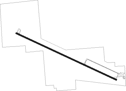
Runway info
| Runway 11 / 29 | ||
| length | 2134m (7001ft) | |
| bearing | 113° / 293° | |
| width | 30m (100ft) | |
| surface | asphalt | |
Nearby beacons
| code | identifier | dist | bearing | frequency |
|---|---|---|---|---|
| AKO | AKRON VOR/DME | 2.2 | 115° | 114.40 |
| TXC | THURMAN VORTAC | 28.6 | 179° | 112.90 |
| SNY | SIDNEY VOR/DME | 56.3 | 15° | 115.90 |
| CNP | CHAPPELL NDB | 64.3 | 40° | 383 |
| ITR | KIT CARSON (BURLINGTON) NDB | 70.6 | 135° | 209 |
Instrument approach procedures
| runway | airway (heading) | route (dist, bearing) |
|---|---|---|
| RW11 | CASMI (84°) | CASMI KUKMY (10mi, 36°) 7500ft |
| RW11 | FENGA (150°) | FENGA KUKMY (10mi, 216°) 7500ft |
| RW11 | KUKMY (113°) | KUKMY 7500ft |
| RNAV | KUKMY 7500ft ADEWU (8mi, 113°) 6300ft KAKO (5mi, 113°) 4770ft (6010mi, 111°) 4966ft JUBOS (5999mi, 291°) 7500ft JUBOS (turn) | |
| RW29 | JUBOS (293°) | JUBOS 7500ft |
| RW29 | KIQER (330°) | KIQER JUBOS (10mi, 36°) 7500ft |
| RW29 | YELUR (265°) | YELUR JUBOS (10mi, 216°) 7500ft |
| RNAV | JUBOS 7500ft OWEBY (8mi, 293°) 6300ft KAKO (6mi, 293°) 4723ft (6010mi, 111°) 4933ft KUKMY (6020mi, 291°) 7500ft KUKMY (turn) |
Disclaimer
The information on this website is not for real aviation. Use this data with the X-Plane flight simulator only! Data taken with kind consent from X-Plane 12 source code and data files. Content is subject to change without notice.