Albany - Albany Intl
Airport details
| Country | United States of America |
| State | New York |
| Region | K6 |
| Airspace | Boston Ctr |
| Municipality | Town of Colonie |
| Elevation | 285ft (87m) |
| Timezone | GMT -5 |
| Coordinates | 42.74396, -73.80087 |
| Magnetic var | |
| Type | land |
| Available since | X-Plane v10.30 |
| ICAO code | KALB |
| IATA code | ALB |
| FAA code | ALB |
Communication
| Albany Intl ATIS | 120.450 |
| Albany Intl Clearance DEL | 127.500 |
| Albany Intl Ground Control | 121.700 |
| Albany Intl Tower | 119.500 |
| Albany Intl Approach | 118.050 |
| Albany Intl Departure | 118.050 |
Approach frequencies
| ILS-cat-II | RW01 | 109.5 | 18.00mi |
| ILS-cat-I | RW19 | 109.5 | 18.00mi |
| 3° GS | RW19 | 109.5 | 18.00mi |
| 3° GS | RW01 | 109.5 | 18.00mi |
Nearby Points of Interest:
Watervliet Shaker Historic District
-Verdoy Schoolhouse
-United States Post Office
-Goodrich School
-Albany Pine Bush
-Bacon-Stickney House
-Frederick Cramer House
-Bryan's Store
-Vischer Ferry Historic District
-Lustron Houses of Jermain Street Historic District
-Abraham Best House
-Watervliet Arsenal
-Iron Building
-J. Leonard Lackman House
-William J. Dickey House
-Olmstead Street Historic District
-Downtown Cohoes Historic District
-Harmony Mills
-St. Mark's Episcopal Church
-McCarthy Building
-Burden Ironworks Office Building
-National State Bank Building
-Central Troy Historic District
-Pumpkin House
-Albany Felt Company Complex
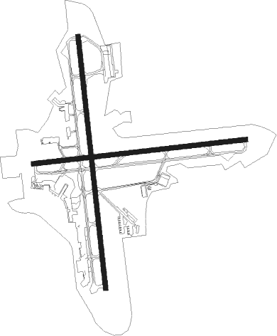
Runway info
Runway 1 / 19  | ||
| length | 2593m (8507ft) | |
| bearing | 358° / 178° | |
| width | 46m (150ft) | |
| surface | asphalt | |
| blast zone | 61m (200ft) / 61m (200ft) | |
| Runway 10 / 28 | ||
| length | 2197m (7208ft) | |
| bearing | 89° / 269° | |
| width | 46m (150ft) | |
| surface | asphalt | |
| displ threshold | 0m (0ft) / 363m (1191ft) | |
| blast zone | 61m (200ft) / 61m (200ft) | |
Nearby beacons
| code | identifier | dist | bearing | frequency |
|---|---|---|---|---|
| ALB | ALBANY VORTAC | 0.2 | 325° | 115.30 |
| AL | HAWKY (ALBANY) NDB | 4.4 | 354° | 219 |
| HEU | HUNTER (SCHENECTADY) NDB | 8.8 | 310° | 356 |
| CAM | CAMBRIDGE VOR/DME | 25.1 | 61° | 115 |
| JJH | JOHNSTOWN NDB | 27.9 | 296° | 523 |
| PFH | PHILMONT (HUDSON) NDB | 29.6 | 171° | 272 |
| GF | GANSE (GLENS FALLS) NDB | 31.8 | 21° | 209 |
| CTR | CHESTER VOR/DME | 46.4 | 118° | 115.10 |
| PWL | PAWLING (POUGHKEEPSIE) VOR/DME | 59.1 | 168° | 114.30 |
| RUT | DME | 59.9 | 47° | 111 |
| DYO | SMUTO (RUTLAND) NDB | 68.5 | 41° | 221 |
Departure and arrival routes
| Transition altitude | 18000ft |
| Transition level | 18000ft |
| SID end points | distance | outbound heading | |
|---|---|---|---|
| RW01 | |||
| ALB7 | 13mi | 346° | |
| RW10 | |||
| ALB7 | 13mi | 346° | |
| RW19 | |||
| ALB7 | 13mi | 346° | |
| RW28 | |||
| ALB7 | 13mi | 346° | |
Instrument approach procedures
| runway | airway (heading) | route (dist, bearing) |
|---|---|---|
| RW01-Y | ATHOS (1°) | ATHOS MUJIK (19mi, 3°) 2600ft |
| RW01-Y | CANAN (305°) | CANAN TULSE (12mi, 271°) 3000ft MUJIK (5mi, 305°) 2600ft |
| RW01-Y | OAKIL (64°) | OAKIL OCCAS (25mi, 85°) 4300ft MUJIK (5mi, 52°) 2600ft |
| RNAV | MUJIK 2600ft FLEIG (6mi, 358°) 1900ft KALB (5mi, 360°) 340ft (4695mi, 120°) 484ft WREAD (4697mi, 300°) 3000ft WREAD (turn) | |
| RW01-Z | FOSEX (267°) | FOSEX BRNTY (4mi, 178°) 3500ft YAYNU (4mi, 246°) 2100ft ZANEG (2mi, 321°) 1400ft |
| RW01-Z | HIGES (315°) | HIGES YAYNU (6mi, 293°) 2100ft ZANEG (2mi, 321°) 1400ft |
| RW01-Z | MUJIK (359°) | MUJIK ZANEG (8mi, 358°) 1400ft |
| RW01-Z | URACI (60°) | URACI WOVAR (4mi, 96°) 2600ft ZANEG (4mi, 57°) 1400ft |
| RW01-Z | YETGU (90°) | YETGU FETPU (4mi, 178°) 3500ft WOVAR (3mi, 129°) 2600ft ZANEG (4mi, 57°) 1400ft |
| RNAV | ZANEG 1400ft KALB (4mi, 1°) 340ft OXFIC (6mi, 355°) OTOLE (7mi, 339°) 3000ft OTOLE (turn) | |
| RW10 | MARIA (102°) | MARIA TURES (10mi, 117°) 3000ft |
| RW10 | SHAHE (80°) | SHAHE TURES (5mi, 56°) 3000ft |
| RNAV | TURES 3000ft ZEJAY (5mi, 89°) 1900ft KALB (5mi, 91°) 327ft (4695mi, 120°) 685ft SIMAY (4689mi, 300°) WARUV (4mi, 81°) 5000ft WARUV (turn) | |
| RW19-Y | CAM (241°) | CAM QIFET (16mi, 264°) 4000ft EYMEY (5mi, 256°) 2000ft |
| RW19-Y | PAYGE (121°) | PAYGE XIPAQ (14mi, 96°) 4000ft EYMEY (6mi, 113°) 2000ft |
| RNAV | EYMEY 2000ft HAUKY (6mi, 178°) 1600ft WESTS (2mi, 178°) 840ft KALB (3mi, 173°) 334ft (4695mi, 120°) 480ft FLEIG (4694mi, 300°) GROUP (6mi, 184°) 3000ft GROUP (turn) | |
| RW19-Z | EYMEY (176°) | EYMEY WISIG (7mi, 178°) 1400ft |
| RW19-Z | SEYON (232°) | SEYON CUGOP (6mi, 261°) 2400ft WISIG (3mi, 227°) 1400ft |
| RW19-Z | TUKUY (264°) | TUKUY NUSIY (4mi, 358°) 3500ft CUGOP (4mi, 300°) 2400ft WISIG (3mi, 227°) 1400ft |
| RW19-Z | WEKOR (93°) | WEKOR OKNUE (4mi, 358°) 3500ft FIGUV (3mi, 42°) 2700ft WISIG (4mi, 116°) 1400ft |
| RW19-Z | ZAKIB (106°) | ZAKIB WOGOK (4mi, 74°) 3700ft FIGUV (3mi, 74°) 2700ft WISIG (4mi, 116°) 1400ft |
| RNAV | WISIG 1400ft KALB (4mi, 175°) 334ft CUVLU (3mi, 181°) GROUP (7mi, 182°) 3000ft GROUP (turn) | |
| RW28 | CAM (241°) | CAM TROSI (16mi, 216°) 3500ft |
| RW28 | CANAN (305°) | CANAN TUTDU (12mi, 358°) 3500ft TROSI (4mi, 312°) 3500ft |
| RNAV | TROSI 3500ft YAKUT (4mi, 269°) 2500ft SIMAY (2mi, 269°) 2200ft KALB (6mi, 267°) 318ft (4695mi, 120°) 685ft ZEJAY (4700mi, 300°) MARIA (14mi, 287°) 3500ft MARIA (turn) |
Disclaimer
The information on this website is not for real aviation. Use this data with the X-Plane flight simulator only! Data taken with kind consent from X-Plane 12 source code and data files. Content is subject to change without notice.