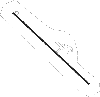
Ava - Ava Bill Martin Mem
Airport details
| Country | United States of America |
| State | Missouri |
| Region | K3 |
| Airspace | Kansas City Ctr |
| Municipality | Douglas County |
| Elevation | 1311ft (400m) |
| Timezone | GMT -6 |
| Coordinates | 36.97189, -92.68195 |
| Magnetic var | |
| Type | land |
| Available since | X-Plane v10.40 |
| ICAO code | KAOV |
| IATA code | n/a |
| FAA code | AOV |
Communication
| AVA BILL MARTIN MEM CTAF | 122.700 |
| AVA BILL MARTIN MEM CTAF | 122.900 |
| AVA BILL MARTIN MEM SPRINGFIELD | 126.350 |
Nearby Points of Interest:
Ava Ranger Station Historic District
-Col. Thomas C. Love House
-John Conkin and Clara Layton Harlin House
-Ozark Courthouse Square Historic District
-Hodgson-Aid Mill
-Springfield National Cemetery
-Edward M. and Della C. Wilhoit House
-Ambassador Apartments
-Pythian Home of Missouri
-Lincoln School
Nearby beacons
| code | identifier | dist | bearing | frequency |
|---|---|---|---|---|
| DGD | DOGWOOD VORTAC | 9.8 | 285° | 109.40 |
| HUW | DME | 38 | 97° | 111.60 |
| SGF | SPRINGFIELD VORTAC | 38.8 | 300° | 116.90 |
| FLP | DME | 41.7 | 162° | 116.05 |
| HRO | HARRISON VOR/DME | 46.8 | 219° | 112.50 |
| BHN | BUCKHORN (FORT LEONARD WOOD) NDB | 51.5 | 39° | 391 |
| TBN | FORNEY (FORT LEONARD WOOD VOR | 53 | 35° | 110 |
| MAP | MAPLES TACAN | 56.6 | 55° | 113.40 |
Instrument approach procedures
| runway | airway (heading) | route (dist, bearing) |
|---|---|---|
| RW13 | GOTPY (131°) | GOTPY 4600ft |
| RNAV | GOTPY 4600ft YOZKY (5mi, 131°) 3200ft ZOPTI (3mi, 131°) 2200ft KAOV (3mi, 131°) 1317ft (5534mi, 112°) 1711ft GAHSU (5527mi, 292°) 3500ft GAHSU (turn) | |
| RW31 | GAHSU (311°) | GAHSU 3500ft |
| RNAV | GAHSU 3500ft YIRPU (5mi, 311°) 3000ft KAOV (5mi, 311°) 1351ft GOTPY (11mi, 311°) 4600ft GOTPY (turn) |
Disclaimer
The information on this website is not for real aviation. Use this data with the X-Plane flight simulator only! Data taken with kind consent from X-Plane 12 source code and data files. Content is subject to change without notice.
