Apple Valley
Airport details
| Country | United States of America |
| State | California |
| Region | K2 |
| Airspace | Los Angeles Ctr |
| Municipality | Apple Valley |
| Elevation | 3062ft (933m) |
| Timezone | GMT -8 |
| Coordinates | 34.57533, -117.18620 |
| Magnetic var | |
| Type | land |
| Available since | X-Plane v10.32 |
| ICAO code | KAPV |
| IATA code | APV |
| FAA code | APV |
Communication
| Apple Valley AWOS | 135.475 |
| Apple Valley CTAF/UNICOM | 122.800 |
| Apple Valley Joshua Approach | 124.550 |
| Apple Valley Joshua Departure | 125.550 |
Nearby Points of Interest:
Highland Historic District
-Rainbow Basin
-San Bernardino Downtown Station
-San Bernardino County Court House
-Mill Creek Zanja
-Redlands Santa Fe Depot District
-Redlands Central Railway Company Car Barn
-U.S. Post Office
-A. K. Smiley Public Library
-Bono's Restaurant and Deli
-Smiley Park Historic District
-Barton Villa
-Beverly Ranch
-Sam and Alfreda Maloof Compound
-Auerbacher Home
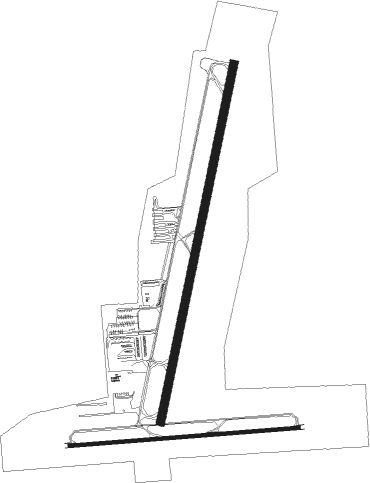
Runway info
Runway 8 / 26  | ||
| length | 1249m (4098ft) | |
| bearing | 90° / 270° | |
| width | 18m (60ft) | |
| surface | asphalt | |
| blast zone | 30m (98ft) / 28m (92ft) | |
| Runway 18 / 36 | ||
| length | 1985m (6512ft) | |
| bearing | 199° / 19° | |
| width | 46m (150ft) | |
| surface | asphalt | |
| displ threshold | 0m (0ft) / 182m (597ft) | |
Nearby beacons
| code | identifier | dist | bearing | frequency |
|---|---|---|---|---|
| VCV | VICTORVILLE VOR/DME | 10.1 | 275° | 109.05 |
| SB | PETIS (SAN BERNARDINO) NDB | 32.4 | 199° | 397 |
| EDW | EDWARDS VORTAC | 36.3 | 307° | 116.40 |
| DAG | DAGGETT VORTAC | 37.9 | 58° | 113.20 |
| HEC | HECTOR VORTAC | 38.1 | 73° | 112.70 |
| RAL | RIVERSIDE VOR | 39.4 | 203° | 112.40 |
| RIV | MARCH (RIVERSIDE) TACAN | 40.4 | 188° | 113 |
| POM | POMONA VORTAC | 42.1 | 230° | 110.40 |
| PDZ | PARADISE (ONTARIO) VORTAC | 42.9 | 208° | 112.20 |
| PMD | PALMDALE VORTAC | 43.5 | 274° | 114.50 |
| HDF | HOMELAND (RIVERSIDE) VOR | 47.9 | 180° | 113.40 |
| PSP | PALM SPRINGS VORTAC | 56.6 | 133° | 115.50 |
| ELB | EL TORO (SANTA ANA) VOR/DME | 60.4 | 211° | 117.20 |
| SLI | SEAL BEACH (LOS ALAMITOS) VORTAC | 64.2 | 228° | 115.70 |
Departure and arrival routes
| Transition altitude | 18000ft |
| Transition level | 18000ft |
| SID end points | distance | outbound heading | |
|---|---|---|---|
| RW36 | |||
| EXCON1 | 44mi | 274° | |
Instrument approach procedures
| runway | airway (heading) | route (dist, bearing) |
|---|---|---|
| RW18 | BASAL (241°) | BASAL DAVAY (9mi, 291°) 6800ft HEDRI (6mi, 269°) 6000ft |
| RW18 | NASTE (112°) | NASTE CUREL (12mi, 59°) 6300ft HEDRI (6mi, 89°) 6000ft |
| RNAV | HEDRI 6000ft VICVU (7mi, 178°) 5800ft JUTGA (3mi, 196°) 4620ft CUVED (1mi, 196°) 4100ft CFFCG (3mi, 196°) 3122ft (6732mi, 106°) 3380ft FAPID (6734mi, 286°) FEBAX (7mi, 268°) NASTE (13mi, 325°) 6000ft NASTE (turn) |
Disclaimer
The information on this website is not for real aviation. Use this data with the X-Plane flight simulator only! Data taken with kind consent from X-Plane 12 source code and data files. Content is subject to change without notice.