Appleton - Appleton Muni
Airport details
| Country | United States of America |
| State | Minnesota |
| Region | K3 |
| Airspace | Minneapolis Ctr |
| Municipality | Swift County |
| Elevation | 1020ft (311m) |
| Timezone | GMT -6 |
| Coordinates | 45.22750, -96.00453 |
| Magnetic var | |
| Type | land |
| Available since | X-Plane v10.32 |
| ICAO code | KAQP |
| IATA code | n/a |
| FAA code | AQP |
Communication
| Appleton Muni CTAF | 122.900 |
Nearby Points of Interest:
Gethsemane Episcopal Church
-Appleton City Hall
-Lac qui Parle Mission
-Lac Qui Parle County Courthouse
-Madison Carnegie Library
-Christ Episcopal Church
-Church of St. Francis Xavier
-Big Stone County Courthouse
-Camp Release State Monument
-Chicago, Milwaukee and St. Paul Depot
-Alberta Teachers House
-Morris Industrial School for Indians
-Church of St. Bridget-Catholic
-Chicago, Milwaukee, St. Paul and Pacific Depot
-Sabin S. Murdock House
-First Congregational Church of Milbank
-Grant County Courthouse
-First State Bank Building
-Graceville Historical Marker
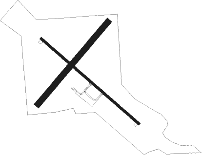
Runway info
Runway 13 / 31  | ||
| length | 1065m (3494ft) | |
| bearing | 126° / 306° | |
| width | 23m (75ft) | |
| surface | asphalt | |
| Runway 04 / 22 | ||
| length | 887m (2910ft) | |
| bearing | 55° / 235° | |
| width | 48m (157ft) | |
| surface | grass | |
Nearby beacons
| code | identifier | dist | bearing | frequency |
|---|---|---|---|---|
| MVE | MONTEVIDEO VOR/DME | 19.6 | 131° | 111.60 |
| MOX | MORRIS VOR/DME | 20.3 | 6° | 109.60 |
| BDH | WILLMAR VOR/DME | 37.7 | 97° | 113.70 |
| GB | GARNO (MARSHALL) NDB | 43.7 | 173° | 253 |
| MML | MARSHALL VOR/DME | 47.4 | 167° | 111 |
| AXN | ALEXANDRIA VOR/DME | 54.5 | 47° | 112.80 |
| RWF | REDWOOD FALLS VOR/DME | 58.9 | 131° | 113.30 |
| FF | HAMRE (FERGUS FALLS) NDB | 59.6 | 357° | 337 |
| BK | CHRLZ (BROOKINGS) NDB | 66 | 227° | 335 |
Instrument approach procedures
| runway | airway (heading) | route (dist, bearing) |
|---|---|---|
| RW13 | AXN (227°) | AXN MAGUJ (49mi, 239°) 3000ft EDULE (5mi, 235°) 2900ft |
| RW13 | DAWSO (48°) | DAWSO MAFXE (17mi, 350°) 2900ft EDULE (5mi, 55°) 2900ft |
| RNAV | EDULE 2900ft ATMAW (6mi, 126°) 2700ft PETIE (3mi, 126°) 1620ft KAQP (2mi, 126°) 1065ft (5659mi, 115°) 1421ft BOMGE (5651mi, 295°) 2900ft BOMGE (turn) |
Disclaimer
The information on this website is not for real aviation. Use this data with the X-Plane flight simulator only! Data taken with kind consent from X-Plane 12 source code and data files. Content is subject to change without notice.