Walnut Ridge - Walnut Ridge Rgnl
Airport details
| Country | United States of America |
| State | Arkansas |
| Region | K4 |
| Airspace | Memphis Ctr |
| Municipality | Walnut Ridge |
| Elevation | 270ft (82m) |
| Timezone | GMT -6 |
| Coordinates | 36.12467, -90.92511 |
| Magnetic var | |
| Type | land |
| Available since | X-Plane v10.40 |
| ICAO code | KARG |
| IATA code | ARG |
| FAA code | ARG |
Communication
| Walnut Ridge Rgnl AWOS 3 | 135.925 |
| Walnut Ridge Rgnl CTAF/UNICOM | 122.800 |
Approach frequencies
| LOC | RW18 | 111.1 | 18.00mi |
Nearby Points of Interest:
Building Number 29
-Walnut Ridge Army Airfield Access Road
-Old Walnut Ridge Post Office
-Portia School
-Black River Bridge
-Old Randolph County Courthouse
-Randolph County Courthouse
-Pocahontas Post Office
-Powhatan Methodist Church
-Old Union School
-Cedar Grove School No. 81
-St. Louis-San Francisco Overpass
-Imboden Methodist Episcopal Church, South
-Dr. John Octavius Hatcher House
-Crowley's Ridge State Park-Dining Hall
-Crowley's Ridge State Park-Bathhouse
-Crowley's Ridge State Park-Bridge
-Crowley's Ridge State Park-Comfort Station
-Holly Grove Presbyterian Church
-Looney-French House
-US Sen. Hattie Caraway Gravesite
-Rice-Upshaw House
-Mercantile Bank Building
-Edward L. Westbrooke Building
-Craighead County Courthouse
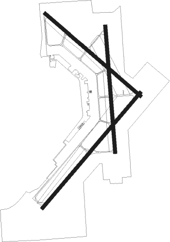
Runway info
Runway 4 / 22  | ||
| length | 1831m (6007ft) | |
| bearing | 51° / 231° | |
| width | 46m (150ft) | |
| surface | concrete | |
| Runway 13 / 31 | ||
| length | 1526m (5007ft) | |
| bearing | 129° / 309° | |
| width | 46m (150ft) | |
| surface | concrete | |
| Runway 18 / 36 | ||
| length | 1527m (5010ft) | |
| bearing | 180° / 0° | |
| width | 46m (150ft) | |
| surface | concrete | |
Nearby beacons
| code | identifier | dist | bearing | frequency |
|---|---|---|---|---|
| ARG | WALNUT RIDGE VORTAC | 1.6 | 243° | 114.50 |
| TNZ | LAWRENCE COUNTY (WALNUT RIDGE) NDB | 4.9 | 1° | 227 |
| JBR | JONESBORO VOR/DME | 22.1 | 127° | 108.60 |
| BV | ALMND (BATESVILLE) NDB | 49.4 | 244° | 335 |
| GQE | GILMORE VOR/DME | 51.5 | 150° | 113 |
| HUW | DME | 65 | 307° | 111.60 |
Instrument approach procedures
| runway | airway (heading) | route (dist, bearing) |
|---|---|---|
| RW04 | XIHAM (50°) | XIHAM 2700ft |
| RNAV | XIHAM 2700ft ZUPTA (7mi, 51°) 1900ft TILVE (3mi, 51°) 800ft KARG (2mi, 47°) 324ft (5450mi, 112°) 529ft ESEGE (5441mi, 292°) 2700ft ESEGE (turn) | |
| RW18 | EYPEB (181°) | EYPEB 2700ft |
| RNAV | EYPEB 2700ft YOFOB (7mi, 180°) 1900ft ROFKI (3mi, 180°) 820ft KARG (2mi, 183°) 318ft (5450mi, 112°) 473ft GUBFO (5450mi, 292°) 3100ft GUBFO (turn) | |
| RW22 | ESEGE (232°) | ESEGE 2700ft |
| RNAV | ESEGE 2700ft OYFAL (7mi, 231°) 1900ft JOMOS (3mi, 231°) 820ft KARG (2mi, 236°) 318ft (5450mi, 112°) 523ft XIHAM (5459mi, 292°) 2700ft XIHAM (turn) | |
| RW36 | GUBFO (360°) | GUBFO 3100ft |
| RNAV | GUBFO 3100ft IMOXY (7mi, 0°) 1900ft WOLSO (3mi, 0°) 780ft KARG (2mi, 357°) 317ft (5450mi, 112°) 472ft EYPEB (5450mi, 292°) 2700ft EYPEB (turn) |
Disclaimer
The information on this website is not for real aviation. Use this data with the X-Plane flight simulator only! Data taken with kind consent from X-Plane 12 source code and data files. Content is subject to change without notice.