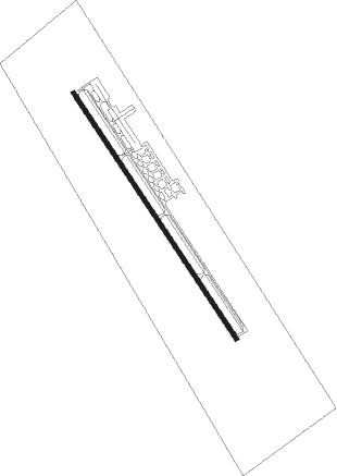
Wharton - Wharton Regl
Airport details
| Country | United States of America |
| State | Texas |
| Region | K4 |
| Airspace | Houston Oceanic Ctr |
| Municipality | Wharton |
| Elevation | 100ft (30m) |
| Timezone | GMT -6 |
| Coordinates | 29.25428, -96.15439 |
| Magnetic var | |
| Type | land |
| Available since | X-Plane v10.40 |
| ICAO code | KARM |
| IATA code | WHT |
| FAA code | ARM |
Communication
| Wharton Regl AWOS 3 | 118.475 |
| Wharton Regl CTAF/UNICOM | 122.700 |
Nearby Points of Interest:
Wharton County Courthouse Historic Commercial District
-Hensley-Gusman House
-Blessing Masonic Lodge No. 411
-Attwater Prairie Chicken National Wildlife Refuge
-John M. and Lottie D. Moore House
-Lamar–Calder House
-R. J. Hill Building
-Colorado County Courthouse
Nearby beacons
| code | identifier | dist | bearing | frequency |
|---|---|---|---|---|
| ELA | EAGLE LAKE VOR/DME | 25.9 | 338° | 116.40 |
| PSX | PALACIOS VORTAC | 30.4 | 197° | 117.30 |
| IDU | INDUSTRY VORTAC | 47.2 | 330° | 110.20 |
| VCT | VICTORIA VOR/DME | 48.2 | 247° | 109 |
| EFD | ELLINGTON (HOUSTON) TACAN | 56.1 | 71° | 109.40 |
| IAH | HUMBLE (HOUSTON) VORTAC | 59.6 | 49° | 116.60 |
| BVP | NIXIN (HOUSTON) NDB | 66.1 | 52° | 326 |
Departure and arrival routes
| Transition altitude | 18000ft |
| Transition level | 18000ft |
| SID end points | distance | outbound heading | |
|---|---|---|---|
| RW14 | |||
| BLTWY7 | 129mi | 13° | |
| WYLSN8 | 139mi | 15° | |
| INDIE8 | 265mi | 36° | |
| LURIC8 | 265mi | 46° | |
| STRYA8 | 280mi | 67° | |
| MMALT5 | 199mi | 84° | |
| STYCK8 | 176mi | 359° | |
| RW32 | |||
| BLTWY7 | 129mi | 13° | |
| WYLSN8 | 139mi | 15° | |
| INDIE8 | 265mi | 36° | |
| LURIC8 | 265mi | 46° | |
| STRYA8 | 280mi | 67° | |
| MMALT5 | 199mi | 84° | |
| STYCK8 | 176mi | 359° | |
| STAR starting points | distance | inbound heading | |
|---|---|---|---|
| ALL | |||
| CESAN4 | 127.6 | 237° | |
| WAPPL6 | 111.7 | 242° | |
Instrument approach procedures
| runway | airway (heading) | route (dist, bearing) |
|---|---|---|
| RW14 | AHESU (123°) | AHESU BEPUH (5mi, 64°) 2000ft |
| RW14 | BEPUH (147°) | BEPUH 6000ft BEPUH (turn) 2000ft |
| RW14 | CAYVI (174°) | CAYVI BEPUH (5mi, 244°) 2000ft |
| RNAV | BEPUH 2000ft DEZIV (6mi, 147°) 1700ft EBOPY (3mi, 147°) 700ft KARM (2mi, 147°) 142ft (5727mi, 107°) 396ft GOGOZ (5722mi, 287°) 2000ft GOGOZ (turn) | |
| RW32 | FARAG (354°) | FARAG GOGOZ (5mi, 64°) 2000ft |
| RW32 | GOGOZ (328°) | GOGOZ 6000ft GOGOZ (turn) 2000ft |
| RW32 | HUBEX (304°) | HUBEX GOGOZ (5mi, 244°) 2000ft |
| RNAV | GOGOZ 2000ft IDFIN (6mi, 328°) 1700ft JIBGA (3mi, 328°) 700ft KARM (2mi, 328°) 139ft (5727mi, 107°) 349ft BEPUH (5732mi, 287°) 2000ft BEPUH (turn) |
Holding patterns
| STAR name | hold at | type | turn | heading* | altitude | leg | speed limit |
|---|---|---|---|---|---|---|---|
| WAPPL6 | BRWCK | VHF | left | 55 (235)° | DME 20.0mi | ICAO rules | |
| WAPPL6 | WAPPL | VHF | left | 55 (235)° | DME 10.0mi | ICAO rules | |
| *) magnetic outbound (inbound) holding course | |||||||
Disclaimer
The information on this website is not for real aviation. Use this data with the X-Plane flight simulator only! Data taken with kind consent from X-Plane 12 source code and data files. Content is subject to change without notice.
