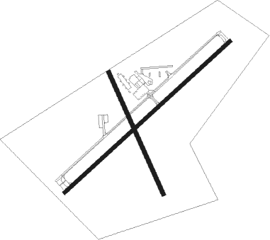
Atlanta - Hall Miller Muni
Airport details
| Country | United States of America |
| State | Texas |
| Region | K4 |
| Airspace | Ft Worth Ctr |
| Municipality | Atlanta |
| Elevation | 277ft (84m) |
| Timezone | GMT -6 |
| Coordinates | 33.10253, -94.19503 |
| Magnetic var | |
| Type | land |
| Available since | X-Plane v10.40 |
| ICAO code | KATA |
| IATA code | n/a |
| FAA code | ATA |
Communication
| Hall Miller Muni CTAF | 122.900 |
Nearby Points of Interest:
Mathews-Powell House
-Cass County Courthouse
-Pleasant Hill School
-Kiblah School
-Kansas City Southern Depot
-Averitt House
-Ritchie Grocery Building
-East Broad Street Historic District
-Texarkana, Arkansas, Municipal Building
-United States Post Office and Courthouse
-Cotton Belt Railroad Office Building
-Swift Building
-Patrick J. Ahern House
-Hopkins Feed and Seed Store
-Wallace Adams Service Station
-Buhrman-Pharr Hardware Company Historic District
-Claude Foulke House
-Augustus M. Garrison House
-Bottoms House
-Miller County Courthouse
-J.K. Wadley House
-Alvah Horace Whitmarsh House
-Mullins Court
-Kittrell House
-Dean House

Nearby beacons
| code | identifier | dist | bearing | frequency |
|---|---|---|---|---|
| ATA | ATLANTA NDB | 0.2 | 71° | 347 |
| TXK | TEXARKANA VORTAC | 25.4 | 16° | 116.30 |
| EIC | BELCHER (SHREVEPORT) VORTAC | 27.7 | 131° | 117.40 |
| TX | TECCO (TEXARKANA) NDB | 29.1 | 34° | 234 |
| BAD | BARKSDALE (BOSSIER CITY) TACAN | 44.7 | 139° | 115.80 |
| HPC | HOPE NDB | 45.9 | 41° | 362 |
| GG | VEELS (LONGVIEW) NDB | 49.3 | 223° | 410 |
| GGG | GREGG CO. (LONGVIEW) VORTAC | 49.8 | 219° | 112.90 |
| EMG | ELM GROVE VORTAC | 51.9 | 139° | 111.20 |
| RPF | CARTHAGE NDB | 55.6 | 186° | 332 |
| ABG | AMBASSADOR (BIG SANDY) NDB | 55.7 | 241° | 404 |
Instrument approach procedures
| runway | airway (heading) | route (dist, bearing) |
|---|---|---|
| RW05 | ANWUM (78°) | ANWUM 2100ft ETROH (5mi, 137°) 2100ft |
| RW05 | BEZQO (33°) | BEZQO 3100ft ETROH (5mi, 317°) 2100ft |
| RW05 | ETROH (57°) | ETROH 2100ft |
| RNAV | ETROH 2100ft MONAJ (6mi, 57°) 2000ft KATA (5mi, 57°) 325ft YOVUK (6mi, 57°) DOGGE (8mi, 301°) 3000ft DOGGE (turn) |
Disclaimer
The information on this website is not for real aviation. Use this data with the X-Plane flight simulator only! Data taken with kind consent from X-Plane 12 source code and data files. Content is subject to change without notice.