Augusta - Augusta State
Airport details
| Country | United States of America |
| State | Maine |
| Region | K6 |
| Airspace | Boston Ctr |
| Municipality | Augusta |
| Elevation | 351ft (107m) |
| Timezone | GMT -5 |
| Coordinates | 44.32065, -69.79732 |
| Magnetic var | |
| Type | land |
| Available since | X-Plane v10.32 |
| ICAO code | KAUG |
| IATA code | AUG |
| FAA code | AUG |
Communication
| Augusta State ASOS | 118.325 |
| Augusta State CTAF | 123.000 |
| Augusta State Clearance DEL | 119.950 |
| Augusta State UNICOM | 123.000 |
| Augusta State PORTLAND Approach/Departure | 128.350 |
Approach frequencies
| ILS-cat-I | RW17 | 108.7 | 18.00mi |
| 3° GS | RW17 | 108.7 | 18.00mi |
Nearby Points of Interest:
Lot Morrill House
-Winthrop Street Historic District
-Alls Souls Church
-Lithgow Public Library
-Kennebec County Courthouse
-Gov. John F. Hill Mansion
-Williams Block
-D.V. Adams Co.-Bussell and Weston
-Sturgis and Haskell Building
-Whitehouse Block
-Libby-Hill Block
-Masonic Hall
-Maine State House
-Water Street
-Vickery Building
-Capitol Complex Historic District
-Old Cony High School
-Algernon Bangs House
-Hallowell Historic District
-Hubbard Free Library
-Elm Hill Farm
-Vaughan Homestead
-John Davis House
-Governor's House
-Togus
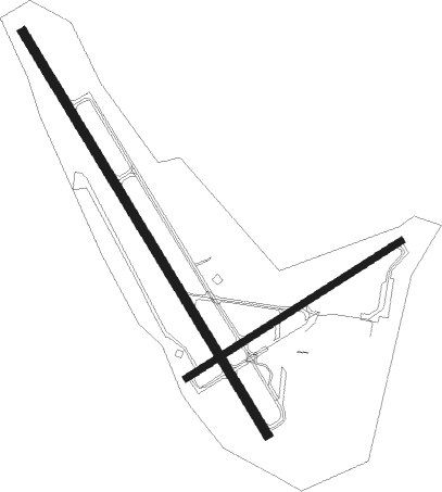
Runway info
Runway 17 / 35  | ||
| length | 1525m (5003ft) | |
| bearing | 145° / 325° | |
| width | 30m (98ft) | |
| surface | asphalt | |
| blast zone | 57m (187ft) / 50m (164ft) | |
| Runway 8 / 26 | ||
| length | 824m (2703ft) | |
| bearing | 69° / 249° | |
| width | 23m (75ft) | |
| surface | asphalt | |
Nearby beacons
| code | identifier | dist | bearing | frequency |
|---|---|---|---|---|
| AUG | AUGUSTA VOR/DME | 0 | 130° | 114.95 |
| AU | DUNNS (AUGUSTA) NDB | 6 | 325° | 366 |
| BUP | BURNHAM (PITTSFIELD) NDB | 29.4 | 49° | 348 |
| LE | LEWIE (AUBURN-LEWISTON) NDB | 31.7 | 236° | 240 |
| SUH | SPRUCEHEAD (OWLS HEAD) NDB | 33.9 | 111° | 356 |
| BGR | BANGOR VORTAC | 50.3 | 61° | 114.80 |
| RQM | RANGELEY NDB | 54.9 | 303° | 221 |
| ENE | KENNEBUNK VOR/DME | 64.3 | 222° | 117.10 |
Instrument approach procedures
| runway | airway (heading) | route (dist, bearing) |
|---|---|---|
| RW08 | ESIRE (68°) | ESIRE 3000ft |
| RNAV | ESIRE 3000ft ANIZI (7mi, 69°) 2000ft KAUG (5mi, 68°) 389ft (4546mi, 122°) 752ft JOKDO (4543mi, 302°) YOSTT (11mi, 56°) 3000ft YOSTT (turn) | |
| RW17 | ANSYN (154°) | ANSYN VIENA (11mi, 162°) 3500ft UPDIZ (5mi, 162°) 2800ft |
| RW17 | NOLLI (61°) | NOLLI UPDIZ (24mi, 32°) 2800ft UPDIZ (turn) 2800ft |
| RW17 | YOSTT (240°) | YOSTT UPDIZ (17mi, 272°) 2800ft UPDIZ (turn) 2800ft |
| RNAV | UPDIZ 2800ft EMUSK (6mi, 145°) 1900ft ZAKUX (3mi, 145°) 1000ft KAUG (2mi, 143°) 371ft (4546mi, 122°) 800ft RAZZR (4536mi, 302°) 3000ft RAZZR (turn) | |
| RW35 | NOLLI (61°) | NOLLI JALMI (16mi, 93°) 3000ft ESALY (5mi, 70°) 3000ft |
| RW35 | YOSTT (240°) | YOSTT ILZID (18mi, 189°) 3000ft ESALY (5mi, 250°) 3000ft |
| RNAV | ESALY 3000ft KURTE (7mi, 325°) 2000ft KAUG (5mi, 325°) 402ft (4546mi, 122°) 610ft UCENO (4551mi, 302°) NOLLI (21mi, 224°) 3000ft NOLLI (turn) |
Disclaimer
The information on this website is not for real aviation. Use this data with the X-Plane flight simulator only! Data taken with kind consent from X-Plane 12 source code and data files. Content is subject to change without notice.